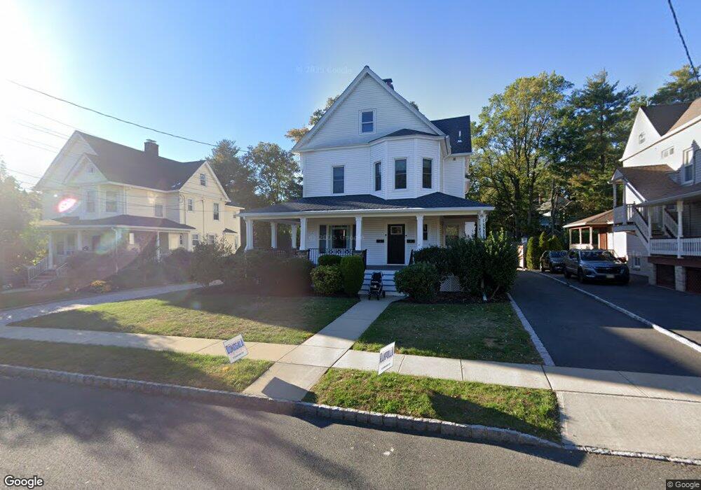
245 Walnut St Unit 2 Westfield, NJ 07090
Estimated Value: $907,000 - $1,402,000
3
Beds
2
Baths
1,300
Sq Ft
$898/Sq Ft
Est. Value
About This Home
This home is located at 245 Walnut St Unit 2, Westfield, NJ 07090 and is currently estimated at $1,167,363, approximately $897 per square foot. 245 Walnut St Unit 2 is a home located in Union County with nearby schools including Franklin Elementary School, Roosevelt Intermediate School, and Westfield Senior High School.
Ownership History
Date
Name
Owned For
Owner Type
Purchase Details
Closed on
Sep 12, 2022
Sold by
White Iii Rollin T
Bought by
White Group
Current Estimated Value
Purchase Details
Closed on
Feb 2, 2009
Sold by
White James S
Bought by
White Rollin T and White James S
Create a Home Valuation Report for This Property
The Home Valuation Report is an in-depth analysis detailing your home's value as well as a comparison with similar homes in the area
Home Values in the Area
Average Home Value in this Area
Purchase History
| Date | Buyer | Sale Price | Title Company |
|---|---|---|---|
| White Group | -- | Zwiren Title | |
| White Group | -- | Zwiren Title | |
| White Rollin T | -- | None Available |
Source: Public Records
Tax History Compared to Growth
Tax History
| Year | Tax Paid | Tax Assessment Tax Assessment Total Assessment is a certain percentage of the fair market value that is determined by local assessors to be the total taxable value of land and additions on the property. | Land | Improvement |
|---|---|---|---|---|
| 2025 | $20,243 | $898,900 | $472,000 | $426,900 |
| 2024 | $15,153 | $898,900 | $472,000 | $426,900 |
| 2023 | $15,153 | $686,900 | $472,000 | $214,900 |
| 2022 | $14,837 | $686,900 | $472,000 | $214,900 |
| 2021 | $14,858 | $686,900 | $472,000 | $214,900 |
| 2020 | $14,823 | $686,900 | $472,000 | $214,900 |
| 2019 | $14,768 | $686,900 | $472,000 | $214,900 |
| 2018 | $14,819 | $159,400 | $75,500 | $83,900 |
| 2017 | $14,738 | $159,400 | $75,500 | $83,900 |
| 2016 | $14,392 | $159,400 | $75,500 | $83,900 |
| 2015 | $14,105 | $159,400 | $75,500 | $83,900 |
| 2014 | $13,640 | $159,400 | $75,500 | $83,900 |
Source: Public Records
Map
Nearby Homes
- 260 Prospect St Unit C15
- 304 E Dudley Ave
- 415 Highland Ave
- 303 Prospect St
- 149 Harrison Ave
- 559 Lawrence Ave
- 517 Clark St
- 645 Kimball Ave
- 724 South Ave W Unit 724A
- 740 Lawrence Ave
- 508 N Chestnut St
- 203 Ross Place
- 215 Ross Place Unit J
- 538 Westfield Ave
- 143 Stanmore Place
- 522 Boulevard
- 122 Stanmore Place
- 350 W Dudley Ave
- 629 Tremont Ave
- 766 Oak Ave
- 245 Walnut St
- 249 Walnut St
- 239 Walnut St
- 239 Walnut St Unit 1
- 251 Walnut St
- 231 Walnut St
- 255 Walnut St Unit 1
- 255 Walnut St Unit Left
- 248 Kimball Ave
- 230 Kimball Ave
- 257 Walnut St
- 227 Walnut St
- 238 Walnut St
- 256 Kimball Ave
- 234 Walnut St
- 244 Walnut St
- 259 Walnut St
- 232 Walnut St
- 250 Walnut St
- 222 Kimball Ave