Estimated Value: $257,000 - $278,000
3
Beds
1
Bath
1,426
Sq Ft
$188/Sq Ft
Est. Value
About This Home
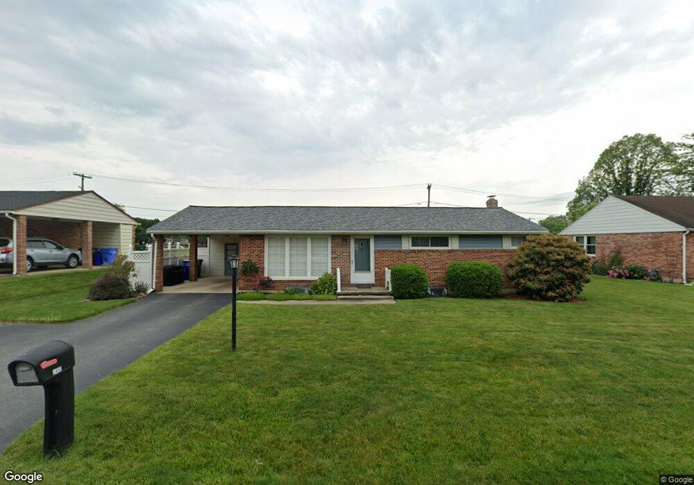
This home is located at 2450 Brookside Ln, York, PA 17402 and is currently estimated at $268,496, approximately $188 per square foot. 2450 Brookside Ln is a home located in York County with nearby schools including York Suburban Middle School, York Suburban Senior High School, and St Joseph School.
Ownership History
Date
Name
Owned For
Owner Type
Purchase Details
Closed on
Apr 22, 2021
Sold by
Cosgrove Tab E and Cosgrove Jacqueline T
Bought by
Cosgrove Kevina A
Current Estimated Value
Home Financials for this Owner
Home Financials are based on the most recent Mortgage that was taken out on this home.
Original Mortgage
$184,630
Outstanding Balance
$166,832
Interest Rate
3.05%
Mortgage Type
New Conventional
Estimated Equity
$101,664
Purchase Details
Closed on
Jul 21, 2020
Sold by
Cosgrove Tab E and Estate Of Ronald E Cosgrove
Bought by
Cosgrove Tab E
Create a Home Valuation Report for This Property
The Home Valuation Report is an in-depth analysis detailing your home's value as well as a comparison with similar homes in the area
Home Values in the Area
Average Home Value in this Area
Purchase History
| Date | Buyer | Sale Price | Title Company |
|---|---|---|---|
| Cosgrove Kevina A | $200,000 | None Available | |
| Cosgrove Tab E | -- | None Available |
Source: Public Records
Mortgage History
| Date | Status | Borrower | Loan Amount |
|---|---|---|---|
| Open | Cosgrove Kevina A | $184,630 |
Source: Public Records
Tax History Compared to Growth
Tax History
| Year | Tax Paid | Tax Assessment Tax Assessment Total Assessment is a certain percentage of the fair market value that is determined by local assessors to be the total taxable value of land and additions on the property. | Land | Improvement |
|---|---|---|---|---|
| 2025 | $4,531 | $129,510 | $28,400 | $101,110 |
| 2024 | $3,806 | $129,510 | $28,400 | $101,110 |
| 2023 | $4,305 | $129,510 | $28,400 | $101,110 |
| 2022 | $4,305 | $129,510 | $28,400 | $101,110 |
| 2021 | $4,121 | $129,510 | $28,400 | $101,110 |
| 2020 | $4,121 | $129,510 | $28,400 | $101,110 |
| 2019 | $3,974 | $129,510 | $28,400 | $101,110 |
| 2018 | $3,918 | $129,510 | $28,400 | $101,110 |
| 2017 | $3,796 | $129,510 | $28,400 | $101,110 |
| 2016 | $0 | $129,510 | $28,400 | $101,110 |
| 2015 | -- | $129,510 | $28,400 | $101,110 |
| 2014 | -- | $129,510 | $28,400 | $101,110 |
Source: Public Records
Map
Nearby Homes
- 1000 Sundale Dr
- 741 S Russell St
- 350 S Royal St
- 500 S Kershaw St
- 2224 Eastern Blvd Unit B
- 445 Quaker Dr
- 56 Jayme Dr Unit 9
- 565 Maywood Rd
- 142 S Vernon St
- 2764 Fairway Dr Unit 2764
- 15 N Harlan St
- 3045 Round Hill Rd
- 2232 Dixie Dr
- 2724 Fairway Dr Unit 2724
- 101 N Vernon St
- 2215 Dixie Dr
- 2559 Fairway Dr Unit 2559
- 1626 Mount Rose Ave
- 105 Pinehurst Rd
- 31 N Manheim St
- 2454 Brookside Ln
- 2446 Brookside Ln
- 2442 Brookside Ln
- 2458 Brookside Ln
- 2449 Brookside Ln
- 2457 Brookside Ln
- 2445 Brookside Ln
- 2462 Brookside Ln
- 2438 Brookside Ln
- 2461 Brookside Ln
- 2441 Brookside Ln
- 2452 Bradford Dr
- 2434 Brookside Ln
- 2465 Brookside Ln
- 2456 Bradford Dr
- 2448 Bradford Dr
- 2437 Brookside Ln
- 560 Sundale Dr
- 2460 Bradford Dr
- 700 Sundale Dr