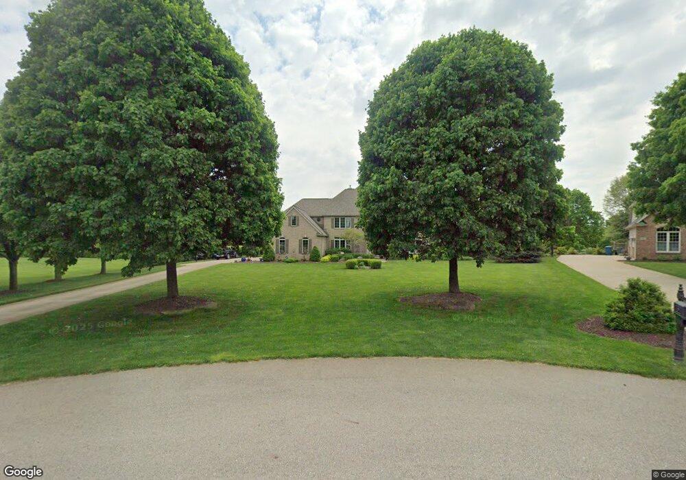
2450 Highridge Cir Saline, MI 48176
Estimated Value: $1,001,515 - $1,280,000
4
Beds
4
Baths
4,678
Sq Ft
$242/Sq Ft
Est. Value
About This Home
This home is located at 2450 Highridge Cir, Saline, MI 48176 and is currently estimated at $1,129,879, approximately $241 per square foot. 2450 Highridge Cir is a home located in Washtenaw County with nearby schools including Woodland Meadows Elementary School, Heritage School, and Saline Middle School.
Ownership History
Date
Name
Owned For
Owner Type
Purchase Details
Closed on
Sep 14, 2021
Sold by
Willkle David J and Willkle Kelly A
Bought by
Wilkie David J and David J Wilkie Trust
Current Estimated Value
Purchase Details
Closed on
Jun 30, 2008
Sold by
Cartus Financial Corp
Bought by
Wilkie David J and Wilkie Kelly A
Home Financials for this Owner
Home Financials are based on the most recent Mortgage that was taken out on this home.
Original Mortgage
$350,000
Interest Rate
6.1%
Purchase Details
Closed on
Jan 25, 2008
Sold by
Dragich Peter A and Dragich Sherry L
Bought by
Cartus Financial Corp
Create a Home Valuation Report for This Property
The Home Valuation Report is an in-depth analysis detailing your home's value as well as a comparison with similar homes in the area
Home Values in the Area
Average Home Value in this Area
Purchase History
| Date | Buyer | Sale Price | Title Company |
|---|---|---|---|
| Wilkie David J | -- | None Available | |
| Wilkie David J | $530,500 | None Available | |
| Cartus Financial Corp | $575,000 | None Available |
Source: Public Records
Mortgage History
| Date | Status | Borrower | Loan Amount |
|---|---|---|---|
| Previous Owner | Wilkie David J | $350,000 |
Source: Public Records
Tax History Compared to Growth
Tax History
| Year | Tax Paid | Tax Assessment Tax Assessment Total Assessment is a certain percentage of the fair market value that is determined by local assessors to be the total taxable value of land and additions on the property. | Land | Improvement |
|---|---|---|---|---|
| 2025 | $10,969 | $496,532 | $0 | $0 |
| 2024 | $10,658 | $476,786 | $0 | $0 |
| 2023 | $10,169 | $399,200 | $0 | $0 |
| 2022 | $13,882 | $395,300 | $0 | $0 |
| 2021 | $13,491 | $391,100 | $0 | $0 |
| 2020 | $12,822 | $381,700 | $0 | $0 |
| 2019 | $12,494 | $386,600 | $386,600 | $0 |
| 2018 | $12,246 | $386,400 | $0 | $0 |
| 2017 | $11,772 | $377,800 | $0 | $0 |
| 2016 | $8,730 | $305,946 | $0 | $0 |
| 2015 | -- | $305,031 | $0 | $0 |
| 2014 | -- | $295,500 | $0 | $0 |
| 2013 | -- | $295,500 | $0 | $0 |
Source: Public Records
Map
Nearby Homes
- 612 Gretchen Ln
- 606 Gretchen Ln
- 631 Gretchen Ln
- 698 Gretchen Ln
- 696 Gretchen Ln
- 693 Gretchen Ln
- 694 Gretchen Ln
- 690 Gretchen Ln
- 751 Haywood Dr
- 709 Risdon Trail S
- 720 Risdon Trail S
- 2604 Wildwood Trail
- 850 Kuss Dr
- 848 Kuss Dr
- 838 Kuss Dr
- 832 Kuss Dr
- 859 Risdon Trail S
- 888 Risdon Trail S
- 853 Risdon Trail S
- 841 Risdon Trail S
- 2460 Highridge Cir
- 2420 Highridge Cir
- 6460 Brookview Dr
- 6470 Brookview Dr
- 6400 Brookview Dr
- 1754 Stoneridge Dr
- 2461 Highridge Cir
- 1772 Stoneridge Dr
- 1736 Stoneridge Dr
- 2451 Highridge Cir
- 2421 Highridge Cir
- 1790 Stoneridge Dr
- 1718 Stoneridge Dr
- 6385 Brookview Dr
- 6365 Brookview Dr
- 6465 Brookview Dr
- 6405 Brookview Dr
- 6445 Brookview Dr
- 6345 Brookview Dr
- 6425 Brookview Dr