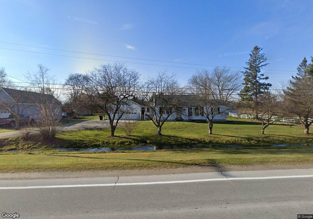
2450 S Range Rd Saint Clair, MI 48079
Estimated Value: $269,000 - $386,000
3
Beds
2
Baths
1,400
Sq Ft
$225/Sq Ft
Est. Value
About This Home
This home is located at 2450 S Range Rd, Saint Clair, MI 48079 and is currently estimated at $314,724, approximately $224 per square foot. 2450 S Range Rd is a home located in St. Clair County with nearby schools including Gearing Elementary School, St. Clair Middle School, and St. Clair High School.
Ownership History
Date
Name
Owned For
Owner Type
Purchase Details
Closed on
Dec 26, 2023
Sold by
Statewide St Clair Llc
Bought by
Carriage House Developments Llc
Current Estimated Value
Home Financials for this Owner
Home Financials are based on the most recent Mortgage that was taken out on this home.
Original Mortgage
$360,000
Outstanding Balance
$354,327
Interest Rate
7.5%
Mortgage Type
Seller Take Back
Estimated Equity
-$39,603
Purchase Details
Closed on
Nov 21, 2023
Sold by
Statewide St Clair Llc
Bought by
Carriage House Developments Llc
Home Financials for this Owner
Home Financials are based on the most recent Mortgage that was taken out on this home.
Original Mortgage
$360,000
Outstanding Balance
$354,327
Interest Rate
7.5%
Mortgage Type
Seller Take Back
Estimated Equity
-$39,603
Create a Home Valuation Report for This Property
The Home Valuation Report is an in-depth analysis detailing your home's value as well as a comparison with similar homes in the area
Home Values in the Area
Average Home Value in this Area
Purchase History
| Date | Buyer | Sale Price | Title Company |
|---|---|---|---|
| Carriage House Developments Llc | $450,000 | Ata National Title Group | |
| Carriage House Developments Llc | $450,000 | Ata National Title Group |
Source: Public Records
Mortgage History
| Date | Status | Borrower | Loan Amount |
|---|---|---|---|
| Open | Carriage House Developments Llc | $360,000 | |
| Closed | Carriage House Developments Llc | $360,000 |
Source: Public Records
Tax History
| Year | Tax Paid | Tax Assessment Tax Assessment Total Assessment is a certain percentage of the fair market value that is determined by local assessors to be the total taxable value of land and additions on the property. | Land | Improvement |
|---|---|---|---|---|
| 2025 | $4,745 | $135,300 | $0 | $0 |
| 2024 | $4,805 | $137,000 | $0 | $0 |
| 2023 | $3,561 | $103,300 | $0 | $0 |
| 2022 | $3,601 | $100,100 | $0 | $0 |
Source: Public Records
Map
Nearby Homes
- 740 Highland Dr
- 1810 Riley Rd
- 606 N 6th St
- 1924 Shelldrake Ln Unit 32
- 252 Shelldrake Ln
- 211 N Carney Dr
- 1932 Sheldrake Ln Unit 30
- 249 Shelldrake Ln
- 239 Shelldrake Ln Unit 40
- 409 N 5th St
- 669 N Riverside Ave Unit 4
- 412 Orchard St
- 231 S Carney Dr
- 4284 Scott B Dr
- 1760 Ash St
- 206 S 4th St
- 920 Clinton Ave
- 841 S 12th St
- TBD Range
- 3071 Regatta Ln
- 2458 S Range Rd
- 2462 S Range Rd
- 0 Ketchum Rd
- 936 Brown St
- 0 S Range Road Parcel H Unit 4217794
- 0 S Range Road Parcel H Unit 926123
- 4538 Ketchum Rd
- 874 N Carney Dr
- 862 N Carney Dr Unit 3
- 860 N Carney Dr
- 876 N Carney Dr
- 4566 Ketchum Rd
- 844 N Carney Dr
- 580 N Carney Dr
- 846 N Carney Dr
- 848 N Carney Dr
- 864 N Carney Dr
- 866 N Carney Dr Unit 1
- 872 N Carney Dr
- 2007 S Range Rd
Your Personal Tour Guide
Ask me questions while you tour the home.