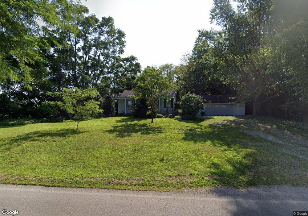
2450 W Possum Rd Springfield, OH 45506
Estimated Value: $153,000 - $208,000
3
Beds
1
Bath
1,152
Sq Ft
$154/Sq Ft
Est. Value
About This Home
This home is located at 2450 W Possum Rd, Springfield, OH 45506 and is currently estimated at $177,341, approximately $153 per square foot. 2450 W Possum Rd is a home located in Clark County with nearby schools including Shawnee Middle School/High School, Clark Preparatory Academy, and Springfield Christian School.
Ownership History
Date
Name
Owned For
Owner Type
Purchase Details
Closed on
Nov 30, 2012
Sold by
Bostick Ryan N
Bought by
Bostick Ryan N and Bostick Tiffany Annette
Current Estimated Value
Purchase Details
Closed on
May 30, 2012
Sold by
Fannie Mae
Bought by
Bostick Ryan N
Home Financials for this Owner
Home Financials are based on the most recent Mortgage that was taken out on this home.
Original Mortgage
$52,401
Interest Rate
4.4%
Mortgage Type
FHA
Purchase Details
Closed on
May 4, 2012
Sold by
Barker Margie E
Bought by
Federal National Mortgage Association
Home Financials for this Owner
Home Financials are based on the most recent Mortgage that was taken out on this home.
Original Mortgage
$52,401
Interest Rate
4.4%
Mortgage Type
FHA
Create a Home Valuation Report for This Property
The Home Valuation Report is an in-depth analysis detailing your home's value as well as a comparison with similar homes in the area
Home Values in the Area
Average Home Value in this Area
Purchase History
| Date | Buyer | Sale Price | Title Company |
|---|---|---|---|
| Bostick Ryan N | -- | None Available | |
| Bostick Ryan N | $59,500 | Oho Real Estate Title | |
| Federal National Mortgage Association | $89,000 | None Available |
Source: Public Records
Mortgage History
| Date | Status | Borrower | Loan Amount |
|---|---|---|---|
| Previous Owner | Bostick Ryan N | $52,401 |
Source: Public Records
Tax History Compared to Growth
Tax History
| Year | Tax Paid | Tax Assessment Tax Assessment Total Assessment is a certain percentage of the fair market value that is determined by local assessors to be the total taxable value of land and additions on the property. | Land | Improvement |
|---|---|---|---|---|
| 2024 | $1,971 | $40,360 | $10,230 | $30,130 |
| 2023 | $1,971 | $40,360 | $10,230 | $30,130 |
| 2022 | $1,955 | $40,360 | $10,230 | $30,130 |
| 2021 | $1,705 | $31,520 | $7,930 | $23,590 |
| 2020 | $1,720 | $31,520 | $7,930 | $23,590 |
| 2019 | $1,747 | $31,520 | $7,930 | $23,590 |
| 2018 | $1,510 | $26,890 | $7,210 | $19,680 |
| 2017 | $1,548 | $26,891 | $7,207 | $19,684 |
| 2016 | $1,396 | $26,891 | $7,207 | $19,684 |
| 2015 | $1,405 | $26,160 | $7,207 | $18,953 |
| 2014 | $1,409 | $26,160 | $7,207 | $18,953 |
| 2013 | $1,224 | $26,160 | $7,207 | $18,953 |
Source: Public Records
Map
Nearby Homes
- 2224 Duquesne Dr
- 1421 Seminole Ave
- 2002 Scioto St
- 1515 W Perrin Ave
- 1824 Springmont Ave
- 1109 Montgomery Ave
- 1010 Heard Ave
- 2642 Springfield Xenia Rd
- 2707 Springfield Xenia Rd
- 1216 Innisfallen Ave
- 0 Montgomery Ave
- 929 S Western Ave
- 924 W State St
- 1201 Dibert Ave
- 1290 Red Oaks Cir
- 1730 Damascus Ave
- 3161 Dayton Rd
- 3161 Dayton Springfield Rd
- 427 Rosewood Ave
- 830 Dibert Ave
- 2440 W Possum Rd
- 2400 W Possum Rd
- 2455 W Possum Rd
- 2425 W Possum Rd
- 2591 W Possum Rd
- 2340 W Possum Rd
- 2351 W Possum Rd
- 2310 W Possum Rd
- 2311 W Possum Rd
- 2661 W Possum Rd
- 2671 W Possum Rd
- 2218 W Possum Rd
- 2110 W Possum Rd
- 1996 Rebert Pike
- 2010 Rebert Pike
- 2094 W Possum Rd
- 2072 Rebert Pike
- 2212 Old Arthur Rd
- 2230 Rebert Pike
- 2075 W Possum Rd