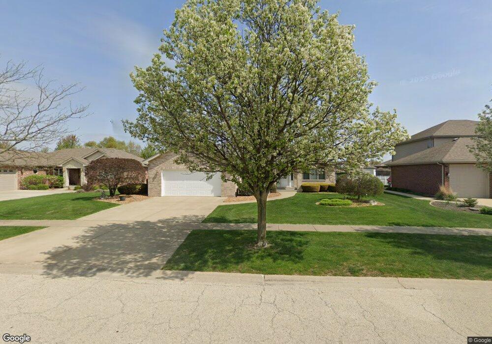
2451 Bluestone Bay Dr Unit 2 New Lenox, IL 60451
Estimated Value: $496,000 - $595,000
3
Beds
2
Baths
2,141
Sq Ft
$248/Sq Ft
Est. Value
About This Home
This home is located at 2451 Bluestone Bay Dr Unit 2, New Lenox, IL 60451 and is currently estimated at $531,535, approximately $248 per square foot. 2451 Bluestone Bay Dr Unit 2 is a home located in Will County with nearby schools including Spencer Trail, Spencer Pointe, and Spencer Crossing Intermediate School.
Ownership History
Date
Name
Owned For
Owner Type
Purchase Details
Closed on
Jun 22, 2011
Sold by
Neel Walter C and Neel Mary M
Bought by
First Midwest Bank and Trust #1-7996
Current Estimated Value
Purchase Details
Closed on
Jun 19, 2006
Sold by
Eagle Ridge Corp
Bought by
Neel Walter C and Neel Mary M
Home Financials for this Owner
Home Financials are based on the most recent Mortgage that was taken out on this home.
Original Mortgage
$127,300
Interest Rate
6.68%
Mortgage Type
Purchase Money Mortgage
Create a Home Valuation Report for This Property
The Home Valuation Report is an in-depth analysis detailing your home's value as well as a comparison with similar homes in the area
Home Values in the Area
Average Home Value in this Area
Purchase History
| Date | Buyer | Sale Price | Title Company |
|---|---|---|---|
| First Midwest Bank | $312,500 | Attorneys Title Guaranty Fun | |
| Neel Walter C | $321,000 | Atg |
Source: Public Records
Mortgage History
| Date | Status | Borrower | Loan Amount |
|---|---|---|---|
| Previous Owner | Neel Walter C | $127,300 |
Source: Public Records
Tax History Compared to Growth
Tax History
| Year | Tax Paid | Tax Assessment Tax Assessment Total Assessment is a certain percentage of the fair market value that is determined by local assessors to be the total taxable value of land and additions on the property. | Land | Improvement |
|---|---|---|---|---|
| 2024 | $10,594 | $146,542 | $37,901 | $108,641 |
| 2023 | $10,594 | $133,585 | $34,550 | $99,035 |
| 2022 | $9,696 | $123,063 | $31,829 | $91,234 |
| 2021 | $9,179 | $115,737 | $29,934 | $85,803 |
| 2020 | $8,903 | $111,608 | $28,866 | $82,742 |
| 2019 | $8,507 | $108,147 | $27,971 | $80,176 |
| 2018 | $8,295 | $104,419 | $27,007 | $77,412 |
| 2017 | $7,870 | $101,417 | $26,231 | $75,186 |
| 2016 | $7,628 | $98,703 | $25,529 | $73,174 |
| 2015 | $7,335 | $95,596 | $24,725 | $70,871 |
| 2014 | $7,335 | $94,416 | $24,420 | $69,996 |
| 2013 | $7,335 | $95,689 | $24,749 | $70,940 |
Source: Public Records
Map
Nearby Homes
- 2758 Bluestone Bay Dr
- 651 Schooner Dr
- 701 Bishops Gate
- 641 Lisson Grove
- 1535 Glenbrooke Ln
- 2667 E Lincoln Hwy
- 190 Pottawatomie Ln
- 1351 E Lincoln Hwy
- 214 Somerset Ct
- 1595 Glenbrooke Ln
- 1591 Glenbrooke Ln
- 1587 Glenbrooke Ln
- 1583 Glenbrooke Ln
- 2019 Royalglen Dr
- 21359 Saddle Ln
- 1738 Orchard Ln
- 21334 Sage Brush Ln
- Avalon Plan at Leigh Creek - Townhome
- Hampton Plan at Leigh Creek - Townhome
- 21170 Sage Brush Ln
- 2441 Bluestone Bay Dr
- 2461 Bluestone Bay Dr
- 787 Mallard Dr
- 2431 Bluestone Bay Dr
- 2471 Bluestone Bay Dr
- 781 Mallard Dr
- 2442 Bluestone Bay Dr
- 2452 Bluestone Bay Dr
- 793 Mallard Dr
- 2462 Bluestone Bay Dr
- 775 Mallard Dr
- 2425 Bluestone Bay Dr
- 2434 Bluestone Bay Dr
- 2481 Bluestone Bay Dr
- 2426 Bluestone Bay Dr
- 2472 Bluestone Bay Dr
- 769 Mallard Dr
- 762 Pintail Dr
- 2415 Bluestone Bay Dr
- 2491 Bluestone Bay Dr