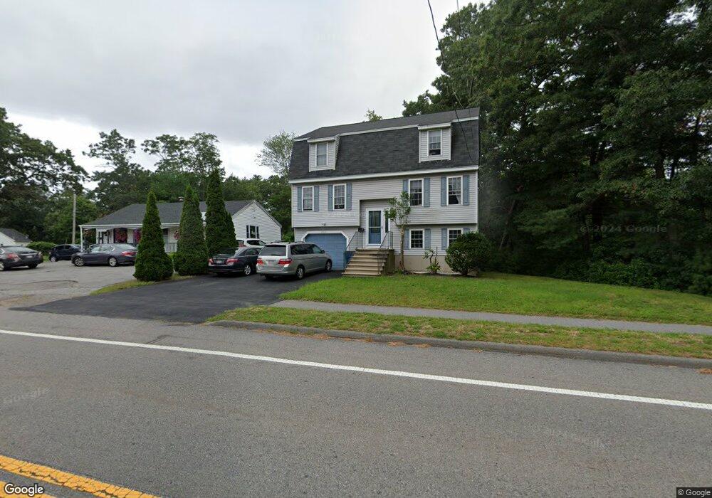
2451 Main St Tewksbury, MA 01876
Estimated Value: $664,000 - $739,000
3
Beds
2
Baths
1,700
Sq Ft
$408/Sq Ft
Est. Value
About This Home
This home is located at 2451 Main St, Tewksbury, MA 01876 and is currently estimated at $694,360, approximately $408 per square foot. 2451 Main St is a home located in Middlesex County with nearby schools including Heath-Brook Elementary School, John W. Wynn Middle School, and John F. Ryan Elementary School.
Ownership History
Date
Name
Owned For
Owner Type
Purchase Details
Closed on
Feb 22, 2002
Sold by
Darrigo Lisa and Darrigo Paul
Bought by
Tam Gene and Tam Jennifer
Current Estimated Value
Purchase Details
Closed on
Oct 29, 1999
Sold by
Winter John Rt and Mangano John R
Bought by
Darrigo Lisa and Darrigo Paul
Create a Home Valuation Report for This Property
The Home Valuation Report is an in-depth analysis detailing your home's value as well as a comparison with similar homes in the area
Home Values in the Area
Average Home Value in this Area
Purchase History
| Date | Buyer | Sale Price | Title Company |
|---|---|---|---|
| Tam Gene | $276,000 | -- | |
| Darrigo Lisa | $209,000 | -- |
Source: Public Records
Mortgage History
| Date | Status | Borrower | Loan Amount |
|---|---|---|---|
| Open | Darrigo Lisa | $140,000 | |
| Closed | Darrigo Lisa | $159,000 | |
| Closed | Darrigo Lisa | $169,000 | |
| Closed | Darrigo Lisa | $180,000 |
Source: Public Records
Tax History Compared to Growth
Tax History
| Year | Tax Paid | Tax Assessment Tax Assessment Total Assessment is a certain percentage of the fair market value that is determined by local assessors to be the total taxable value of land and additions on the property. | Land | Improvement |
|---|---|---|---|---|
| 2025 | $7,559 | $571,800 | $262,200 | $309,600 |
| 2024 | $7,279 | $543,600 | $249,800 | $293,800 |
| 2023 | $7,075 | $501,800 | $227,000 | $274,800 |
| 2022 | $6,664 | $438,400 | $197,400 | $241,000 |
| 2021 | $6,255 | $397,900 | $170,100 | $227,800 |
| 2020 | $6,069 | $380,000 | $162,100 | $217,900 |
| 2019 | $5,881 | $371,300 | $154,200 | $217,100 |
| 2018 | $5,928 | $367,500 | $171,400 | $196,100 |
| 2017 | $5,607 | $343,800 | $171,400 | $172,400 |
| 2016 | $5,389 | $329,600 | $171,400 | $158,200 |
| 2015 | $5,206 | $318,000 | $166,200 | $151,800 |
| 2014 | $4,946 | $307,000 | $166,200 | $140,800 |
Source: Public Records
Map
Nearby Homes
- 76 Whelan Rd
- 70 Whelan Rd
- 70 Birch St
- 70 Birch St
- 15 Hoover Rd
- 2465 Main St
- 12 Hoover Rd
- 2477 Main St
- 40 Birch St
- 39 Birch St
- 2500 Main St
- 2500 Main St Unit 204
- 2500 Main St Unit 210
- 2500 Main St Unit Multi
- 2500 Main St Unit 209
- 2500 Main St Unit 101
- 2500 Main St Unit 110
- 2500 Main St Unit 208209
- 2500 Main St Unit 211
- 2500 Main St Unit 102