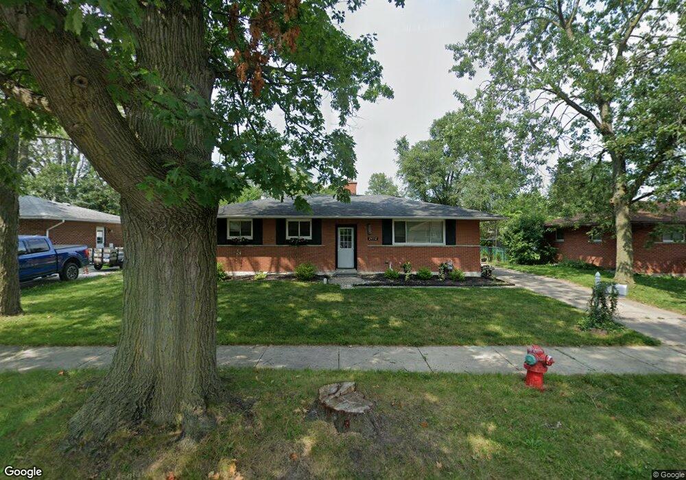
24512 Laurel St Flat Rock, MI 48134
Estimated Value: $202,401 - $243,000
Studio
1
Bath
1,088
Sq Ft
$208/Sq Ft
Est. Value
About This Home
This home is located at 24512 Laurel St, Flat Rock, MI 48134 and is currently estimated at $226,350, approximately $208 per square foot. 24512 Laurel St is a home located in Wayne County with nearby schools including Ethel C. Bobcean Elementary School, John M. Barnes Elementary School, and Thomas Simpson Middle School.
Ownership History
Date
Name
Owned For
Owner Type
Purchase Details
Closed on
Aug 22, 2018
Sold by
Emery Jeff A
Bought by
Emery Jeff A and Emery Kelley S
Current Estimated Value
Purchase Details
Closed on
Jul 31, 2018
Sold by
Emery Jeff A
Bought by
Emery Jeff A and Emery Jeffrey A
Purchase Details
Closed on
Aug 31, 2015
Sold by
Bogard David M
Bought by
Cross Carol and Polvi Leach Catherine M
Purchase Details
Closed on
Jul 11, 2015
Sold by
Cross Carol and Polvi Leach Catherine M
Bought by
Emery Jeffrey A
Purchase Details
Closed on
Jul 25, 2007
Sold by
Emery Edward E
Bought by
Emery Susan M
Create a Home Valuation Report for This Property
The Home Valuation Report is an in-depth analysis detailing your home's value as well as a comparison with similar homes in the area
Home Values in the Area
Average Home Value in this Area
Purchase History
| Date | Buyer | Sale Price | Title Company |
|---|---|---|---|
| Emery Jeff A | -- | None Available | |
| Emery Jeff A | -- | None Available | |
| Cross Carol | -- | Attorney | |
| Emery Jeffrey A | $32,741 | Attorney | |
| Emery Susan M | -- | None Available |
Source: Public Records
Tax History
| Year | Tax Paid | Tax Assessment Tax Assessment Total Assessment is a certain percentage of the fair market value that is determined by local assessors to be the total taxable value of land and additions on the property. | Land | Improvement |
|---|---|---|---|---|
| 2025 | $2,659 | $103,300 | $0 | $0 |
| 2024 | $2,581 | $93,200 | $0 | $0 |
| 2023 | $2,462 | $86,300 | $0 | $0 |
| 2022 | $2,981 | $70,500 | $0 | $0 |
| 2021 | $2,969 | $69,500 | $0 | $0 |
| 2020 | $2,929 | $69,800 | $0 | $0 |
| 2019 | $2,874 | $63,600 | $0 | $0 |
| 2018 | $2,234 | $59,800 | $0 | $0 |
| 2017 | $1,178 | $57,300 | $0 | $0 |
| 2016 | $3,613 | $54,100 | $0 | $0 |
| 2015 | $4,975 | $53,600 | $0 | $0 |
| 2013 | $4,820 | $48,200 | $0 | $0 |
| 2012 | $1,990 | $50,700 | $10,100 | $40,600 |
Source: Public Records
Map
Nearby Homes
- 24664 E Huron River Dr
- 23897 Romero
- 23838 Meadows Ave
- 23911 Romero
- 29726 Red Cedar Dr
- 23814 Meadows Ave
- 23883 Romero
- 23855 Romero
- 23869 Romero
- 23841 Romero
- 23827 Romero
- 0 Woodruff Unit 20251062264
- 24943 Mayfair St
- 29715 Walnut St
- 23376 Port St
- 29530 Cambridge St
- 23965 Gibraltar Rd
- VL Gibraltar Rd
- 00 Gibraltar Rd
- 23452 Astrid Ln
- 24524 Laurel St
- 24498 Laurel St
- 24533 Palmetto Dr
- 24519 Palmetto Dr
- 24536 Laurel St
- 24482 Laurel St
- 24505 Palmetto Dr
- 24547 Palmetto Dr
- 24513 Laurel St
- 24501 Laurel St
- 24525 Laurel St
- 24548 Laurel St
- 24485 Laurel St
- 24475 Palmetto Dr
- 24561 Palmetto Dr
- 24468 Laurel St
- 24537 Laurel St
- 24473 Laurel St
- 24571 Palmetto Dr
- 24463 Palmetto Dr
Your Personal Tour Guide
Ask me questions while you tour the home.