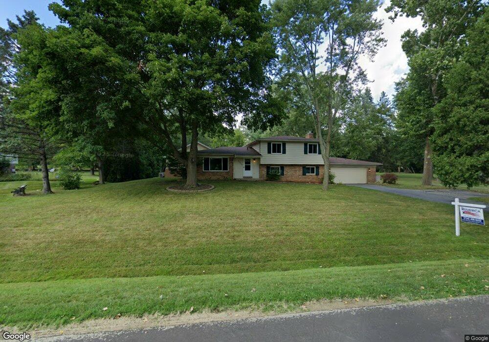
24520 S Cromwell Dr Unit Bldg-Unit Franklin, MI 48025
Estimated Value: $492,000 - $791,058
3
Beds
4
Baths
2,934
Sq Ft
$238/Sq Ft
Est. Value
About This Home
This home is located at 24520 S Cromwell Dr Unit Bldg-Unit, Franklin, MI 48025 and is currently estimated at $697,765, approximately $237 per square foot. 24520 S Cromwell Dr Unit Bldg-Unit is a home located in Oakland County with nearby schools including Wylie E. Groves High School, West Maple Elementary School, and Berkshire Middle School.
Ownership History
Date
Name
Owned For
Owner Type
Purchase Details
Closed on
Feb 22, 2019
Sold by
Montayne Paula Marie
Bought by
Grezlik Eric and Grezlik Sara
Current Estimated Value
Home Financials for this Owner
Home Financials are based on the most recent Mortgage that was taken out on this home.
Original Mortgage
$240,000
Outstanding Balance
$210,573
Interest Rate
4.4%
Mortgage Type
New Conventional
Estimated Equity
$487,192
Purchase Details
Closed on
Jan 15, 2008
Sold by
Chae Charlie B and Chae So Yeon
Bought by
Deutsche Bank National Trust
Purchase Details
Closed on
Oct 7, 2002
Sold by
Jones Kevin
Bought by
Chae Charlie B
Purchase Details
Closed on
Aug 3, 2001
Sold by
Rust Barbara J
Bought by
Jones Kevin
Home Financials for this Owner
Home Financials are based on the most recent Mortgage that was taken out on this home.
Original Mortgage
$225,000
Interest Rate
7.03%
Create a Home Valuation Report for This Property
The Home Valuation Report is an in-depth analysis detailing your home's value as well as a comparison with similar homes in the area
Home Values in the Area
Average Home Value in this Area
Purchase History
| Date | Buyer | Sale Price | Title Company |
|---|---|---|---|
| Grezlik Eric | $300,000 | Sonoma Title Guarantee | |
| Deutsche Bank National Trust | $258,750 | None Available | |
| Chae Charlie B | $235,000 | -- | |
| Jones Kevin | $250,000 | -- |
Source: Public Records
Mortgage History
| Date | Status | Borrower | Loan Amount |
|---|---|---|---|
| Open | Grezlik Eric | $240,000 | |
| Previous Owner | Jones Kevin | $225,000 |
Source: Public Records
Tax History Compared to Growth
Tax History
| Year | Tax Paid | Tax Assessment Tax Assessment Total Assessment is a certain percentage of the fair market value that is determined by local assessors to be the total taxable value of land and additions on the property. | Land | Improvement |
|---|---|---|---|---|
| 2024 | $7,913 | $294,890 | $0 | $0 |
| 2023 | $7,503 | $286,120 | $0 | $0 |
| 2022 | $8,120 | $260,510 | $0 | $0 |
| 2021 | $8,086 | $232,720 | $0 | $0 |
| 2020 | $6,900 | $227,730 | $0 | $0 |
| 2019 | $3,848 | $226,250 | $0 | $0 |
| 2018 | $6,352 | $189,700 | $0 | $0 |
| 2017 | $5,055 | $189,700 | $0 | $0 |
| 2016 | $2,997 | $125,060 | $0 | $0 |
| 2015 | -- | $115,860 | $0 | $0 |
| 2014 | -- | $97,810 | $0 | $0 |
| 2011 | -- | $82,400 | $0 | $0 |
Source: Public Records
Map
Nearby Homes
- 24459 Bloomington Ct
- 24924 Riverwood Dr
- 25330 Devon Ln
- 25325 Devon Ln
- 31011 Pioneer Ave
- 0000 Woodlynne Dr
- 25265 Canterbury Rd
- 25635 River Dr
- 23301 W 14 Mile Rd
- 30526 Birchway Dr
- 30630 Helmandale Dr
- 31050 Briarcliff Rd
- 7357 W Greenwich Dr
- 30476 Birchway Dr
- 32533 Robinhood Dr
- 31264 Coachlight Ln
- 7200 Telegraph Rd
- 30915 Timberbrook Ln
- 26075 Woodlore Rd
- 32696 Ravine Dr
- 24520 S Cromwell Dr
- 24560 S Cromwell Dr
- 24480 S Cromwell Dr
- 30636 Birchway Dr
- 24555 Tudor Ln
- 24505 Tudor Ln
- 24523 S Cromwell Dr
- 24605 Tudor Ln
- 24479 S Cromwell Dr
- 24440 S Cromwell Dr
- 24565 S Cromwell Dr
- 24620 S Cromwell Dr
- 24455 Tudor Ln
- 24441 S Cromwell Dr
- 24655 Tudor Ln
- 24617 S Cromwell Dr
- 24550 Tudor Ln
- 24600 Tudor Ln
- 24500 Tudor Ln
- 24450 Tudor Ln