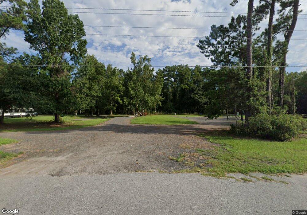
24531 Highway 82 Waynesville, GA 31566
Estimated Value: $131,704
2
Beds
2
Baths
280
Sq Ft
$470/Sq Ft
Est. Value
About This Home
This home is located at 24531 Highway 82, Waynesville, GA 31566 and is currently estimated at $131,704, approximately $470 per square foot. 24531 Highway 82 is a home with nearby schools including Waynesville Primary School, Atkinson Elementary School, and Brantley County Middle School.
Ownership History
Date
Name
Owned For
Owner Type
Purchase Details
Closed on
May 31, 2022
Sold by
Hamilton Todd Alan
Bought by
Oasis 82 Llc
Current Estimated Value
Home Financials for this Owner
Home Financials are based on the most recent Mortgage that was taken out on this home.
Original Mortgage
$102,000
Interest Rate
4.16%
Mortgage Type
Mortgage Modification
Purchase Details
Closed on
Apr 22, 2022
Sold by
Gibson William Clinton
Bought by
Hamilton Todd Alan
Home Financials for this Owner
Home Financials are based on the most recent Mortgage that was taken out on this home.
Original Mortgage
$102,000
Interest Rate
4.16%
Mortgage Type
Mortgage Modification
Create a Home Valuation Report for This Property
The Home Valuation Report is an in-depth analysis detailing your home's value as well as a comparison with similar homes in the area
Home Values in the Area
Average Home Value in this Area
Purchase History
| Date | Buyer | Sale Price | Title Company |
|---|---|---|---|
| Oasis 82 Llc | -- | -- | |
| Hamilton Todd Alan | $120,000 | -- |
Source: Public Records
Mortgage History
| Date | Status | Borrower | Loan Amount |
|---|---|---|---|
| Previous Owner | Hamilton Todd Alan | $102,000 |
Source: Public Records
Tax History Compared to Growth
Tax History
| Year | Tax Paid | Tax Assessment Tax Assessment Total Assessment is a certain percentage of the fair market value that is determined by local assessors to be the total taxable value of land and additions on the property. | Land | Improvement |
|---|---|---|---|---|
| 2024 | $1,248 | $37,370 | $16,614 | $20,756 |
| 2023 | $950 | $27,431 | $6,675 | $20,756 |
| 2022 | $343 | $10,275 | $6,675 | $3,600 |
| 2021 | $374 | $3,848 | $0 | $3,848 |
| 2020 | $385 | $3,667 | $0 | $3,667 |
| 2019 | $385 | $3,724 | $0 | $3,724 |
| 2018 | $64 | $1,894 | $0 | $1,894 |
| 2017 | $64 | $1,894 | $0 | $1,894 |
| 2016 | $416 | $1,982 | $0 | $1,982 |
| 2015 | -- | $11,542 | $7,942 | $3,600 |
Source: Public Records
Map
Nearby Homes
- 23 Hawks Way
- LOT 22 Hawks Way
- LOT 24 Hawks Way
- LOT 20 Hawks Way
- LOT 21 Hawks Way
- LOT 25 Hawks Way
- 115 Red Hawk Ct
- 24 Hawk's Way
- 22 Hawk's Way
- 23 Hawk's Way
- 20 Hawk's Way
- 21 Hawk's Way
- 25 Hawk's Way
- LOT 13 Old Waynesville Rd
- LOT 15 Old Waynesville Rd
- Lot 14 Old Waynesville Rd
- Lot 16 Old Waynesville Rd
- 48 Hawks Way
- 13 Old Waynesville Rd
- 15 Old Waynesville Rd
- 24546 Highway 82
- 22270 Hwy 82
- 82.52 ac Boot Harrison Rd
- Tract 4 Ratcliff Rd
- 720 Gibson Cir
- 0 Buster Walker Rd Unit 130 7002487
- 0 Jesse Trail Unit 122 7002482
- 0 Jesse Trail Unit 121 7002476
- 0 Jesse Trail Unit 120 7002471
- 0 Jesse Trail Unit 119 7002463
- 0 Jesse Trail Unit 118 7002458
- 0 April Rd Unit 88 7002418
- 0 Buster Walker Rd Unit 85 7002405
- 0 April Rd Unit 82 7002402
- 0 April Rd Unit 81 7002393
- 0 Buster Walker Rd Unit 70 7002371
- 0 Buster Walker Rd Unit 61 7002308
- 0 Buster Walker Rd Unit 41 7002293
- 0 Buster Walker Rd Unit 40 7002289
- 0 Buster Walker Rd Unit 39 7002280
