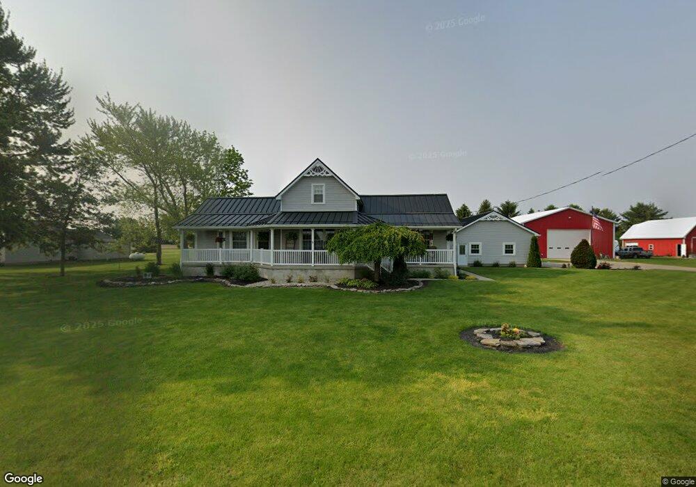
24551 Road U20 Delphos, OH 45833
Estimated Value: $216,000 - $288,538
--
Bed
2
Baths
2,671
Sq Ft
$94/Sq Ft
Est. Value
About This Home
This home is located at 24551 Road U20, Delphos, OH 45833 and is currently estimated at $252,385, approximately $94 per square foot. 24551 Road U20 is a home located in Putnam County with nearby schools including Fort Jennings Elementary School, Fort Jennings High School, and Delphos St. John's High School.
Create a Home Valuation Report for This Property
The Home Valuation Report is an in-depth analysis detailing your home's value as well as a comparison with similar homes in the area
Home Values in the Area
Average Home Value in this Area
Tax History Compared to Growth
Tax History
| Year | Tax Paid | Tax Assessment Tax Assessment Total Assessment is a certain percentage of the fair market value that is determined by local assessors to be the total taxable value of land and additions on the property. | Land | Improvement |
|---|---|---|---|---|
| 2024 | $2,775 | $94,900 | $6,060 | $88,840 |
| 2023 | $2,863 | $74,110 | $4,640 | $69,470 |
| 2022 | $2,473 | $74,113 | $4,641 | $69,472 |
| 2021 | $2,504 | $74,110 | $4,640 | $69,470 |
| 2020 | $2,517 | $63,880 | $3,910 | $59,970 |
| 2019 | $2,195 | $65,670 | $4,640 | $61,030 |
| 2018 | $2,167 | $65,670 | $4,640 | $61,030 |
| 2017 | $2,223 | $65,670 | $4,640 | $61,030 |
| 2016 | $2,122 | $63,880 | $3,910 | $59,970 |
| 2015 | $2,330 | $63,880 | $3,910 | $59,970 |
| 2014 | $2,356 | $63,880 | $3,910 | $59,970 |
| 2013 | $2,404 | $63,880 | $3,910 | $59,970 |
Source: Public Records
Map
Nearby Homes
- 1303 Carolyn Dr
- 1220 Rose Anna Dr
- 810 N Franklin St
- 650 E 6th St
- 704 N Franklin St
- 628 N Pierce St
- 610 N Washington St
- 914 E 3rd St
- 903 E 3rd St
- 821 E 3rd St
- 405 N Franklin St
- 210 E 3rd St
- 503 W 6th St
- 604 W 6th St
- 633 E 2nd St
- 616 W 5th St
- 409 N Bredeick St
- 221 S Main St
- 424 S Canal St
- 508 S Washington St
- 24535 Road U20
- 24533 Road U20
- 24486 Road U20
- 21654 State Route 190
- 24444 Road U20
- 21901 State Route 190
- 21970 State Route 190
- 21909 State Route 190
- 1709 Fort Jennings Rd
- 1831 Carolyn Dr
- 1707 Fort Jennings Rd
- 1830 Fort Jennings Rd
- 1200 Grothause St
- 1791 Carolyn Dr
- 1220 Grothause St
- 21499 State Route 190
- 1705 Fort Jennings Rd
- 21484 State Route 190
- 1741 Carolyn Dr