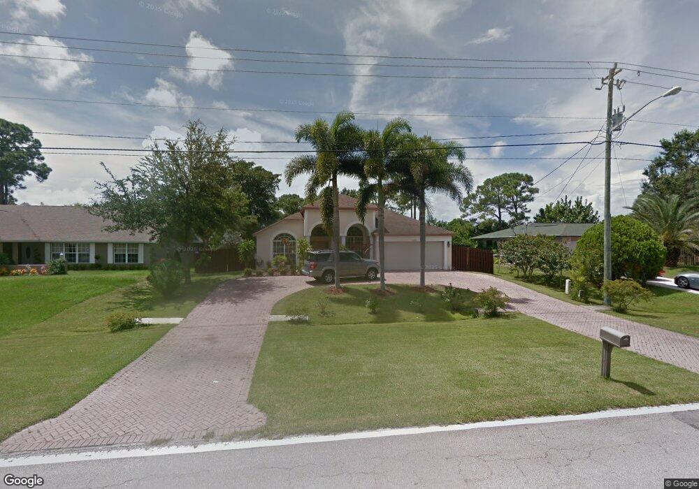
2458 SW Bayshore Blvd Port Saint Lucie, FL 34984
Canal Pointe NeighborhoodEstimated Value: $421,755 - $460,000
3
Beds
2
Baths
2,083
Sq Ft
$215/Sq Ft
Est. Value
About This Home
This home is located at 2458 SW Bayshore Blvd, Port Saint Lucie, FL 34984 and is currently estimated at $447,939, approximately $215 per square foot. 2458 SW Bayshore Blvd is a home located in St. Lucie County with nearby schools including Floresta Elementary School, Morningside Elementary School, and Northport K-8 School.
Ownership History
Date
Name
Owned For
Owner Type
Purchase Details
Closed on
Jul 23, 2004
Sold by
Cummins Harold and Cummins Ruby
Bought by
Jean Estime and Jean Yolene
Current Estimated Value
Home Financials for this Owner
Home Financials are based on the most recent Mortgage that was taken out on this home.
Original Mortgage
$154,050
Outstanding Balance
$74,607
Interest Rate
5.97%
Mortgage Type
Purchase Money Mortgage
Estimated Equity
$373,332
Purchase Details
Closed on
Jul 26, 2002
Sold by
Tyson Bobby Gene
Bought by
Cummins Harold and Cummins Ruby
Purchase Details
Closed on
Jan 10, 1997
Sold by
Meade John P and Meade Dorothy F
Bought by
Tyson Bobb Gene
Create a Home Valuation Report for This Property
The Home Valuation Report is an in-depth analysis detailing your home's value as well as a comparison with similar homes in the area
Home Values in the Area
Average Home Value in this Area
Purchase History
| Date | Buyer | Sale Price | Title Company |
|---|---|---|---|
| Jean Estime | $237,000 | Fidelity Natl Title Ins Co | |
| Cummins Harold | $8,000 | -- | |
| Tyson Bobb Gene | $8,000 | -- |
Source: Public Records
Mortgage History
| Date | Status | Borrower | Loan Amount |
|---|---|---|---|
| Open | Jean Estime | $154,050 |
Source: Public Records
Tax History Compared to Growth
Tax History
| Year | Tax Paid | Tax Assessment Tax Assessment Total Assessment is a certain percentage of the fair market value that is determined by local assessors to be the total taxable value of land and additions on the property. | Land | Improvement |
|---|---|---|---|---|
| 2025 | $2,824 | $150,367 | -- | -- |
| 2024 | $2,860 | $146,130 | -- | -- |
| 2023 | $2,860 | $141,874 | $0 | $0 |
| 2022 | $2,728 | $137,742 | $0 | $0 |
| 2021 | $2,636 | $133,731 | $0 | $0 |
| 2020 | $2,644 | $131,885 | $0 | $0 |
| 2019 | $2,613 | $128,920 | $0 | $0 |
| 2018 | $2,477 | $126,517 | $0 | $0 |
| 2017 | $2,669 | $185,400 | $24,000 | $161,400 |
| 2016 | $2,630 | $162,500 | $18,000 | $144,500 |
| 2015 | $2,652 | $132,900 | $10,000 | $122,900 |
| 2014 | $2,532 | $119,567 | $0 | $0 |
Source: Public Records
Map
Nearby Homes
- 2518 SW Cooper Ln
- 2621 SW Harem Cir
- 2477 SW Falcon Cir
- 183 SW Airview Ave
- 279 SW Statler Ave
- 2624 SW Harem Cir
- 2613 SW Harem Cir
- 2671 SW Union Terrace
- 2640 SW Harem Cir
- 171 SW Glenwood Dr
- 2329 SW Fern Cir
- 2585 SW Cameo Blvd
- 2574 SW Cameo Blvd
- 2544 SW Cameo Blvd
- 2590 SW Hinchman St
- 2602 SW Cameo Blvd
- 2668 SW Cameo Blvd
- 2221 SW Edison Cir
- 131 SW Essex Dr
- 164 SE Osprey Ridge
- 2450 SW Bayshore Blvd
- 2466 SW Bayshore Blvd Unit 1
- 2466 SW Bayshore Blvd
- 2442 SW Bayshore Blvd
- 2449 SW Cooper Ln
- 2465 SW Cooper Ln
- 2449 SE Cooper Ln
- 299 SW Langfield Ave
- 2441 SW Cooper Ln
- 2434 SW Bayshore Blvd
- 2473 SE Cooper Ln
- 2457 SW Cooper Ln
- 2473 SW Cooper Ln
- 2473 SW Bayshore Blvd
- 297 SW Langfield Ave
- 2426 SW Bayshore Blvd
- 290 SW Airview Ave
- 2490 SW Bayshore Blvd
- 2458 SE Cooper Ln
- 2450 SE Cooper Ln