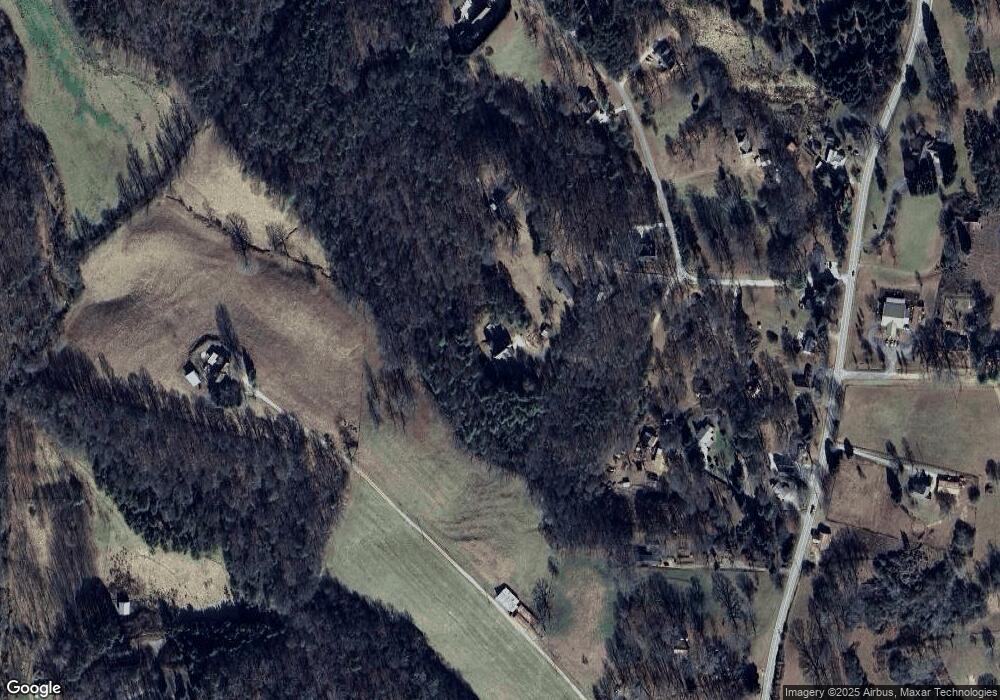
246 Cy Grant Rd Clarkesville, GA 30523
Estimated Value: $368,000 - $584,000
4
Beds
4
Baths
2,261
Sq Ft
$217/Sq Ft
Est. Value
About This Home
This home is located at 246 Cy Grant Rd, Clarkesville, GA 30523 and is currently estimated at $490,428, approximately $216 per square foot. 246 Cy Grant Rd is a home located in Habersham County with nearby schools including Clarkesville Elementary School, North Habersham Middle School, and Habersham Success Academy.
Ownership History
Date
Name
Owned For
Owner Type
Purchase Details
Closed on
Jan 26, 2017
Sold by
Gallagher Jill
Bought by
Gallagher James Richard and Gallagher Jill
Current Estimated Value
Home Financials for this Owner
Home Financials are based on the most recent Mortgage that was taken out on this home.
Original Mortgage
$188,000
Outstanding Balance
$95,409
Interest Rate
4.32%
Mortgage Type
New Conventional
Estimated Equity
$395,019
Create a Home Valuation Report for This Property
The Home Valuation Report is an in-depth analysis detailing your home's value as well as a comparison with similar homes in the area
Home Values in the Area
Average Home Value in this Area
Purchase History
| Date | Buyer | Sale Price | Title Company |
|---|---|---|---|
| Gallagher James Richard | -- | -- |
Source: Public Records
Mortgage History
| Date | Status | Borrower | Loan Amount |
|---|---|---|---|
| Open | Gallagher James Richard | $188,000 |
Source: Public Records
Tax History Compared to Growth
Tax History
| Year | Tax Paid | Tax Assessment Tax Assessment Total Assessment is a certain percentage of the fair market value that is determined by local assessors to be the total taxable value of land and additions on the property. | Land | Improvement |
|---|---|---|---|---|
| 2025 | $3,339 | $198,872 | $31,406 | $167,466 |
| 2024 | -- | $172,932 | $14,856 | $158,076 |
| 2023 | $2,339 | $145,828 | $14,856 | $130,972 |
| 2022 | $2,679 | $125,848 | $13,204 | $112,644 |
| 2021 | $2,536 | $112,756 | $12,380 | $100,376 |
| 2020 | $2,445 | $99,056 | $12,380 | $86,676 |
| 2019 | $2,447 | $99,056 | $12,380 | $86,676 |
| 2018 | $2,432 | $99,056 | $12,380 | $86,676 |
| 2017 | $2,352 | $91,944 | $12,380 | $79,564 |
| 2016 | $2,279 | $229,860 | $12,380 | $79,564 |
| 2015 | $2,254 | $229,860 | $12,380 | $79,564 |
| 2014 | $2,261 | $223,840 | $12,380 | $77,156 |
| 2013 | -- | $89,536 | $12,380 | $77,156 |
Source: Public Records
Map
Nearby Homes
- 1096 Sutton Mill Rd
- 2041 Highway 197 N
- 555 Highway 197 N
- 220 Hardman Rd
- 132 James Rd
- 165 Pearl St
- 219 Signing Tree Ln
- 124 Signing Tree Ln
- 104 Brando Trail
- 145 Goldust Ave
- 0 Old Clarkesville Mill Rd Unit (LOT 13)
- 0 Old Clarkesville Mill Rd Unit (LOT 11)
- 0 Old Clarkesville Mill Rd Unit (LOT 12)
- 0 Sutton Mill Rd Unit 10644026
- 206 Sycamore Way
- 182 Farm Hill Dr
- 297 Old Clarkesville Mill Rd
- 117 Village Green Way
- 214 Old Clarkesville Mill Rd Unit B
- 1955 Alec Mountain Rd
- 284 Cy Grant Rd
- 197 Cy Grant Rd
- 204 Cy Grant Rd
- 200 Cy Grant Rd
- 00 Clarkesville Heights Dr
- 362 Castle Rock Trail
- 1005 Annie Ruby Dr
- 165 Clarkesville Heights Dr
- 197 Castle Rock Trail
- 1229 Highway 197 N
- 1001 Annie Ruby Dr
- 1201 Highway 197 N
- 0 Clarkesville Heights Dr Unit 10224222
- 0 Clarkesville Heights Dr Unit 7302444
- 0 Clarkesville Heights Dr Unit 10215098
- 0 Clarkesville Heights Dr Unit 7291066
- 0 Clarkesville Heights Dr Unit 12 7301558
- 1101 Highway 197 N
- 134 Clarkesville Heights Dr
- 168 Clarkesville Heights Dr Unit 13
