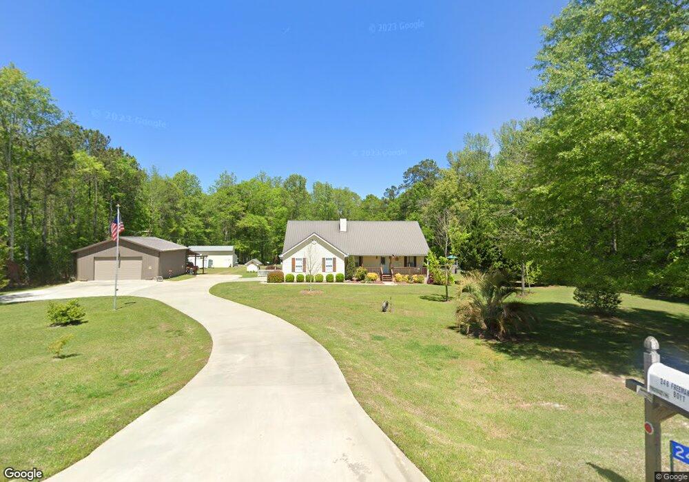
246 Freeman Rd Barnesville, GA 30204
Estimated Value: $347,737 - $399,000
3
Beds
2
Baths
2,046
Sq Ft
$180/Sq Ft
Est. Value
About This Home
This home is located at 246 Freeman Rd, Barnesville, GA 30204 and is currently estimated at $369,184, approximately $180 per square foot. 246 Freeman Rd is a home located in Lamar County with nearby schools including Lamar County Primary School, Lamar County Elementary School, and Lamar County Middle School.
Ownership History
Date
Name
Owned For
Owner Type
Purchase Details
Closed on
Aug 24, 2005
Sold by
Long Betty J
Bought by
Boyt Angela M
Current Estimated Value
Purchase Details
Closed on
Dec 20, 1999
Sold by
Laney John Todd
Bought by
Long J W
Purchase Details
Closed on
Mar 5, 1999
Sold by
Bst Properties Inc
Bought by
Laney John Todd
Purchase Details
Closed on
Feb 20, 1999
Sold by
Worthy John S
Bought by
Bst Properties Inc
Create a Home Valuation Report for This Property
The Home Valuation Report is an in-depth analysis detailing your home's value as well as a comparison with similar homes in the area
Home Values in the Area
Average Home Value in this Area
Purchase History
| Date | Buyer | Sale Price | Title Company |
|---|---|---|---|
| Boyt Angela M | $135,000 | -- | |
| Long J W | $105,000 | -- | |
| Laney John Todd | $13,500 | -- | |
| Bst Properties Inc | $11,900 | -- |
Source: Public Records
Tax History Compared to Growth
Tax History
| Year | Tax Paid | Tax Assessment Tax Assessment Total Assessment is a certain percentage of the fair market value that is determined by local assessors to be the total taxable value of land and additions on the property. | Land | Improvement |
|---|---|---|---|---|
| 2025 | $2,540 | $115,739 | $13,590 | $102,149 |
| 2024 | $2,540 | $101,147 | $13,590 | $87,557 |
| 2023 | $2,496 | $92,319 | $13,590 | $78,729 |
| 2022 | $2,148 | $79,691 | $7,206 | $72,485 |
| 2021 | $1,737 | $59,661 | $7,206 | $52,455 |
| 2020 | $1,828 | $59,661 | $7,206 | $52,455 |
| 2019 | $1,833 | $59,661 | $7,206 | $52,455 |
Source: Public Records
Map
Nearby Homes
- 249 Ponderosa Ln
- 725 Mccollum Rd
- 235 Rocky Branch Rd
- 410 Country Kitchen Rd
- 1207 Highway 36 W
- 144 Berry Rd
- 150 Berry Rd
- 146 Berry Rd
- 148 Berry Rd
- 818 Cannafax Rd
- 1505 Willis Rd
- 0 Perkins Rd Unit 253616
- 0 Perkins Rd Unit 10625263
- 0 Perkins Rd Unit 10635198
- 254 Needleleaf Dr
- 1972 Rest Haven Rd
- 2222 Barnesville Hwy
- 0 U S 341
- 0 Us Highway 41
- 0 Veterns Pkwy Unit 10515268