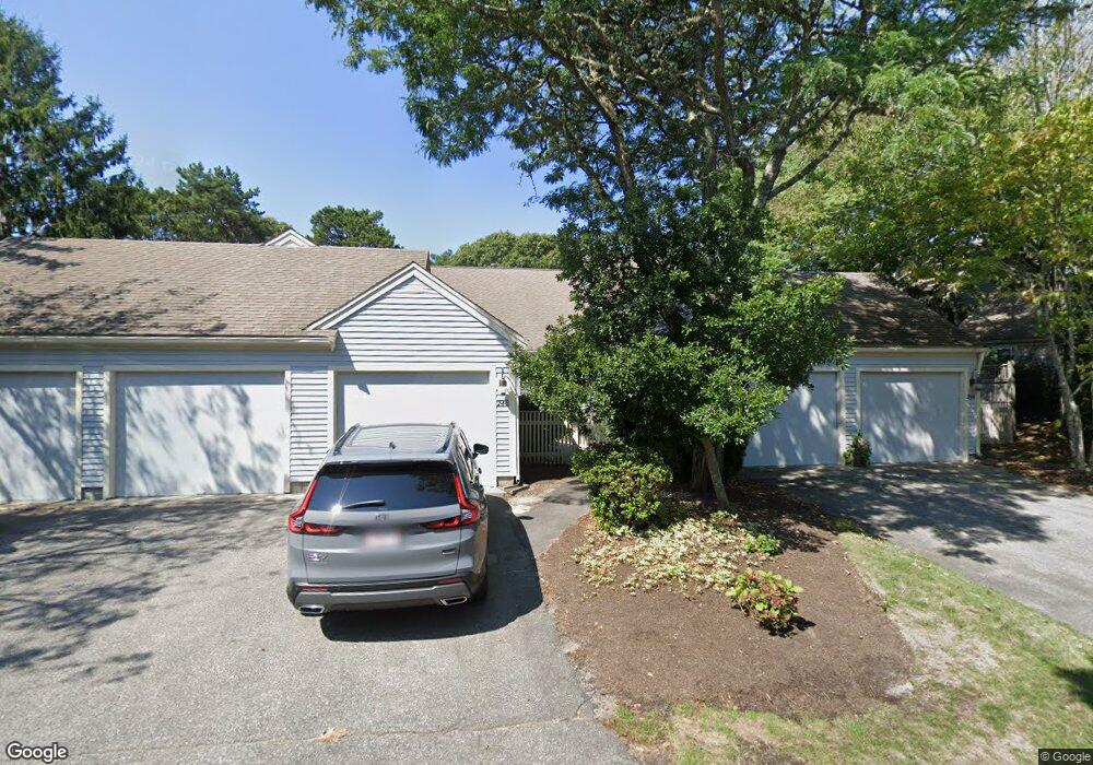
246 Kates Path Yarmouth Port, MA 02675
Yarmouth Port NeighborhoodEstimated Value: $483,000 - $595,000
2
Beds
3
Baths
1,154
Sq Ft
$468/Sq Ft
Est. Value
About This Home
This home is located at 246 Kates Path, Yarmouth Port, MA 02675 and is currently estimated at $540,534, approximately $468 per square foot. 246 Kates Path is a home located in Barnstable County with nearby schools including Dennis-Yarmouth Regional High School.
Ownership History
Date
Name
Owned For
Owner Type
Purchase Details
Closed on
Jun 17, 2015
Sold by
Kelley Coleman and Kelley Roberta
Bought by
Coleman Kelley Ft
Current Estimated Value
Purchase Details
Closed on
Jan 29, 2010
Sold by
Powers Christine M and Powers Christine E
Bought by
Mccarrick Jane M
Purchase Details
Closed on
Jun 7, 2002
Sold by
Hasty Edward H and Hasty Beverly A
Bought by
Powers Christine M
Home Financials for this Owner
Home Financials are based on the most recent Mortgage that was taken out on this home.
Original Mortgage
$300,000
Interest Rate
6.9%
Mortgage Type
Purchase Money Mortgage
Create a Home Valuation Report for This Property
The Home Valuation Report is an in-depth analysis detailing your home's value as well as a comparison with similar homes in the area
Home Values in the Area
Average Home Value in this Area
Purchase History
| Date | Buyer | Sale Price | Title Company |
|---|---|---|---|
| Coleman Kelley Ft | -- | -- | |
| Mccarrick Jane M | $280,000 | -- | |
| Powers Christine M | $375,000 | -- |
Source: Public Records
Mortgage History
| Date | Status | Borrower | Loan Amount |
|---|---|---|---|
| Previous Owner | Powers Christine M | $300,000 |
Source: Public Records
Tax History Compared to Growth
Tax History
| Year | Tax Paid | Tax Assessment Tax Assessment Total Assessment is a certain percentage of the fair market value that is determined by local assessors to be the total taxable value of land and additions on the property. | Land | Improvement |
|---|---|---|---|---|
| 2025 | $3,168 | $447,400 | $0 | $447,400 |
| 2024 | $3,182 | $431,100 | $0 | $431,100 |
| 2023 | $2,866 | $353,400 | $0 | $353,400 |
| 2022 | $3,273 | $356,500 | $0 | $356,500 |
| 2021 | $3,184 | $333,100 | $0 | $333,100 |
| 2020 | $3,214 | $321,400 | $0 | $321,400 |
| 2019 | $3,014 | $298,400 | $0 | $298,400 |
| 2018 | $2,835 | $275,500 | $0 | $275,500 |
| 2017 | $2,645 | $264,000 | $0 | $264,000 |
| 2016 | $2,520 | $252,500 | $0 | $252,500 |
| 2015 | -- | $265,300 | $0 | $265,300 |
Source: Public Records
Map
Nearby Homes
- 228 Kates Path
- 17 Kates Path Unit A
- 34 Kates Path
- 34 Kates Path Unit 34
- 64 Kates Path
- 50 John Hall Cartway
- 50 John Hall Cartway Unit 50
- 42 John Hall Cartway Unit 42
- 43 Canterbury Rd
- 7 Forest Gate Unit 7
- 44 Stratford Ln
- 25 Oak Glen Village Unit 25
- 25 Oak Glen
- 30 W Woods
- 30 W Woods Cir Unit 30
- 2 Pine Grove
- 86 Pompano Rd
- 51 Bray Farm Rd N
- 6 Nimble Hill Dr
- 1 Barnacle Rd
- 136 Kates Path Unit C
- 244 Kates Path
- 234 Kates Path
- 232 Kates Path
- 230 Kates Path
- 224 Kates Path
- 222 Kates Path
- 220 Kates Path
- 218 Kates Path
- 214 Kates Path
- 212 Kates Path
- 138 Kates Path
- 136 Kates Path
- 134 Kates Path
- 132 Kates Path
- 130 Kates Path
- 77 Kates Path
- 75 Kates Path
- 73 Kates Path
- 71 Kates Path