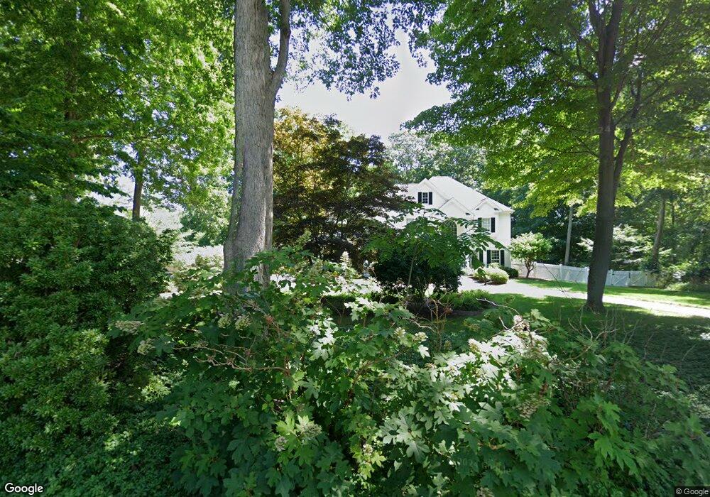
246 Mungertown Rd Madison, CT 06443
Estimated Value: $1,035,893 - $1,234,000
4
Beds
4
Baths
3,369
Sq Ft
$327/Sq Ft
Est. Value
About This Home
This home is located at 246 Mungertown Rd, Madison, CT 06443 and is currently estimated at $1,102,473, approximately $327 per square foot. 246 Mungertown Rd is a home located in New Haven County with nearby schools including Walter C. Polson Upper Middle School, Daniel Hand High School, and The Country School.
Ownership History
Date
Name
Owned For
Owner Type
Purchase Details
Closed on
Jul 26, 2023
Sold by
Lynch Michael J and Lynch Deborah D
Bought by
Lynch
Current Estimated Value
Purchase Details
Closed on
Jun 9, 1998
Sold by
Pmc Design Build Inc
Bought by
Lynch Michael J and Lynch Deborah D
Home Financials for this Owner
Home Financials are based on the most recent Mortgage that was taken out on this home.
Original Mortgage
$260,000
Interest Rate
7.05%
Mortgage Type
Purchase Money Mortgage
Create a Home Valuation Report for This Property
The Home Valuation Report is an in-depth analysis detailing your home's value as well as a comparison with similar homes in the area
Home Values in the Area
Average Home Value in this Area
Purchase History
| Date | Buyer | Sale Price | Title Company |
|---|---|---|---|
| Lynch | -- | None Available | |
| Lynch Michael J | $436,568 | -- |
Source: Public Records
Mortgage History
| Date | Status | Borrower | Loan Amount |
|---|---|---|---|
| Previous Owner | Lynch Michael J | $250,000 | |
| Previous Owner | Lynch Michael J | $212,000 | |
| Previous Owner | Lynch Michael J | $260,000 |
Source: Public Records
Tax History
| Year | Tax Paid | Tax Assessment Tax Assessment Total Assessment is a certain percentage of the fair market value that is determined by local assessors to be the total taxable value of land and additions on the property. | Land | Improvement |
|---|---|---|---|---|
| 2025 | $13,664 | $609,200 | $149,600 | $459,600 |
| 2024 | $13,402 | $609,200 | $149,600 | $459,600 |
| 2023 | $13,055 | $435,600 | $115,000 | $320,600 |
| 2022 | $12,811 | $435,600 | $115,000 | $320,600 |
| 2021 | $12,567 | $435,600 | $115,000 | $320,600 |
| 2020 | $12,349 | $435,600 | $115,000 | $320,600 |
| 2019 | $12,349 | $435,600 | $115,000 | $320,600 |
| 2018 | $12,638 | $450,700 | $133,100 | $317,600 |
| 2017 | $12,304 | $450,700 | $133,100 | $317,600 |
| 2016 | $11,939 | $450,700 | $133,100 | $317,600 |
| 2015 | $11,437 | $444,000 | $133,100 | $310,900 |
| 2014 | $15,288 | $607,400 | $163,600 | $443,800 |
Source: Public Records
Map
Nearby Homes
- 300 Mungertown Rd
- 198 Green Hill Rd
- 173 Wildwood Ave
- 23 Sheep Pasture Rd
- 26 Opening Hill Rd
- 38 Opening Hill Rd
- 22 Nathans Ln
- 75 Fairview Dr
- 67 Boston Post Rd Unit 8
- 2 Esterly Farms Rd
- 461 Green Hill Rd
- 31 Stony Lane Lot 3 Rd
- 31 Stony Lane Lot 2 Rd
- 31 Stony Lane Lot 1 Rd
- 4 Boston Post Rd
- 42 Wildcat Rd
- 14 Centre Village Dr
- 37 Lantern Hill Rd
- 90 Robin Ridge Dr
- 18 Kelsey Springs Dr
- 236 Mungertown Rd
- 258 Mungertown Rd
- 231 Green Hill Rd
- 42 Old Schoolhouse Rd
- 245 Mungertown Rd
- 268 Mungertown Rd
- 239 Mungertown Rd
- 233 Mungertown Rd
- 227 Green Hill Rd
- 262 Mungertowncol Rd
- 262 Mungertownranch Rd
- 262 Mungertown Rd
- 235 Green Hill Rd
- 221 Green Hill Rd
- 15 Riverside Terrace
- 17 Riverside Terrace
- 227 Mungertown Rd
- 11 Riverside Terrace
- 278 Mungertown Rd
- 264 Mungertown Rd
Your Personal Tour Guide
Ask me questions while you tour the home.