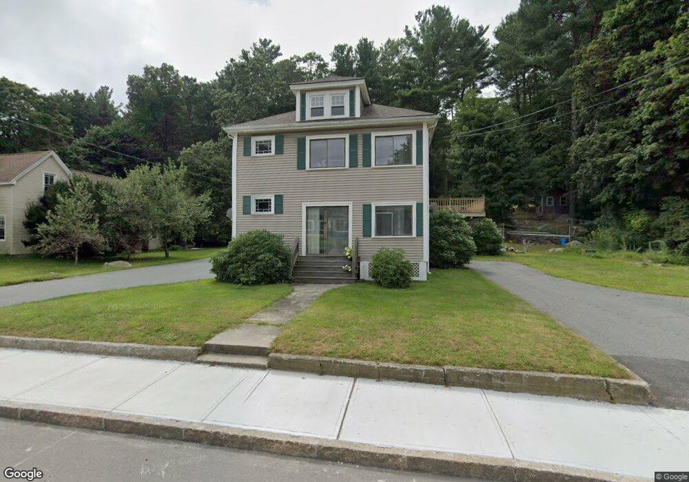
246 N Main St Uxbridge, MA 01569
Estimated Value: $529,000 - $664,000
6
Beds
3
Baths
3,220
Sq Ft
$183/Sq Ft
Est. Value
About This Home
This home is located at 246 N Main St, Uxbridge, MA 01569 and is currently estimated at $590,667, approximately $183 per square foot. 246 N Main St is a home located in Worcester County with nearby schools including Uxbridge High School, Our Lady of the Valley Regional School, and Whitinsville Christian School.
Ownership History
Date
Name
Owned For
Owner Type
Purchase Details
Closed on
Jun 29, 2022
Sold by
Burke John D
Bought by
246 North Main Street Ret
Current Estimated Value
Purchase Details
Closed on
Jun 28, 1978
Bought by
Burke John D
Create a Home Valuation Report for This Property
The Home Valuation Report is an in-depth analysis detailing your home's value as well as a comparison with similar homes in the area
Home Values in the Area
Average Home Value in this Area
Purchase History
| Date | Buyer | Sale Price | Title Company |
|---|---|---|---|
| 246 North Main Street Ret | -- | None Available | |
| Burke John D | -- | -- |
Source: Public Records
Mortgage History
| Date | Status | Borrower | Loan Amount |
|---|---|---|---|
| Previous Owner | Burke John D | $160,000 | |
| Previous Owner | Burke John D | $120,000 |
Source: Public Records
Tax History
| Year | Tax Paid | Tax Assessment Tax Assessment Total Assessment is a certain percentage of the fair market value that is determined by local assessors to be the total taxable value of land and additions on the property. | Land | Improvement |
|---|---|---|---|---|
| 2025 | $61 | $467,700 | $138,300 | $329,400 |
| 2024 | $5,894 | $456,200 | $126,800 | $329,400 |
| 2023 | $5,598 | $401,300 | $115,300 | $286,000 |
| 2022 | $5,298 | $349,500 | $104,500 | $245,000 |
| 2021 | $5,183 | $327,600 | $99,900 | $227,700 |
| 2020 | $5,216 | $311,600 | $103,700 | $207,900 |
| 2019 | $5,200 | $299,700 | $96,100 | $203,600 |
| 2018 | $4,696 | $273,500 | $96,100 | $177,400 |
| 2017 | $4,111 | $242,400 | $91,300 | $151,100 |
| 2016 | $4,264 | $242,700 | $90,500 | $152,200 |
| 2015 | $4,120 | $236,800 | $90,500 | $146,300 |
Source: Public Records
Map
Nearby Homes
- 26 Rivulet St
- 71 Rivulet St Unit B
- 12 Hartford Ave E
- 3 Strathmore Shire Unit A
- 138 Elm St
- 0 Homestead Ave
- 235 Rivulet St
- 218 E Hartford Ave Unit 218
- 86 Hunter Rd
- 164 Heritage Dr Unit 164
- 16 Farnum St
- 125 Heritage Dr
- 24 Olde Canal Way Unit 24
- 5 Peter St Unit D
- 237 Heritage Dr Unit 237
- 240 Heritage Dr
- 288-290 Providence Rd
- 79 High St
- 56 S Main St
- 79 Country Club Dr
- 242 N Main St
- 250 N Main St
- 245 N Main St
- 234 N Main St
- 253 N Main St
- 255 N Main St
- 239 N Main St
- 2 Rivulet St
- 230 N Main St
- 228 N Main St
- 235 N Main St
- 229 N Main St
- 8 S Bowlder St
- 8 S Bowlder St Unit 8B
- 8 S Bowlder St Unit A
- 220 N Main St
- 6 Rivulet St
- 265 N Main St
- 265 N Main St Unit C
- 33 Garden St
Your Personal Tour Guide
Ask me questions while you tour the home.