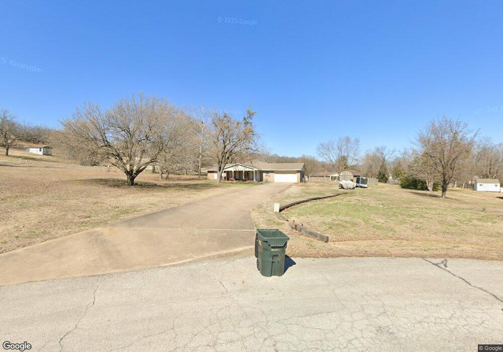
2460 Mustang Cir Sapulpa, OK 74066
Estimated Value: $197,000 - $209,000
3
Beds
2
Baths
1,394
Sq Ft
$145/Sq Ft
Est. Value
About This Home
This home is located at 2460 Mustang Cir, Sapulpa, OK 74066 and is currently estimated at $202,791, approximately $145 per square foot. 2460 Mustang Cir is a home located in Creek County with nearby schools including Lone Star Public School, Eagle Point Christian Academy, and American Christian Academy.
Ownership History
Date
Name
Owned For
Owner Type
Purchase Details
Closed on
Dec 8, 2017
Sold by
Zike Julie
Bought by
Zwirtz Charles
Current Estimated Value
Purchase Details
Closed on
Apr 8, 2013
Sold by
Zwirtz Charles David and Zwirtz Lisa
Bought by
The Zwirtz Family Trust
Purchase Details
Closed on
Mar 11, 2005
Sold by
Maloney Edna M
Bought by
Zwirtz Charles David
Home Financials for this Owner
Home Financials are based on the most recent Mortgage that was taken out on this home.
Original Mortgage
$77,343
Outstanding Balance
$38,946
Interest Rate
5.71%
Mortgage Type
FHA
Estimated Equity
$163,845
Create a Home Valuation Report for This Property
The Home Valuation Report is an in-depth analysis detailing your home's value as well as a comparison with similar homes in the area
Home Values in the Area
Average Home Value in this Area
Purchase History
| Date | Buyer | Sale Price | Title Company |
|---|---|---|---|
| Zwirtz Charles | -- | None Available | |
| The Zwirtz Family Trust | -- | None Available | |
| Zwirtz Charles David | -- | None Available |
Source: Public Records
Mortgage History
| Date | Status | Borrower | Loan Amount |
|---|---|---|---|
| Open | Zwirtz Charles David | $77,343 |
Source: Public Records
Tax History Compared to Growth
Tax History
| Year | Tax Paid | Tax Assessment Tax Assessment Total Assessment is a certain percentage of the fair market value that is determined by local assessors to be the total taxable value of land and additions on the property. | Land | Improvement |
|---|---|---|---|---|
| 2025 | $1,255 | $13,374 | $3,152 | $10,222 |
| 2024 | $1,255 | $12,985 | $3,060 | $9,925 |
| 2023 | $1,255 | $12,606 | $3,060 | $9,546 |
| 2022 | $1,195 | $12,239 | $3,060 | $9,179 |
| 2021 | $1,176 | $11,883 | $3,060 | $8,823 |
| 2020 | $1,323 | $11,537 | $3,060 | $8,477 |
| 2019 | $1,086 | $11,201 | $3,060 | $8,141 |
| 2018 | $1,068 | $10,875 | $3,060 | $7,815 |
| 2017 | $1,075 | $10,875 | $3,060 | $7,815 |
| 2016 | $1,105 | $10,875 | $3,060 | $7,815 |
| 2015 | -- | $10,875 | $3,060 | $7,815 |
| 2014 | -- | $10,770 | $3,060 | $7,710 |
Source: Public Records
Map
Nearby Homes
- 416 W Fairlane Dr Unit A-B
- 273 W Fairlane Dr
- 2600 S Hickory St
- 605 W Mockingbird Ln
- 1965 S Scott St
- 1915 S Muskogee St
- 41 W Fairlane Ct
- 19 E Fairlane Ct
- 103 E Fairlane Ct
- 119 E Ross Ave
- 1424 S Main St
- 120 E Burnham Ave
- 211 E Wells Blvd
- 1220 S Cedar St
- 1120 W Keeling Ave
- 1160 W Keeling Ave
- 119 E Davis Ave
- 121 E Davis Ave
- 920 S Oklahoma St
- 910 S Diane St
- 2437 Galaxy Rd
- 2456 Mustang Cir
- 2403 Galaxy Rd
- 2468 Mustang Cir
- 2417 Galaxy Rd
- 485 Fairlane Dr
- 485 W Fairlane Dr
- 2445 Mustang Cir
- 2457 Mustang Cir
- 474 Galaxy Rd
- 460 Galaxy Rd
- 2463 Mustang Cir
- 2436 Galaxy Rd
- 450 Galaxy Rd
- null Galaxy Rd
- 2438 S Independence St
- 2434 S Independence St
- 2442 S Independence St
- 2430 S Independence St
- 2418 Galaxy Rd