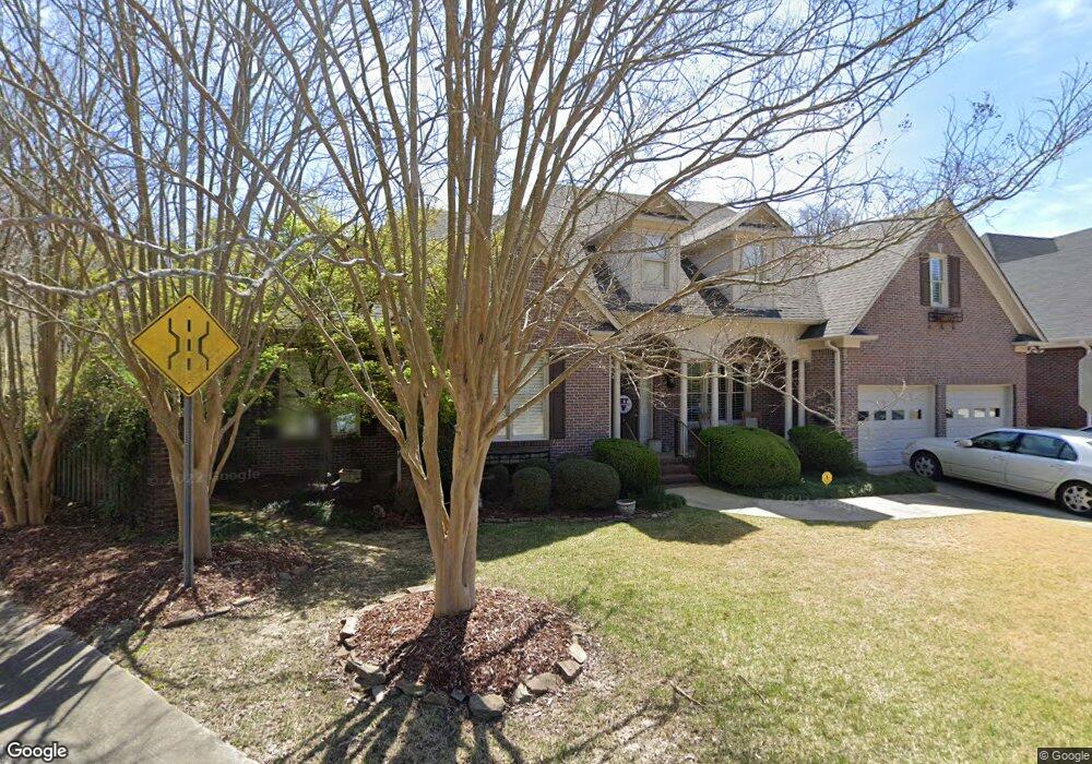
2460 Robert Ln Birmingham, AL 35243
Estimated Value: $574,379 - $736,000
3
Beds
3
Baths
2,667
Sq Ft
$252/Sq Ft
Est. Value
About This Home
This home is located at 2460 Robert Ln, Birmingham, AL 35243 and is currently estimated at $671,845, approximately $251 per square foot. 2460 Robert Ln is a home located in Jefferson County with nearby schools including Grantswood Community Elementary School, Shades Valley High School, and Southminster Day School.
Ownership History
Date
Name
Owned For
Owner Type
Purchase Details
Closed on
Jul 28, 2006
Sold by
Brunner Lynn W Horn and Brunner Richard Anton
Bought by
Harris Jerry and Harris Mary Ann
Current Estimated Value
Purchase Details
Closed on
Jul 9, 2002
Sold by
Sproul Blalock Pate Inc
Bought by
Horn Lynn W
Home Financials for this Owner
Home Financials are based on the most recent Mortgage that was taken out on this home.
Original Mortgage
$10,000
Outstanding Balance
$3,496
Interest Rate
4.25%
Mortgage Type
Credit Line Revolving
Estimated Equity
$668,349
Create a Home Valuation Report for This Property
The Home Valuation Report is an in-depth analysis detailing your home's value as well as a comparison with similar homes in the area
Home Values in the Area
Average Home Value in this Area
Purchase History
| Date | Buyer | Sale Price | Title Company |
|---|---|---|---|
| Harris Jerry | $434,900 | None Available | |
| Horn Lynn W | $284,267 | -- |
Source: Public Records
Mortgage History
| Date | Status | Borrower | Loan Amount |
|---|---|---|---|
| Open | Horn Lynn W | $10,000 |
Source: Public Records
Tax History Compared to Growth
Tax History
| Year | Tax Paid | Tax Assessment Tax Assessment Total Assessment is a certain percentage of the fair market value that is determined by local assessors to be the total taxable value of land and additions on the property. | Land | Improvement |
|---|---|---|---|---|
| 2024 | $2,463 | $50,220 | -- | -- |
| 2022 | $2,463 | $50,210 | $13,700 | $36,510 |
| 2021 | $2,364 | $48,240 | $13,700 | $34,540 |
| 2020 | $2,153 | $44,030 | $13,700 | $30,330 |
| 2019 | $2,040 | $41,780 | $0 | $0 |
| 2018 | $2,182 | $44,620 | $0 | $0 |
| 2017 | $1,955 | $40,080 | $0 | $0 |
| 2016 | $1,916 | $39,300 | $0 | $0 |
| 2015 | $1,916 | $39,300 | $0 | $0 |
| 2014 | $1,895 | $41,520 | $0 | $0 |
| 2013 | $1,895 | $41,520 | $0 | $0 |
Source: Public Records
Map
Nearby Homes
- 1719 Collinwood Ct
- 1723 Collinwood Ct
- 2317 Garland Dr
- 3413 Ridgedale Dr
- 3444 Creekwood Dr
- 2232 Garland Dr
- 1375 Badham Dr
- 1321 Willoughby Rd
- 1281 Branchwater Ln
- 1120 Nina's Way
- 1125 Nina's Way
- The Laurel Plan at Woodruff Cottages
- The Bellamy Plan at Woodruff Cottages
- The Hampton Plan at Woodruff Cottages
- The Iris Plan at Woodruff Cottages
- The Madison Plan at Woodruff Cottages
- 1207 Cheval Ln
- 3425 Ridge Dell Cir
- 3583 Valley Cir
- 1583 Creekstone Cir
- 2711 Crandall Ct
- 2470 Robert Ln
- 2707 Crandall Ct
- 2715 Crandall Ct
- 2701 Crandall Ct
- 2480 Robert Ln
- 2471 Robert Ln
- 2719 Crandall Ct
- 2723 Crandall Ct
- 2720 Crandall Ct
- 2704 Crandall Ct
- 2490 Robert Ln
- 2708 Crandall Ct
- 2700 Crandall Ct
- 1510 Cambridge Cir
- 2485 Robert Ln
- 2712 Crandall Ct
- 1506 Cambridge Cir
- 1514 Cambridge Cir
- 2716 Crandall Ct