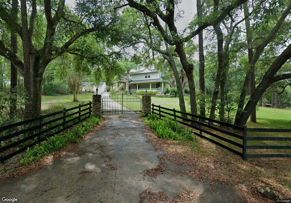
2460 S Hill Ave Deland, FL 32724
Estimated Value: $589,000 - $710,000
4
Beds
3
Baths
3,716
Sq Ft
$169/Sq Ft
Est. Value
About This Home
This home is located at 2460 S Hill Ave, Deland, FL 32724 and is currently estimated at $627,816, approximately $168 per square foot. 2460 S Hill Ave is a home located in Volusia County with nearby schools including Freedom Elementary School, Deland High School, and Deland Middle School.
Ownership History
Date
Name
Owned For
Owner Type
Purchase Details
Closed on
Mar 15, 2002
Sold by
Olday Richard F and Olday Danette L
Bought by
Olday Richard F and Olday Danette L
Current Estimated Value
Purchase Details
Closed on
Jul 31, 1996
Sold by
Theis David A and Theis Andrea L
Bought by
Olday Richard F
Home Financials for this Owner
Home Financials are based on the most recent Mortgage that was taken out on this home.
Original Mortgage
$90,000
Interest Rate
8.2%
Mortgage Type
Purchase Money Mortgage
Purchase Details
Closed on
Oct 15, 1984
Bought by
Olday Richard F and Olday Danette L
Create a Home Valuation Report for This Property
The Home Valuation Report is an in-depth analysis detailing your home's value as well as a comparison with similar homes in the area
Home Values in the Area
Average Home Value in this Area
Purchase History
| Date | Buyer | Sale Price | Title Company |
|---|---|---|---|
| Olday Richard F | -- | -- | |
| Olday Richard F | $174,000 | -- | |
| Olday Richard F | $22,500 | -- |
Source: Public Records
Mortgage History
| Date | Status | Borrower | Loan Amount |
|---|---|---|---|
| Previous Owner | Olday Richard F | $90,000 |
Source: Public Records
Tax History Compared to Growth
Tax History
| Year | Tax Paid | Tax Assessment Tax Assessment Total Assessment is a certain percentage of the fair market value that is determined by local assessors to be the total taxable value of land and additions on the property. | Land | Improvement |
|---|---|---|---|---|
| 2025 | $4,041 | $264,213 | -- | -- |
| 2024 | $4,041 | $256,767 | -- | -- |
| 2023 | $4,041 | $249,289 | $0 | $0 |
| 2022 | $3,971 | $242,028 | $0 | $0 |
| 2021 | $4,125 | $234,979 | $0 | $0 |
| 2020 | $4,068 | $231,735 | $0 | $0 |
| 2019 | $4,208 | $226,525 | $0 | $0 |
| 2018 | $4,208 | $222,301 | $0 | $0 |
| 2017 | $4,230 | $217,729 | $0 | $0 |
| 2016 | $4,046 | $213,251 | $0 | $0 |
| 2015 | $4,129 | $211,769 | $0 | $0 |
| 2014 | $4,088 | $210,088 | $0 | $0 |
Source: Public Records
Map
Nearby Homes
- 316 Nowell Loop
- 1020 Orange Camp Rd
- 810 E Yorkshire Dr
- 1545 Covered Bridge Dr
- 493 Nowell Loop
- 1741 Alanson Dr
- 1440 Arroyo Vista Dr
- 1621 Timber Hills Dr
- 1660 Timber Edge Dr
- 204 Wellington Woods Ave
- 218 Wellington Woods Ave
- 0000 Roos Ln
- 511 Baroness Way
- 435 Anne St
- 2438 Dartmouth Rd
- 217 Elizabeth Rd
- 391 Lady Bella Place
- 115 Duchess Rd
- 2032 Yorkshire Dr
- 2401 Oxmoor Dr
- 890 Orange Camp Rd
- 860 Orange Camp Rd
- 2450 S Hill Ave
- 880 Braemar Ln
- 865 Orange Camp Rd
- 1630 Alanson Dr
- 2440 S Hill Ave
- 2427 Clay Mark Ln
- 881 Braemar Ln
- 840 Braemar Ln
- 861 Braemar Ln
- 2430 S Hill Ave
- 2435 Clay Mark Ln
- 2390 Southern Pines Place
- 820 Orange Camp Rd
- 865 Braemar Ln
- 841 Braemar Ln
- 1640 Alanson Dr
- 820 Braemar Ln
- 2426 Clay Mark Ln