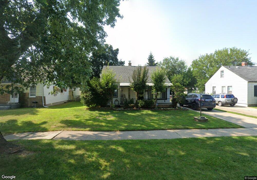
24613 Powers Ave Dearborn Heights, MI 48125
Estimated Value: $152,000 - $166,000
3
Beds
1
Bath
892
Sq Ft
$175/Sq Ft
Est. Value
About This Home
This home is located at 24613 Powers Ave, Dearborn Heights, MI 48125 and is currently estimated at $156,088, approximately $174 per square foot. 24613 Powers Ave is a home located in Wayne County with nearby schools including West Village Academy and Quest Charter Academy.
Ownership History
Date
Name
Owned For
Owner Type
Purchase Details
Closed on
Oct 21, 2014
Sold by
Treasurer Of The Charter County Of Wayne
Bought by
Msr Holding Llc
Current Estimated Value
Purchase Details
Closed on
Sep 21, 2000
Sold by
Ralph R Roberts Real Est
Bought by
Milne Laurie A
Purchase Details
Closed on
Apr 22, 1998
Sold by
Shrf Ramon L Cancel Pr
Bought by
Indianapolis Union Federal Savings Bank Of
Purchase Details
Closed on
Oct 31, 1995
Sold by
Cancel Ramon L
Bought by
Cancel Ramon L
Create a Home Valuation Report for This Property
The Home Valuation Report is an in-depth analysis detailing your home's value as well as a comparison with similar homes in the area
Home Values in the Area
Average Home Value in this Area
Purchase History
| Date | Buyer | Sale Price | Title Company |
|---|---|---|---|
| Msr Holding Llc | $33,000 | None Available | |
| Milne Laurie A | $88,500 | -- | |
| Indianapolis Union Federal Savings Bank Of | $62,851 | -- | |
| Cancel Ramon L | $58,000 | -- |
Source: Public Records
Tax History Compared to Growth
Tax History
| Year | Tax Paid | Tax Assessment Tax Assessment Total Assessment is a certain percentage of the fair market value that is determined by local assessors to be the total taxable value of land and additions on the property. | Land | Improvement |
|---|---|---|---|---|
| 2025 | $1,448 | $66,800 | $0 | $0 |
| 2024 | $1,448 | $59,300 | $0 | $0 |
| 2023 | $2,371 | $51,300 | $0 | $0 |
| 2022 | $2,148 | $44,300 | $0 | $0 |
| 2021 | $1,921 | $38,600 | $0 | $0 |
| 2019 | $1,734 | $29,600 | $0 | $0 |
| 2018 | $1,112 | $26,300 | $0 | $0 |
| 2017 | $1,146 | $26,200 | $0 | $0 |
| 2016 | $2,122 | $26,600 | $0 | $0 |
| 2015 | $2,470 | $24,700 | $0 | $0 |
| 2013 | $2,560 | $26,600 | $0 | $0 |
| 2010 | -- | $31,300 | $0 | $0 |
Source: Public Records
Map
Nearby Homes
- 24443 Powers Ave
- 24360 Pennie St
- 24339 Eton Ave
- 4856 Carolee Ln
- 24117 Eton Ave
- 24035 Currier St
- 24754 Annapolis St
- 24727 Hopkins St
- 5118 Michael St
- 24426 Lehigh St
- 24635 Stanford St
- 24409 Stanford St
- 5963 Vivian St
- 4147 Westlake St
- 4901 Cornell St
- 25118 Lehigh St
- 5689 Cornell St
- 25243 Lehigh St
- 6020 Vivian St
- 4489 Westpoint St
- 24601 Powers Ave
- 24625 Powers Ave
- 24639 Powers Ave
- 24612 Currier St
- 24620 Currier St
- 24602 Currier St
- 24628 Currier St
- 24451 Powers Ave
- 24651 Powers Ave
- 24614 Powers Ave
- 24640 Currier St
- 24626 Powers Ave
- 24703 Powers Ave
- 24638 Powers Ave
- 24452 Currier St
- 24652 Currier St
- 24452 Powers Ave
- 24650 Powers Ave
- 24444 Currier St Unit Bldg-Unit
- 24444 Currier St