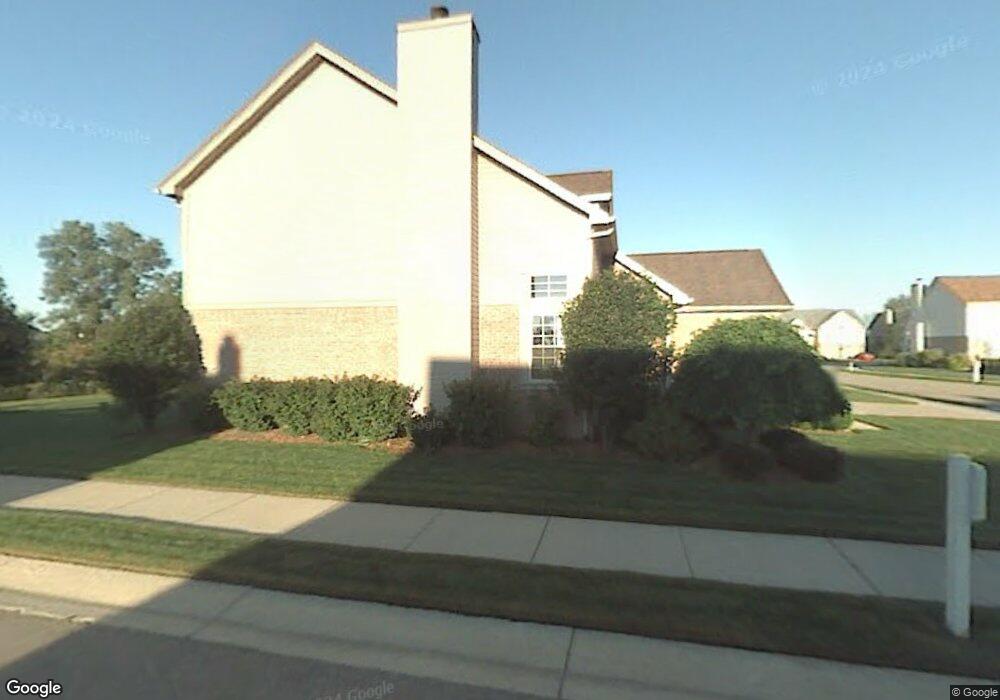
24625 Jason Dr Unit 13 Flat Rock, MI 48134
Estimated Value: $343,791 - $384,000
3
Beds
4
Baths
1,706
Sq Ft
$211/Sq Ft
Est. Value
About This Home
This home is located at 24625 Jason Dr Unit 13, Flat Rock, MI 48134 and is currently estimated at $360,198, approximately $211 per square foot. 24625 Jason Dr Unit 13 is a home located in Wayne County with nearby schools including Wegienka Elementary School, Patrick Henry Middle School, and Brownstown Middle School.
Ownership History
Date
Name
Owned For
Owner Type
Purchase Details
Closed on
Feb 21, 2020
Sold by
Swanson Mark A and Gutowski Renee N
Bought by
Gutowski Renee N
Current Estimated Value
Home Financials for this Owner
Home Financials are based on the most recent Mortgage that was taken out on this home.
Original Mortgage
$176,000
Outstanding Balance
$155,236
Interest Rate
3.4%
Mortgage Type
New Conventional
Estimated Equity
$204,962
Purchase Details
Closed on
Jul 25, 2005
Sold by
Jones Yancey D
Bought by
Swanson Mark A
Create a Home Valuation Report for This Property
The Home Valuation Report is an in-depth analysis detailing your home's value as well as a comparison with similar homes in the area
Home Values in the Area
Average Home Value in this Area
Purchase History
| Date | Buyer | Sale Price | Title Company |
|---|---|---|---|
| Gutowski Renee N | -- | Transtar National Title | |
| Swanson Mark A | $186,000 | Commonwealth Land Title |
Source: Public Records
Mortgage History
| Date | Status | Borrower | Loan Amount |
|---|---|---|---|
| Open | Gutowski Renee N | $176,000 |
Source: Public Records
Tax History Compared to Growth
Tax History
| Year | Tax Paid | Tax Assessment Tax Assessment Total Assessment is a certain percentage of the fair market value that is determined by local assessors to be the total taxable value of land and additions on the property. | Land | Improvement |
|---|---|---|---|---|
| 2025 | $3,917 | $143,000 | $0 | $0 |
| 2024 | $3,917 | $133,900 | $0 | $0 |
| 2023 | $2,038 | $116,200 | $0 | $0 |
| 2022 | $3,752 | $107,500 | $0 | $0 |
| 2021 | $3,465 | $104,300 | $0 | $0 |
| 2020 | $3,412 | $102,700 | $0 | $0 |
| 2019 | $3,371 | $104,000 | $0 | $0 |
| 2018 | $1,781 | $89,300 | $0 | $0 |
| 2017 | $3,075 | $110,800 | $0 | $0 |
| 2016 | $3,252 | $89,300 | $0 | $0 |
| 2015 | $6,723 | $84,000 | $0 | $0 |
| 2013 | $6,513 | $76,700 | $0 | $0 |
| 2012 | -- | $63,200 | $12,500 | $50,700 |
Source: Public Records
Map
Nearby Homes
- 23607 Telegraph Rd
- 24436 Mount Olive Dr
- 23851 Andrew Blvd
- 24320 Westpointe St
- 22886 Sylvan Ave
- 23869 McCort Dr Unit 68
- Argonne Ave 8.8 Acre Argonne Ave
- Argonne Ave 5 Acres Argonne Ave
- Pineridge II Plan at Timber Creek
- Oakmont Plan at Timber Creek
- Oakcrest Plan at Timber Creek
- Hickory Plan at Timber Creek
- Edgewood Plan at Timber Creek
- Birch Plan at Timber Creek
- Arlington Plan at Timber Creek
- 23311 Redman Ct Unit 35
- 23840 Brentwood Dr Unit 102
- 26077 Timber Creek Blvd
- 23300 Brentwood Dr
- 24048 Hemlock Dr Unit 7
- 24613 Jason Dr
- 24643 Jason Dr
- 24595 Jason Dr
- 24665 Jason Dr
- 24583 Jason Dr
- 24628 Jason Dr Unit 59
- 24610 Jason Dr
- 24646 Jason Dr Unit 58
- 24592 Jason Dr Unit 61
- 24575 Jason Dr
- 24683 Jason Dr
- 23677 Christopher Dr
- 24564 Jason Dr Unit 62
- 23627 Christopher Dr
- 24705 Jason Dr Unit 17
- 24713 Jason Dr
- 24563 Jason Dr
- 23597 Christopher Dr Unit 54
- 23678 Christopher Dr Unit 48
- 24546 Jason Dr Unit 63