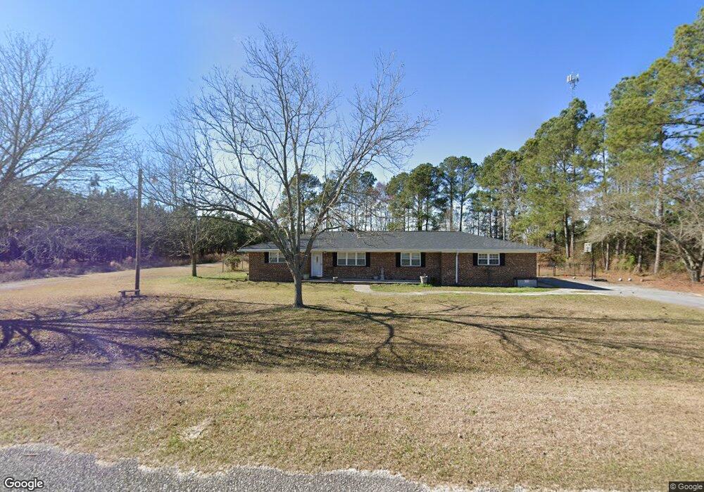
2463 Dd Durrence Rd Glennville, GA 30427
Estimated Value: $208,000 - $281,000
--
Bed
2
Baths
2,679
Sq Ft
$89/Sq Ft
Est. Value
About This Home
This home is located at 2463 Dd Durrence Rd, Glennville, GA 30427 and is currently estimated at $237,226, approximately $88 per square foot. 2463 Dd Durrence Rd is a home located in Tattnall County with nearby schools including Tattnall County High School.
Ownership History
Date
Name
Owned For
Owner Type
Purchase Details
Closed on
Dec 3, 2013
Sold by
Cowart Tammy Driggers
Bought by
Kennedy Dana R and Kennedy Tonja D
Current Estimated Value
Home Financials for this Owner
Home Financials are based on the most recent Mortgage that was taken out on this home.
Original Mortgage
$90,000
Outstanding Balance
$66,599
Interest Rate
4.19%
Mortgage Type
New Conventional
Estimated Equity
$170,627
Purchase Details
Closed on
Jun 2, 2005
Sold by
Cowart Tammy Driggers
Bought by
Cowart Tammy Driggers
Create a Home Valuation Report for This Property
The Home Valuation Report is an in-depth analysis detailing your home's value as well as a comparison with similar homes in the area
Home Values in the Area
Average Home Value in this Area
Purchase History
| Date | Buyer | Sale Price | Title Company |
|---|---|---|---|
| Kennedy Dana R | $90,000 | -- | |
| Cowart Tammy Driggers | -- | -- |
Source: Public Records
Mortgage History
| Date | Status | Borrower | Loan Amount |
|---|---|---|---|
| Open | Kennedy Dana R | $90,000 |
Source: Public Records
Tax History Compared to Growth
Tax History
| Year | Tax Paid | Tax Assessment Tax Assessment Total Assessment is a certain percentage of the fair market value that is determined by local assessors to be the total taxable value of land and additions on the property. | Land | Improvement |
|---|---|---|---|---|
| 2025 | $1,952 | $96,352 | $3,000 | $93,352 |
| 2024 | $1,959 | $71,992 | $3,000 | $68,992 |
| 2023 | $1,455 | $71,992 | $3,000 | $68,992 |
| 2022 | $1,623 | $59,992 | $3,000 | $56,992 |
| 2021 | $1,407 | $53,776 | $3,000 | $50,776 |
| 2020 | $1,489 | $53,776 | $3,000 | $50,776 |
| 2019 | $1,170 | $44,208 | $3,000 | $41,208 |
| 2018 | $1,236 | $44,208 | $3,000 | $41,208 |
| 2017 | $1,226 | $44,208 | $3,000 | $41,208 |
| 2016 | $1,203 | $42,388 | $3,000 | $39,388 |
| 2015 | -- | $41,908 | $3,000 | $38,908 |
| 2014 | -- | $43,184 | $3,000 | $40,184 |
| 2013 | -- | $43,184 | $3,000 | $40,184 |
Source: Public Records
Map
Nearby Homes
- 7307 Blocker Rd
- 12444 U S 301
- 87.21 AC Bay Branch Church Rd
- 0 Bay Branch Church Rd Unit 25551331
- 2386 Beards Creek Church Rd
- 00 Sharpe Ln
- LOT 7 Camp Ground Rd
- Birdford Lake Rd
- 3772 US Highway 301
- 0000 Homer Waters Rd
- 0 Homer Waters Rd
- 4164 Perry Rd
- 5563 U S 301
- 655 N Caswell St
- 653 N Caswell St
- 498 Walter L Dasher Rd
- 105 Widgeon Ln
- Tract 1 Simon St
- Tract 2 Simon St
- 302 N Church St
- 2388 Dd Durrence Rd
- 2360 Dd Durrence Rd
- 2631 Dd Durrence Rd
- 2167 Dd Durrence Rd
- 2947 Dd Durrence Rd
- 920 John L Deal Sr Rd
- 4313 Harmony Church Rd
- 4101 Harmony Church Rd
- 1600 Wa Bacon Rd
- 4453 Harmony Church Rd
- 639 Dowdy Dutton Rd
- 4174 Harmony Church Rd
- 1602 Wa Bacon Rd
- 4298 Harmony Church Rd
- 13993 Us Highway 301
- 4346 Harmony Church Rd
- 15 Ottis Rd
- 14335 Us Highway 301
- 14381 Us Highway 301
- 58 Ottis Oliver Rd