Estimated Value: $173,000 - $246,000
3
Beds
2
Baths
1,092
Sq Ft
$185/Sq Ft
Est. Value
About This Home
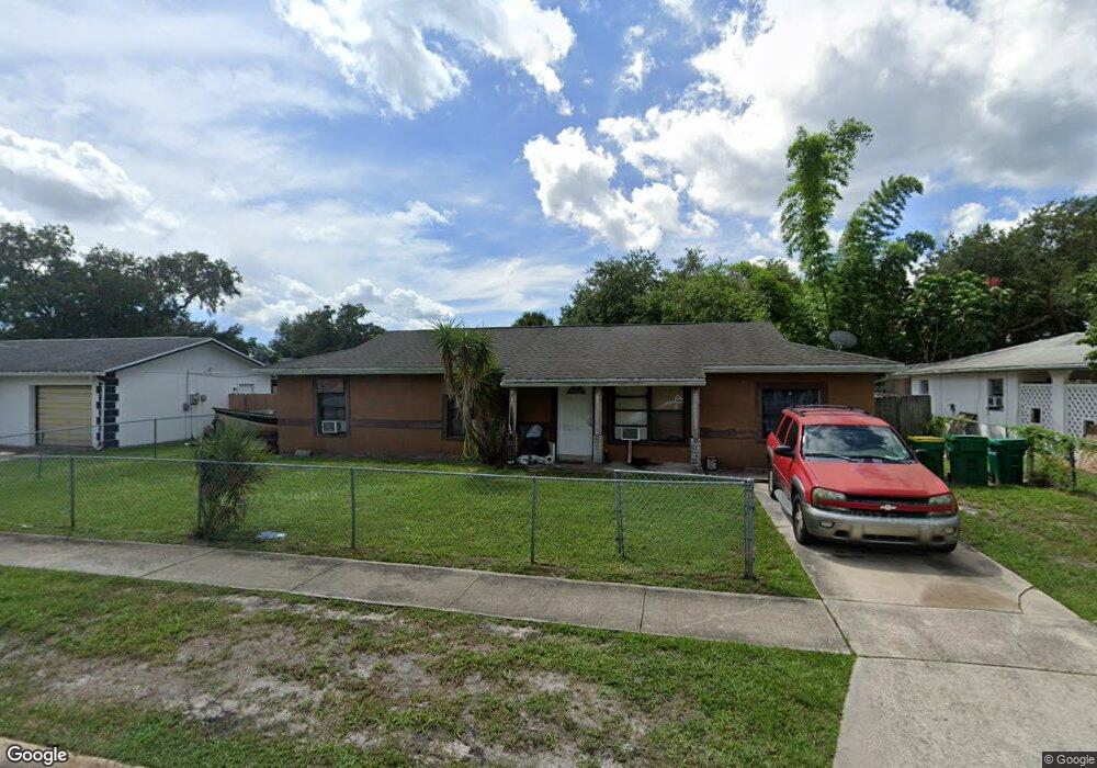
This home is located at 2463 Mercury Dr, Cocoa, FL 32926 and is currently estimated at $201,721, approximately $184 per square foot. 2463 Mercury Dr is a home located in Brevard County with nearby schools including Saturn Elementary School, Cocoa High School, and Space Coast Christian Academy.
Ownership History
Date
Name
Owned For
Owner Type
Purchase Details
Closed on
Apr 7, 2017
Sold by
Wall Colin P and Wall Heather A
Bought by
Henderson Ken and Henderson Lesa
Current Estimated Value
Home Financials for this Owner
Home Financials are based on the most recent Mortgage that was taken out on this home.
Original Mortgage
$75,000
Outstanding Balance
$62,222
Interest Rate
4.1%
Estimated Equity
$139,499
Purchase Details
Closed on
May 20, 2013
Sold by
The Bank Of New York Mellon
Bought by
Wall Colin P and Wall Heather A
Purchase Details
Closed on
Apr 8, 2013
Sold by
Grfen Tony L and Cole Andrea
Bought by
The Bank Of New York Mellon and The Bank Of New York
Purchase Details
Closed on
Sep 29, 2000
Sold by
Buckner Keith and Buckner Kimberly
Bought by
Green Tony L
Home Financials for this Owner
Home Financials are based on the most recent Mortgage that was taken out on this home.
Original Mortgage
$56,621
Interest Rate
7.97%
Mortgage Type
Purchase Money Mortgage
Create a Home Valuation Report for This Property
The Home Valuation Report is an in-depth analysis detailing your home's value as well as a comparison with similar homes in the area
Home Values in the Area
Average Home Value in this Area
Purchase History
| Date | Buyer | Sale Price | Title Company |
|---|---|---|---|
| Henderson Ken | $75,000 | Federal Title Ins Agency Inc | |
| Wall Colin P | $19,500 | Attorney | |
| The Bank Of New York Mellon | -- | Attorney | |
| Green Tony L | $57,300 | -- |
Source: Public Records
Mortgage History
| Date | Status | Borrower | Loan Amount |
|---|---|---|---|
| Open | Henderson Ken | $75,000 | |
| Previous Owner | Green Tony L | $56,621 |
Source: Public Records
Tax History Compared to Growth
Tax History
| Year | Tax Paid | Tax Assessment Tax Assessment Total Assessment is a certain percentage of the fair market value that is determined by local assessors to be the total taxable value of land and additions on the property. | Land | Improvement |
|---|---|---|---|---|
| 2025 | $2,093 | $141,550 | -- | -- |
| 2024 | $1,733 | $152,070 | -- | -- |
| 2023 | $1,733 | $101,380 | $0 | $0 |
| 2022 | $1,592 | $96,930 | $0 | $0 |
| 2021 | $1,523 | $82,620 | $15,000 | $67,620 |
| 2020 | $1,498 | $81,460 | $15,000 | $66,460 |
| 2019 | $1,451 | $79,580 | $15,000 | $64,580 |
| 2018 | $1,409 | $74,550 | $15,000 | $59,550 |
| 2017 | $1,342 | $67,390 | $15,000 | $52,390 |
| 2016 | $1,305 | $63,450 | $15,000 | $48,450 |
| 2015 | $1,226 | $55,530 | $15,000 | $40,530 |
| 2014 | $1,233 | $55,160 | $17,000 | $38,160 |
Source: Public Records
Map
Nearby Homes
- 2442 Dianne Dr
- 2508 Palmetto Dr
- 2472 Victor Rd
- 722 Venus Dr
- 703 Venus Dr
- 717 Lunar Lake Cir
- 1301 N Range Rd
- 0000 N Range Rd
- 1353 S Stetson Dr
- 2029 Ivy Dr Unit 2
- 1326 Stetson Ct
- 2559 Hooper Rd
- 1422 E Stetson Cir
- 1686 Ritzcraft St Unit 326
- 1424 E Stetson Cir
- 158 Atkinson St
- 1810 Dixon Blvd
- 1723 Dixon Blvd Unit 4
- 1666 Terrace St
- 1686 Ackley Rd
- 2465 Mercury Dr
- 2459 Mercury Dr
- 2467 Mercury Dr
- 2464 Uranus Dr
- 2462 Uranus Dr
- 2460 Uranus Dr
- 2469 Mercury Dr
- 2466 Uranus Dr Unit Right
- 2466 Uranus Dr
- 2458 Mercury Dr
- 2458 Uranus Dr
- 2449 Mercury Dr
- 2455 Mercury Dr
- 2468 Uranus Dr Unit Left
- 2462 Mercury Dr
- 2471 Mercury Dr
- 2456 Uranus Dr
- 2466 Mercury Dr
- 2457 Uranus Dr
- 2472 Uranus Dr Unit B