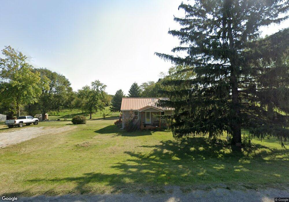
2466 S Wyckles Rd Decatur, IL 62522
Estimated Value: $118,000 - $176,781
2
Beds
1
Bath
894
Sq Ft
$165/Sq Ft
Est. Value
About This Home
This home is located at 2466 S Wyckles Rd, Decatur, IL 62522 and is currently estimated at $147,594, approximately $165 per square foot. 2466 S Wyckles Rd is a home located in Macon County with nearby schools including South Shores Elementary School and Stephen Decatur Middle School.
Ownership History
Date
Name
Owned For
Owner Type
Purchase Details
Closed on
May 5, 2020
Sold by
Hines Andrew R
Bought by
Hines Andrew R and Hines Amy
Current Estimated Value
Purchase Details
Closed on
Jun 29, 2005
Sold by
Jackson Alphonso
Bought by
Hines Andrew R and Hines Sherri L
Home Financials for this Owner
Home Financials are based on the most recent Mortgage that was taken out on this home.
Original Mortgage
$48,500
Outstanding Balance
$25,465
Interest Rate
5.75%
Mortgage Type
New Conventional
Estimated Equity
$122,129
Purchase Details
Closed on
Mar 1, 2000
Create a Home Valuation Report for This Property
The Home Valuation Report is an in-depth analysis detailing your home's value as well as a comparison with similar homes in the area
Home Values in the Area
Average Home Value in this Area
Purchase History
| Date | Buyer | Sale Price | Title Company |
|---|---|---|---|
| Hines Andrew R | -- | None Available | |
| Hines Andrew R | -- | None Available | |
| -- | $79,500 | -- |
Source: Public Records
Mortgage History
| Date | Status | Borrower | Loan Amount |
|---|---|---|---|
| Open | Hines Andrew R | $48,500 |
Source: Public Records
Tax History Compared to Growth
Tax History
| Year | Tax Paid | Tax Assessment Tax Assessment Total Assessment is a certain percentage of the fair market value that is determined by local assessors to be the total taxable value of land and additions on the property. | Land | Improvement |
|---|---|---|---|---|
| 2024 | $3,538 | $51,081 | $11,540 | $39,541 |
| 2023 | $3,231 | $46,532 | $11,540 | $34,992 |
| 2022 | $3,095 | $44,393 | $11,010 | $33,383 |
| 2021 | $2,840 | $42,232 | $10,474 | $31,758 |
| 2020 | $1,878 | $40,029 | $9,928 | $30,101 |
| 2019 | $1,878 | $40,029 | $9,928 | $30,101 |
| 2018 | $1,774 | $38,504 | $9,550 | $28,954 |
| 2017 | $1,733 | $38,145 | $9,461 | $28,684 |
| 2016 | $1,742 | $27,741 | $9,441 | $18,300 |
| 2015 | $1,612 | $26,933 | $9,166 | $17,767 |
| 2014 | $1,485 | $26,666 | $9,075 | $17,591 |
| 2013 | $1,486 | $26,666 | $9,075 | $17,591 |
Source: Public Records
Map
Nearby Homes
- 2529 W Alice Ln
- 3031 Heritage Rd
- 5180 W Cantrell St
- 2207 Forest Crest Dr
- 445 S Wyckles Rd
- 356 S Wyckles Rd
- 3247 Nevada Rd
- 3335 Nevada Rd
- 1739 Moorwood Dr
- 3316 Ferris Dr
- 15 Calumet Rd
- 1833 Burning Tree Dr
- 3445 Greenview Dr
- 170 S Hillcrest Blvd
- 2705 S Taylor Rd
- 2970 Olympia Dr
- 1745 Heritage Rd
- 468 N Megan Dr
- 345 S Westdale Ave
- 480 N Hillcrest Blvd
- 2485 S Wyckles Rd
- 2518 S Wyckles Rd
- 4462 W Rock Springs Rd
- 2526 S Wyckles Rd
- 2551 S Wyckles Rd
- 2340 S Wyckles Rd
- 2340 S Wyckles Rd
- 2315 S Wyckles Rd
- 4620 W Rock Springs Rd
- 2555 S Wyckles Rd
- 4358 Hartung Rd
- 2310 Nell Dr
- 2287 S Wyckles Rd
- 2585 S Wyckles Rd
- 2288 Nell Dr
- 4635 W Rock Springs Rd
- 2282 Nell Dr
- 4695 W Rock Springs Rd
- 2270 Nell Dr
- 2339 Karl Ln