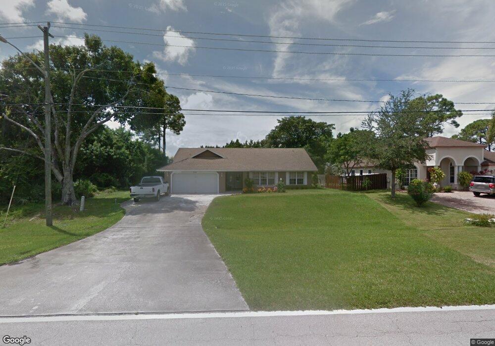
2466 SW Bayshore Blvd Unit 1 Port Saint Lucie, FL 34984
Canal Pointe NeighborhoodEstimated Value: $405,000 - $423,000
3
Beds
2
Baths
2,344
Sq Ft
$178/Sq Ft
Est. Value
About This Home
This home is located at 2466 SW Bayshore Blvd Unit 1, Port Saint Lucie, FL 34984 and is currently estimated at $416,301, approximately $177 per square foot. 2466 SW Bayshore Blvd Unit 1 is a home located in St. Lucie County with nearby schools including Floresta Elementary School, Morningside Elementary School, and Northport K-8 School.
Ownership History
Date
Name
Owned For
Owner Type
Purchase Details
Closed on
Apr 23, 1999
Sold by
Cassista Sandra and Cassista Sandra J
Bought by
Bero David and Bero Gloria M
Current Estimated Value
Home Financials for this Owner
Home Financials are based on the most recent Mortgage that was taken out on this home.
Original Mortgage
$89,250
Interest Rate
7.66%
Mortgage Type
Purchase Money Mortgage
Create a Home Valuation Report for This Property
The Home Valuation Report is an in-depth analysis detailing your home's value as well as a comparison with similar homes in the area
Home Values in the Area
Average Home Value in this Area
Purchase History
| Date | Buyer | Sale Price | Title Company |
|---|---|---|---|
| Bero David | $105,000 | -- |
Source: Public Records
Mortgage History
| Date | Status | Borrower | Loan Amount |
|---|---|---|---|
| Previous Owner | Bero David | $89,250 |
Source: Public Records
Tax History Compared to Growth
Tax History
| Year | Tax Paid | Tax Assessment Tax Assessment Total Assessment is a certain percentage of the fair market value that is determined by local assessors to be the total taxable value of land and additions on the property. | Land | Improvement |
|---|---|---|---|---|
| 2025 | $2,039 | $109,107 | -- | -- |
| 2024 | $1,975 | $106,033 | -- | -- |
| 2023 | $1,975 | $102,945 | $0 | $0 |
| 2022 | $1,858 | $99,947 | $0 | $0 |
| 2021 | $1,753 | $97,036 | $0 | $0 |
| 2020 | $1,749 | $95,697 | $0 | $0 |
| 2019 | $1,721 | $93,546 | $0 | $0 |
| 2018 | $1,621 | $91,802 | $0 | $0 |
| 2017 | $1,818 | $139,400 | $24,000 | $115,400 |
| 2016 | $1,787 | $133,000 | $18,000 | $115,000 |
| 2015 | $1,796 | $104,300 | $10,000 | $94,300 |
| 2014 | $1,727 | $86,759 | $0 | $0 |
Source: Public Records
Map
Nearby Homes
- 2518 SW Cooper Ln
- 2621 SW Harem Cir
- 183 SW Airview Ave
- 2624 SW Harem Cir
- 2477 SW Falcon Cir
- 279 SW Statler Ave
- 2613 SW Harem Cir
- 2671 SW Union Terrace
- 2640 SW Harem Cir
- 171 SW Glenwood Dr
- 2329 SW Fern Cir
- 2585 SW Cameo Blvd
- 2574 SW Cameo Blvd
- 2590 SW Hinchman St
- 2544 SW Cameo Blvd
- 2602 SW Cameo Blvd
- 2668 SW Cameo Blvd
- 164 SE Osprey Ridge
- 2618 SW River Shore Dr
- 2221 SW Edison Cir
- 2466 SW Bayshore Blvd
- 2458 SW Bayshore Blvd
- 2450 SW Bayshore Blvd
- 2465 SW Cooper Ln
- 2473 SE Cooper Ln
- 2473 SW Cooper Ln
- 2473 SW Bayshore Blvd
- 2449 SW Cooper Ln
- 2442 SW Bayshore Blvd
- 299 SW Langfield Ave
- 2449 SE Cooper Ln
- 2490 SW Bayshore Blvd
- 2457 SW Cooper Ln
- 281 SW Inwood Ave
- 2489 SW Cooper Ln
- 2441 SW Cooper Ln
- 297 SW Langfield Ave
- 2434 SW Bayshore Blvd
- 2309 SE Cooper Ln
- 2457 SE Cooper Ln