Estimated Value: $223,000 - $288,000
3
Beds
2
Baths
1,000
Sq Ft
$261/Sq Ft
Est. Value
About This Home
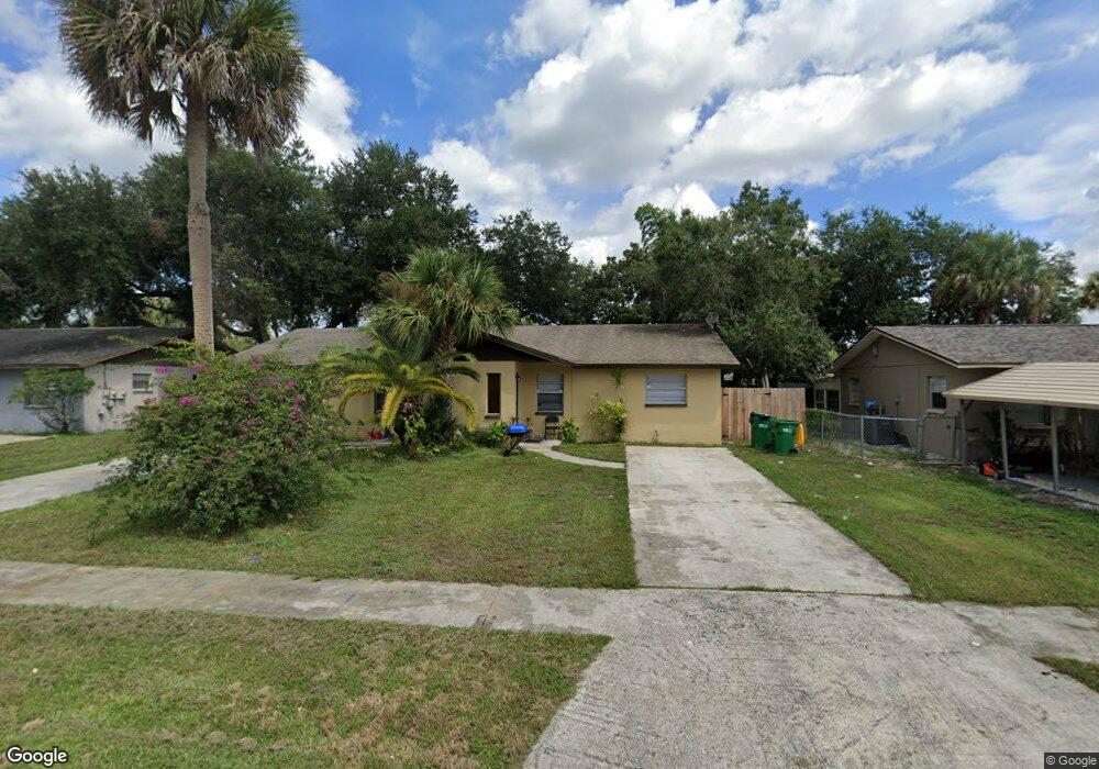
This home is located at 2466 Uranus Dr Unit Right, Cocoa, FL 32926 and is currently estimated at $260,560, approximately $260 per square foot. 2466 Uranus Dr Unit Right is a home located in Brevard County with nearby schools including Saturn Elementary School, Cocoa High School, and RFM Christian Academy.
Ownership History
Date
Name
Owned For
Owner Type
Purchase Details
Closed on
Nov 29, 2018
Sold by
2466 Uranus Drive Llc
Bought by
Spi Of Florida Llc
Current Estimated Value
Purchase Details
Closed on
Apr 4, 2006
Sold by
Searle Mary P and Searle Polly
Bought by
2466 Uranus Drive Llc
Home Financials for this Owner
Home Financials are based on the most recent Mortgage that was taken out on this home.
Original Mortgage
$168,000
Interest Rate
6.2%
Purchase Details
Closed on
Mar 16, 2006
Sold by
Merrill Shawn P
Bought by
Searle Mary P
Home Financials for this Owner
Home Financials are based on the most recent Mortgage that was taken out on this home.
Original Mortgage
$168,000
Interest Rate
6.2%
Purchase Details
Closed on
Jun 11, 1993
Sold by
Tipton Freddie L and Tipton Andrew J
Bought by
Merrill Shawn P and Merrill Kimberly Sue
Home Financials for this Owner
Home Financials are based on the most recent Mortgage that was taken out on this home.
Original Mortgage
$60,950
Interest Rate
7.45%
Create a Home Valuation Report for This Property
The Home Valuation Report is an in-depth analysis detailing your home's value as well as a comparison with similar homes in the area
Home Values in the Area
Average Home Value in this Area
Purchase History
| Date | Buyer | Sale Price | Title Company |
|---|---|---|---|
| Spi Of Florida Llc | $100,000 | Fidelity National Title Of F | |
| 2466 Uranus Drive Llc | -- | Attorney | |
| Searle Mary P | $162,900 | Island Title & Escrow Corp | |
| Merrill Shawn P | $60,000 | -- |
Source: Public Records
Mortgage History
| Date | Status | Borrower | Loan Amount |
|---|---|---|---|
| Previous Owner | 2466 Uranus Drive Llc | $168,000 | |
| Previous Owner | Merrill Shawn P | $60,950 |
Source: Public Records
Tax History
| Year | Tax Paid | Tax Assessment Tax Assessment Total Assessment is a certain percentage of the fair market value that is determined by local assessors to be the total taxable value of land and additions on the property. | Land | Improvement |
|---|---|---|---|---|
| 2025 | $3,536 | $268,800 | -- | -- |
| 2024 | $2,862 | $268,800 | -- | -- |
| 2023 | $2,862 | $171,360 | -- | -- |
| 2022 | $2,413 | $126,000 | $0 | $0 |
| 2021 | $2,259 | $98,730 | $30,000 | $68,730 |
| 2020 | $2,091 | $91,450 | $30,000 | $61,450 |
| 2019 | $1,924 | $84,670 | $21,000 | $63,670 |
| 2018 | $2,022 | $90,000 | $0 | $90,000 |
| 2017 | $1,940 | $82,000 | $0 | $82,000 |
| 2016 | $1,879 | $75,000 | $0 | $0 |
| 2015 | $1,861 | $71,500 | $17,000 | $54,500 |
| 2014 | $1,768 | $65,000 | $17,000 | $48,000 |
Source: Public Records
Map
Nearby Homes
- 2442 Dianne Dr
- 2475 Mercury Dr
- 764 Lunar Lake Cir
- 766 Lunar Lake Cir
- 2472 Victor Rd
- 703 Venus Dr
- 717 Lunar Lake Cir
- 2409 Granger Rd
- 2511 Hathaway Dr
- 1301 N Range Rd
- 0000 N Range Rd
- 1703 Spartan St Unit SRO737
- 2029 Ivy Dr
- 1326 Stetson Ct
- 1686 Ritzcraft St Unit 326
- 1666 Terrace St
- 1810 Dixon Blvd
- 1711 Dixon Blvd Unit 179
- 1508 Belleview Rd
- 914 Clearlake Rd Unit 211B
- 2466 Uranus Dr
- 2468 Uranus Dr Unit Left
- 2464 Uranus Dr
- 2472 Uranus Dr Unit B
- 2472 Uranus Dr Unit A
- 2472 Uranus Dr
- 2472 Uranus Dr Unit Right
- 2470 Uranus Dr Unit Right
- 2462 Uranus Dr
- 2465 Mercury Dr
- 2467 Mercury Dr
- 2469 Mercury Dr
- 2463 Mercury Dr
- 2457 Uranus Dr
- 2460 Uranus Dr
- 2471 Mercury Dr
- 2476 Uranus Dr
- 2467 Uranus Dr
- 2469 Uranus Dr
- 2458 Uranus Dr
Your Personal Tour Guide
Ask me questions while you tour the home.