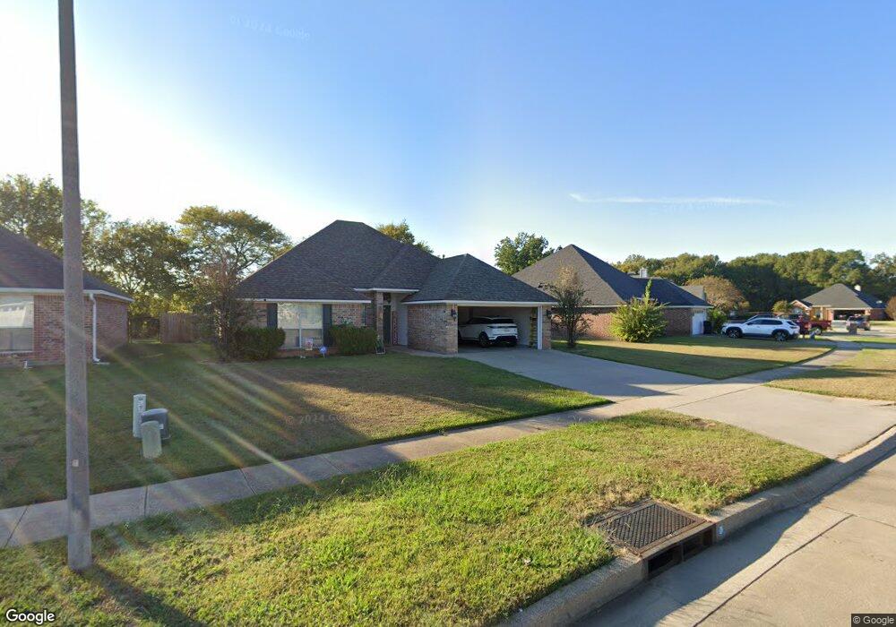
2467 Brookside Dr Bossier City, LA 71111
Estimated Value: $256,000 - $260,000
3
Beds
2
Baths
1,631
Sq Ft
$158/Sq Ft
Est. Value
About This Home
This home is located at 2467 Brookside Dr, Bossier City, LA 71111 and is currently estimated at $257,249, approximately $157 per square foot. 2467 Brookside Dr is a home located in Bossier Parish with nearby schools including The Lee Academy Pilot School, Stockwell Place Elementary School, and Cope Middle School.
Ownership History
Date
Name
Owned For
Owner Type
Purchase Details
Closed on
Dec 30, 2020
Sold by
Meyer Ryan P
Bought by
Reed Curtis
Current Estimated Value
Home Financials for this Owner
Home Financials are based on the most recent Mortgage that was taken out on this home.
Original Mortgage
$225,060
Outstanding Balance
$200,831
Interest Rate
2.7%
Mortgage Type
Purchase Money Mortgage
Estimated Equity
$56,418
Purchase Details
Closed on
Aug 30, 2013
Sold by
Perry Randolph Mark and Perry Deniece Louise Rabon
Bought by
Meyer Ryan Paul
Home Financials for this Owner
Home Financials are based on the most recent Mortgage that was taken out on this home.
Original Mortgage
$181,649
Interest Rate
3.87%
Mortgage Type
FHA
Create a Home Valuation Report for This Property
The Home Valuation Report is an in-depth analysis detailing your home's value as well as a comparison with similar homes in the area
Home Values in the Area
Average Home Value in this Area
Purchase History
| Date | Buyer | Sale Price | Title Company |
|---|---|---|---|
| Reed Curtis | $220,000 | None Available | |
| Meyer Ryan Paul | $185,000 | Multiple |
Source: Public Records
Mortgage History
| Date | Status | Borrower | Loan Amount |
|---|---|---|---|
| Open | Reed Curtis | $225,060 | |
| Previous Owner | Meyer Ryan Paul | $181,649 |
Source: Public Records
Tax History Compared to Growth
Tax History
| Year | Tax Paid | Tax Assessment Tax Assessment Total Assessment is a certain percentage of the fair market value that is determined by local assessors to be the total taxable value of land and additions on the property. | Land | Improvement |
|---|---|---|---|---|
| 2024 | $1,894 | $21,772 | $3,000 | $18,772 |
| 2023 | $1,583 | $18,350 | $2,900 | $15,450 |
| 2022 | $1,163 | $18,350 | $2,900 | $15,450 |
| 2021 | $414 | $18,350 | $2,900 | $15,450 |
| 2020 | $1,162 | $18,350 | $2,900 | $15,450 |
| 2019 | $1,198 | $18,520 | $2,900 | $15,620 |
| 2018 | $1,198 | $18,520 | $2,900 | $15,620 |
| 2017 | $1,605 | $18,520 | $2,900 | $15,620 |
| 2016 | $1,605 | $18,520 | $2,900 | $15,620 |
| 2015 | $419 | $18,420 | $2,900 | $15,520 |
| 2014 | $419 | $18,420 | $2,900 | $15,520 |
Source: Public Records
Map
Nearby Homes
- 6012 Whitney Dr
- 2508 Cole Cir
- 4002 Wilderness Ln
- 2481 Churchill Dr
- 5705 Lake Side Dr
- 2319 Windsor Ct
- 163 Dogwood South Ln
- 2212 Landau Ln
- 6020 Applegate Cir
- 6019 Ellington Way
- 0 Victoria's Dr
- 122 Dogwood South Ln
- 6012 Ellington Way
- 6014 Ellington Way
- 3406 Heatherbrook Dr
- 3237 Pinehaven Ln
- 8401 Dogwood Trail
- 5526 Lake Side Dr
- 3609 Willow Wisp Cir
- 113 Red Fox Cir
- 2465 Brookside Dr
- 2469 Brookside Dr
- 2463 Brookside Dr
- 6006 Whitney Dr
- 2471 Brookside Dr
- 6001 Zachary Cir
- 2461 Brookside Dr
- 2473 Brookside Dr
- 6008 Whitney Dr
- 6001 Whitney Dr
- 6003 Whitney Dr
- 6005 Whitney Dr
- 2459 Brookside Dr
- 6003 Zachary Cir
- 6010 Whitney Dr
- 6007 Whitney Dr
- 6000 Zachary Cir
- 6009 Whitney Dr
- 6005 Zachary Cir
- 2457 Brookside Dr