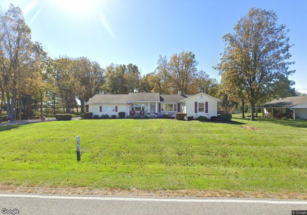
24670 Buckland Holden Rd Waynesfield, OH 45896
Estimated Value: $230,000 - $306,000
2
Beds
2
Baths
1,808
Sq Ft
$154/Sq Ft
Est. Value
About This Home
This home is located at 24670 Buckland Holden Rd, Waynesfield, OH 45896 and is currently estimated at $279,226, approximately $154 per square foot. 24670 Buckland Holden Rd is a home located in Auglaize County with nearby schools including Waynesfield-Goshen Local Elementary School and Waynesfield-Goshen Local High School.
Ownership History
Date
Name
Owned For
Owner Type
Purchase Details
Closed on
Feb 14, 2006
Sold by
Morgan Jimmy L and Morgan Barbara A
Bought by
Coder Daniel W
Current Estimated Value
Purchase Details
Closed on
Nov 1, 1993
Sold by
Smith Crady J
Bought by
Morgan Jimmy L
Purchase Details
Closed on
May 14, 1992
Sold by
Coder Alan Lee
Bought by
Smith Crady J
Create a Home Valuation Report for This Property
The Home Valuation Report is an in-depth analysis detailing your home's value as well as a comparison with similar homes in the area
Home Values in the Area
Average Home Value in this Area
Purchase History
| Date | Buyer | Sale Price | Title Company |
|---|---|---|---|
| Coder Daniel W | $50,533 | None Available | |
| Morgan Jimmy L | $93,500 | -- | |
| Smith Crady J | $78,500 | -- |
Source: Public Records
Tax History Compared to Growth
Tax History
| Year | Tax Paid | Tax Assessment Tax Assessment Total Assessment is a certain percentage of the fair market value that is determined by local assessors to be the total taxable value of land and additions on the property. | Land | Improvement |
|---|---|---|---|---|
| 2024 | $4,701 | $74,740 | $10,370 | $64,370 |
| 2023 | $2,611 | $74,740 | $10,370 | $64,370 |
| 2022 | $2,287 | $55,460 | $9,840 | $45,620 |
| 2021 | $2,279 | $55,460 | $9,840 | $45,620 |
| 2020 | $2,242 | $55,458 | $9,839 | $45,619 |
| 2019 | $1,826 | $46,218 | $8,201 | $38,017 |
| 2018 | $1,775 | $46,218 | $8,201 | $38,017 |
| 2017 | $1,766 | $46,218 | $8,201 | $38,017 |
| 2016 | $1,531 | $41,339 | $7,809 | $33,530 |
| 2015 | $1,532 | $41,339 | $7,809 | $33,530 |
| 2014 | $1,534 | $41,339 | $7,809 | $33,530 |
| 2013 | $1,704 | $41,339 | $7,809 | $33,530 |
Source: Public Records
Map
Nearby Homes
- 105 Guthrie St
- 202 W Mulberry St
- 25836 Ohio 67
- 8150 Amherst Rd
- 5065 Amherst Rd
- 22275 Buckland Holden Rd
- 7165 Faulkner Rd
- 6616 Bellefontaine Rd
- 20630 State Route 67
- 6381 McPheron Rd
- E Hanthorn Rd
- 5600 E Hanthorn Rd
- 4160 E Hanthorn Rd
- 0 Ohio 67
- 37 N Main St
- 17 E Walnut St
- 1855 S Cool Rd
- 3080 E Hanthorn Rd
- 200 S Main St
- 4080 Bellefontaine Rd
- 24702 Buckland Holden Rd
- 24600 Buckland Holden Rd
- 24792 Buckland Holden Rd
- 24920 Buckland Holden Rd
- 24353 Buckland Holden Rd
- 18811 State Route 196
- 19206 State Route 196
- 24144 Buckland Holden Rd
- 18686 State Route 196
- 19425 State Route 196
- 18928 Santa Fe Line Rd
- 18481 State Route 196
- 19140 Santa Fe Line Rd
- 19232 Santa Fe Line Rd
- 18443 State Route 196
- 23955 Buckland Holden Rd
- 18740 Santa Fe Line Rd
- 18402 Santa Fe Line Rd
- 18401 State Route 196