Estimated Value: $954,000 - $1,284,000
5
Beds
3
Baths
4,518
Sq Ft
$238/Sq Ft
Est. Value
About This Home
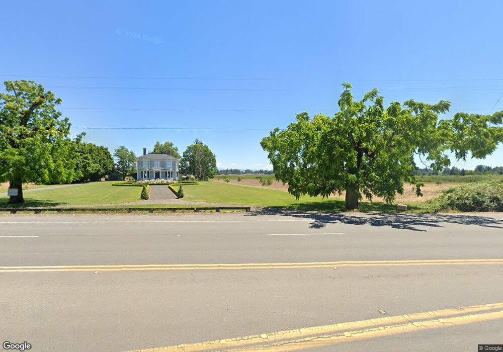
This home is located at 24670 S Highway 99e, Canby, OR 97013 and is currently estimated at $1,076,026, approximately $238 per square foot. 24670 S Highway 99e is a home located in Clackamas County with nearby schools including Josefa L. Sambrano Elementary School, Philander Lee Elementary School, and Baker Prairie Middle School.
Ownership History
Date
Name
Owned For
Owner Type
Purchase Details
Closed on
Jan 11, 2005
Sold by
Byrnes Mike
Bought by
Falconer Jeffrey and Falconer Amy
Current Estimated Value
Home Financials for this Owner
Home Financials are based on the most recent Mortgage that was taken out on this home.
Original Mortgage
$359,650
Outstanding Balance
$180,952
Interest Rate
5.8%
Mortgage Type
Purchase Money Mortgage
Estimated Equity
$895,074
Purchase Details
Closed on
Oct 15, 2004
Sold by
Miller Virginia L
Bought by
Miller Virginia L and The Virginia Miller Revocable Trust
Create a Home Valuation Report for This Property
The Home Valuation Report is an in-depth analysis detailing your home's value as well as a comparison with similar homes in the area
Home Values in the Area
Average Home Value in this Area
Purchase History
| Date | Buyer | Sale Price | Title Company |
|---|---|---|---|
| Falconer Jeffrey | $500,000 | First American | |
| Miller Virginia L | -- | -- |
Source: Public Records
Mortgage History
| Date | Status | Borrower | Loan Amount |
|---|---|---|---|
| Open | Falconer Jeffrey | $359,650 | |
| Closed | Falconer Jeffrey | $115,350 |
Source: Public Records
Tax History Compared to Growth
Tax History
| Year | Tax Paid | Tax Assessment Tax Assessment Total Assessment is a certain percentage of the fair market value that is determined by local assessors to be the total taxable value of land and additions on the property. | Land | Improvement |
|---|---|---|---|---|
| 2025 | $7,103 | $496,336 | -- | -- |
| 2024 | $6,906 | $481,880 | -- | -- |
| 2023 | $6,906 | $467,845 | $0 | $0 |
| 2022 | $6,314 | $454,219 | $0 | $0 |
| 2021 | $6,068 | $440,990 | $0 | $0 |
| 2020 | $5,976 | $428,146 | $0 | $0 |
| 2019 | $5,664 | $415,676 | $0 | $0 |
| 2018 | $5,547 | $403,569 | $0 | $0 |
| 2017 | $5,412 | $391,815 | $0 | $0 |
| 2016 | $5,226 | $380,403 | $0 | $0 |
| 2015 | $5,040 | $369,323 | $0 | $0 |
| 2014 | $4,895 | $358,566 | $0 | $0 |
Source: Public Records
Map
Nearby Homes
- 1655 S Elm St Unit 2
- 1655 S Elm St
- 1655 S Elm St Unit 302
- 1339 S Baywood Ct
- 916 NW 2nd Ave
- 850 NW 3rd Ave
- 1198 SW 1st Ave
- 812 NW 3rd Ave
- 6869 S Knights Bridge Rd
- 6815 S Knights Bridge Rd
- 442 SW 15th Ave Unit 15
- 448 SW 15th Ave Unit 14
- 452 SW 15th Ave Unit 13
- 476 SW 15th Ave
- 1400 S Elm St Unit 91
- 589 NW 3rd Ave
- 431 SW 3rd Ave
- 1491 S Fir St Unit 18
- 1487 S Fir St Unit Lot17
- 1485 S Fir St Unit Lot 16
- 7171 S Tull Rd Unit 1
- 24550 S Highway 99e
- 0 S Tull Rd
- 24551 S Cass St
- 24582 S Barlow Rd
- 3040 S Barlow Rd
- 102 N Main St
- 356 NW 1st St
- 24560 S Barlow Rd
- 24561 S Cass St
- 103 N Main St
- 24540 S Highway 99 E Unit 1
- 24540 S
- 24561 S
- 103 N Maple St
- 24695 S Barlow Rd
- 101 N 1st St
- 103 N Oak St
- 108 N 1st St
- 106 N Main St