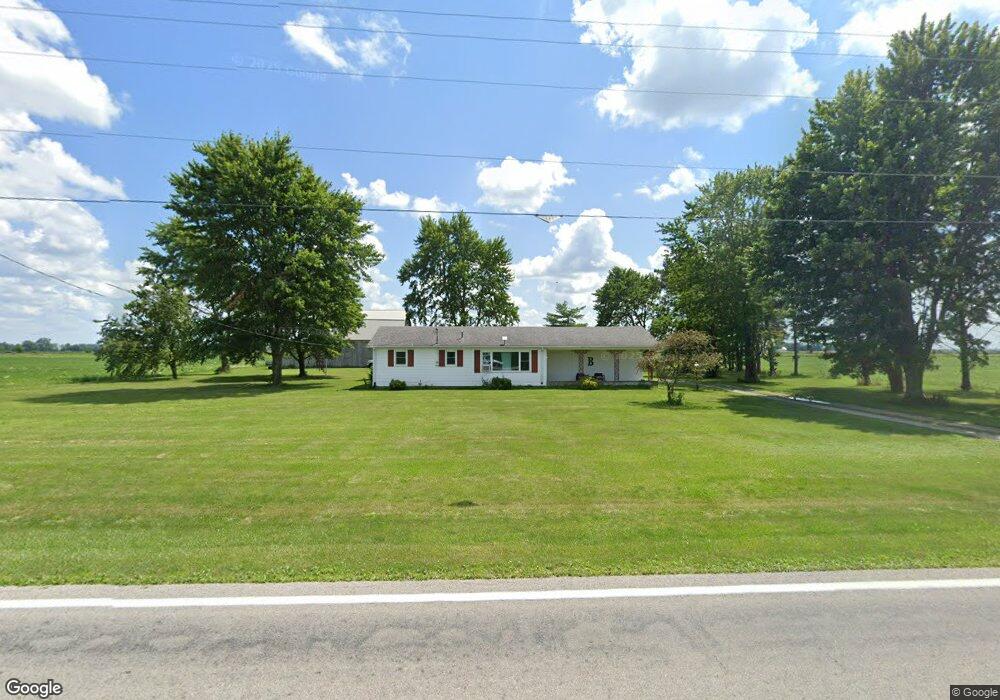
24675 State Route 18 Deshler, OH 43516
Estimated Value: $200,000 - $235,000
3
Beds
2
Baths
1,126
Sq Ft
$190/Sq Ft
Est. Value
About This Home
This home is located at 24675 State Route 18, Deshler, OH 43516 and is currently estimated at $214,079, approximately $190 per square foot. 24675 State Route 18 is a home located in Wood County with nearby schools including Patrick Henry Middle School and Patrick Henry High School.
Ownership History
Date
Name
Owned For
Owner Type
Purchase Details
Closed on
Sep 18, 2018
Sold by
Petersen Leon D and Estate Of Ellen M Petersen
Bought by
Lamb Taylor B
Current Estimated Value
Home Financials for this Owner
Home Financials are based on the most recent Mortgage that was taken out on this home.
Original Mortgage
$142,373
Outstanding Balance
$123,902
Interest Rate
4.5%
Mortgage Type
FHA
Estimated Equity
$90,177
Purchase Details
Closed on
Jan 1, 1990
Bought by
Petersen Harold M
Create a Home Valuation Report for This Property
The Home Valuation Report is an in-depth analysis detailing your home's value as well as a comparison with similar homes in the area
Home Values in the Area
Average Home Value in this Area
Purchase History
| Date | Buyer | Sale Price | Title Company |
|---|---|---|---|
| Lamb Taylor B | $145,000 | None Available | |
| Petersen Harold M | -- | -- |
Source: Public Records
Mortgage History
| Date | Status | Borrower | Loan Amount |
|---|---|---|---|
| Open | Lamb Taylor B | $142,373 |
Source: Public Records
Tax History Compared to Growth
Tax History
| Year | Tax Paid | Tax Assessment Tax Assessment Total Assessment is a certain percentage of the fair market value that is determined by local assessors to be the total taxable value of land and additions on the property. | Land | Improvement |
|---|---|---|---|---|
| 2024 | $2,110 | $51,590 | $15,645 | $35,945 |
| 2023 | $2,110 | $51,600 | $15,650 | $35,950 |
| 2021 | $2,052 | $40,710 | $12,950 | $27,760 |
| 2020 | $2,070 | $40,710 | $12,950 | $27,760 |
| 2019 | $1,602 | $33,180 | $11,760 | $21,420 |
| 2018 | $1,180 | $33,180 | $11,760 | $21,420 |
| 2017 | $1,173 | $33,180 | $11,760 | $21,420 |
| 2016 | $956 | $31,430 | $9,170 | $22,260 |
| 2015 | $951 | $31,430 | $9,170 | $22,260 |
| 2014 | $1,011 | $31,430 | $9,170 | $22,260 |
| 2013 | $950 | $28,560 | $8,330 | $20,230 |
Source: Public Records
Map
Nearby Homes
- 139 S Lind St
- 126 S Keyser Ave
- 429 N Park St
- 224 S Keyser Ave
- 330 W Elm St
- 320 S Keyser Ave
- 408 W Elm St
- 527 W Maple St
- 114 N Harvest Dr
- 117 Meadow Ln
- 109 N Harvest St
- 106 N Harvest Dr
- 115 Meadow Ln
- 113 N Meadow Ln
- 122 N Harvest St
- 116 Meadow Ln
- 119 N Harvest St
- 112 N Harvest Dr
- 121 N Harvest St
- 118 N Harvest Dr
- 24906 Deshler Rd
- 24675 Deshler Rd
- 3260 Henry Wood Co Line Rd
- 1075 State Route 18
- C315 County Road 1
- 24262 State Route 18
- 24240 State Route 18
- 24204 State Route 18
- 24141 State Route 18
- 1035 County Road D
- 1392 E Water St
- 1042 County Road D
- 741 E Water St
- 1064 County Road D
- 1064 County Road D
- 24952 Oil Center Rd
- 1094 County Road D
- 1140 County Road D
- 1140 County Road D
- 1126 County Road D