Estimated Value: $171,000 - $199,000
--
Bed
--
Bath
1,120
Sq Ft
$165/Sq Ft
Est. Value
About This Home
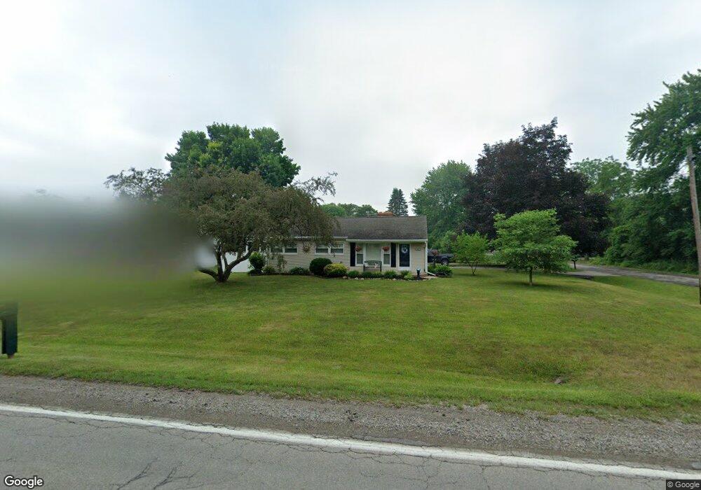
This home is located at 2469 W Wilson Rd, Clio, MI 48420 and is currently estimated at $184,682, approximately $164 per square foot. 2469 W Wilson Rd is a home located in Genesee County with nearby schools including George R. Carter Middle School and Clio Area High School.
Ownership History
Date
Name
Owned For
Owner Type
Purchase Details
Closed on
Dec 20, 2007
Sold by
Brady Dana M and Thomas Dana M
Bought by
Sherwood Norman D and Sherwood Betty E
Current Estimated Value
Home Financials for this Owner
Home Financials are based on the most recent Mortgage that was taken out on this home.
Original Mortgage
$109,137
Outstanding Balance
$69,115
Interest Rate
6.31%
Mortgage Type
FHA
Estimated Equity
$115,567
Purchase Details
Closed on
Jul 20, 2007
Sold by
Mortgage Electronic Registration Systems
Bought by
Bank Of New York
Purchase Details
Closed on
Jun 29, 2007
Sold by
Brady Dana M
Bought by
Mortgage Electronic Registration Systems
Purchase Details
Closed on
Mar 2, 2001
Sold by
Springgay Jeffrey L
Bought by
Brady Dana M
Home Financials for this Owner
Home Financials are based on the most recent Mortgage that was taken out on this home.
Original Mortgage
$93,500
Interest Rate
11.2%
Create a Home Valuation Report for This Property
The Home Valuation Report is an in-depth analysis detailing your home's value as well as a comparison with similar homes in the area
Home Values in the Area
Average Home Value in this Area
Purchase History
| Date | Buyer | Sale Price | Title Company |
|---|---|---|---|
| Sherwood Norman D | $110,000 | Cislo Title Co | |
| Bank Of New York | -- | None Available | |
| Mortgage Electronic Registration Systems | $99,630 | None Available | |
| Brady Dana M | $110,000 | Lawyers Title Insurance Corp |
Source: Public Records
Mortgage History
| Date | Status | Borrower | Loan Amount |
|---|---|---|---|
| Open | Sherwood Norman D | $109,137 | |
| Previous Owner | Brady Dana M | $93,500 |
Source: Public Records
Tax History Compared to Growth
Tax History
| Year | Tax Paid | Tax Assessment Tax Assessment Total Assessment is a certain percentage of the fair market value that is determined by local assessors to be the total taxable value of land and additions on the property. | Land | Improvement |
|---|---|---|---|---|
| 2025 | $2,013 | $85,800 | $0 | $0 |
| 2024 | $828 | $76,400 | $0 | $0 |
| 2023 | $790 | $78,500 | $0 | $0 |
| 2022 | $1,801 | $68,900 | $0 | $0 |
| 2021 | $1,780 | $62,100 | $0 | $0 |
| 2020 | $697 | $56,500 | $0 | $0 |
| 2019 | $636 | $51,800 | $0 | $0 |
| 2018 | $1,480 | $48,800 | $0 | $0 |
| 2017 | $1,412 | $48,800 | $0 | $0 |
| 2016 | $1,399 | $47,100 | $0 | $0 |
| 2015 | $1,401 | $44,800 | $0 | $0 |
| 2012 | -- | $40,600 | $40,600 | $0 |
Source: Public Records
Map
Nearby Homes
- 897 Park View
- Elements 2070 Plan at Pheasant Run
- 11159 Pheasant Run Dr
- Integrity 1610 Plan at Pheasant Run - Integrity
- Elements 1800 Plan at Pheasant Run
- Integrity 2061 V8.1a Plan at Pheasant Run - Integrity
- Integrity 1830 Plan at Pheasant Run - Integrity
- Elements 2700 Plan at Pheasant Run
- Elements 2090 Plan at Pheasant Run
- Elements 2200 Plan at Pheasant Run
- Integrity 2085 Plan at Pheasant Run - Integrity
- Integrity 1605 Plan at Pheasant Run - Integrity
- Integrity 1880 Plan at Pheasant Run - Integrity
- Integrity 2080 Plan at Pheasant Run - Integrity
- Integrity 2000 Plan at Pheasant Run - Integrity
- Integrity 2190 Plan at Pheasant Run - Integrity
- Integrity 1800 Plan at Pheasant Run - Integrity
- Elements 2390 Plan at Pheasant Run
- Elements 1680 Plan at Pheasant Run
- Integrity 2060 Plan at Pheasant Run - Integrity
- 2461 W Wilson Rd
- 10504 Leann Dr
- 2487 W Wilson Rd
- 2449 W Wilson Rd
- 10492 Leann Dr
- 2456 W Wilson Rd
- 10503 Leann Dr
- 2495 W Wilson Rd
- 2464 W Wilson Rd Unit 16
- 11015 Varna St
- 10493 Leann Dr
- 10484 Leann Dr
- 2503 W Wilson Rd
- 10493 Varna St
- 10476 Leann Dr
- 2490 W Wilson Rd
- 11023 Varna St
- 10483 Leann Dr
- 2496 W Wilson Rd
- 11008 Varna St