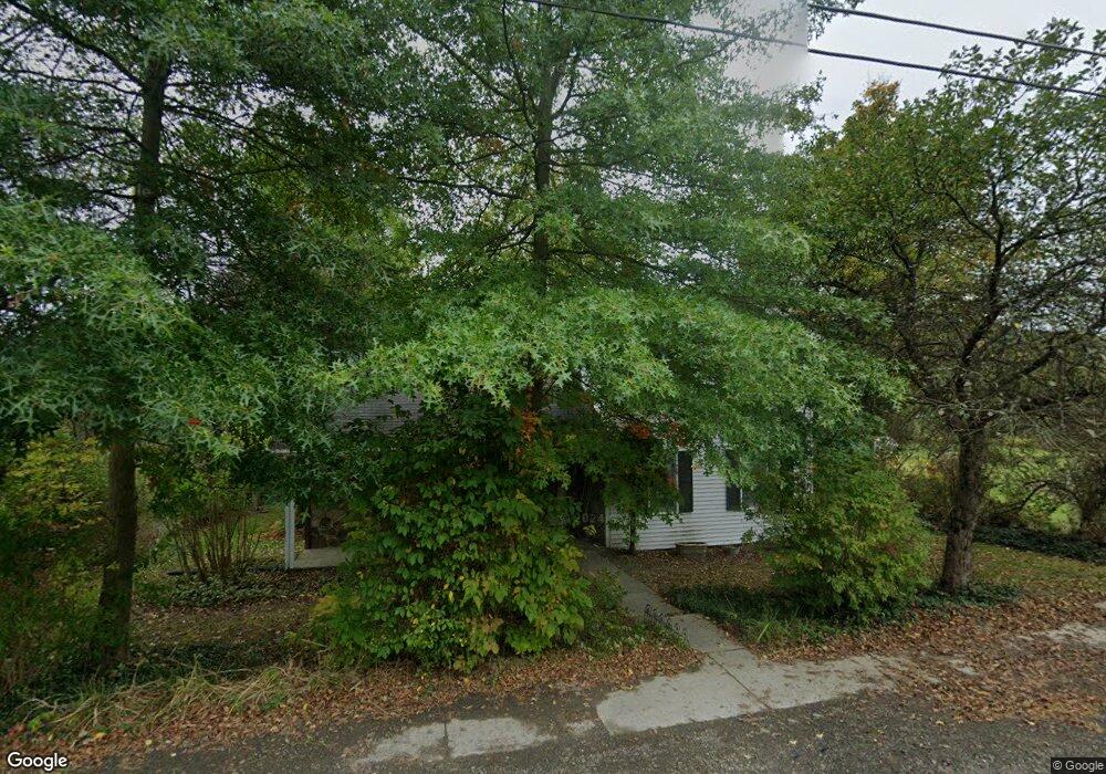
247 Brooklyn St Mansfield, PA 16933
Estimated Value: $115,000 - $164,605
3
Beds
2
Baths
1,506
Sq Ft
$100/Sq Ft
Est. Value
About This Home
This home is located at 247 Brooklyn St, Mansfield, PA 16933 and is currently estimated at $149,901, approximately $99 per square foot. 247 Brooklyn St is a home located in Tioga County with nearby schools including Warren L. Miller Elementary School, North Penn-Mansfield Jr./Sr. High School, and New Covenant Academy.
Ownership History
Date
Name
Owned For
Owner Type
Purchase Details
Closed on
Mar 9, 2018
Sold by
Moulton David and Christine Moulton C
Bought by
Moulton C Christine
Current Estimated Value
Purchase Details
Closed on
Jul 15, 2010
Sold by
Seidel Gregory S
Bought by
Moulton David and Moulton Christine C
Home Financials for this Owner
Home Financials are based on the most recent Mortgage that was taken out on this home.
Original Mortgage
$64,800
Interest Rate
4.23%
Mortgage Type
Purchase Money Mortgage
Create a Home Valuation Report for This Property
The Home Valuation Report is an in-depth analysis detailing your home's value as well as a comparison with similar homes in the area
Home Values in the Area
Average Home Value in this Area
Purchase History
| Date | Buyer | Sale Price | Title Company |
|---|---|---|---|
| Moulton C Christine | -- | None Available | |
| Moulton David | $72,000 | None Available |
Source: Public Records
Mortgage History
| Date | Status | Borrower | Loan Amount |
|---|---|---|---|
| Closed | Moulton David | $64,800 |
Source: Public Records
Tax History
| Year | Tax Paid | Tax Assessment Tax Assessment Total Assessment is a certain percentage of the fair market value that is determined by local assessors to be the total taxable value of land and additions on the property. | Land | Improvement |
|---|---|---|---|---|
| 2025 | $2,492 | $132,390 | $20,390 | $112,000 |
| 2024 | $3,526 | $132,390 | $20,390 | $112,000 |
| 2023 | $2,180 | $65,500 | $12,050 | $53,450 |
| 2022 | $2,158 | $65,500 | $12,050 | $53,450 |
| 2021 | $2,134 | $65,500 | $12,050 | $53,450 |
| 2020 | $2,123 | $65,500 | $12,050 | $53,450 |
| 2019 | $2,114 | $65,500 | $12,050 | $53,450 |
| 2018 | $2,098 | $66,050 | $12,600 | $53,450 |
| 2017 | -- | $66,050 | $12,600 | $53,450 |
| 2016 | $2,015 | $66,050 | $12,600 | $53,450 |
| 2015 | -- | $66,050 | $12,600 | $53,450 |
| 2014 | -- | $66,050 | $12,600 | $53,450 |
Source: Public Records
Map
Nearby Homes
- 54 Nadalini Dr Unit 23
- 2141-2165 S Main St
- 324 S Main St (6 64 Acres)
- 16684 US Highway 6
- 70 Eighth St
- 0 Fourth St
- 28 Sherwood St
- 101 Hemlock Dr
- 11 Garside St
- - Townview Dr
- 62 Canoe Camp Creek Rd
- 00 Pickle Hill Rd
- 65 Hillside Dr
- 0 Cherry Ridge Dr
- 999 Ore Bed Rd
- 2865 Spencer Road (3 Acres)
- 18789 Route 6
- 2313 Pennsylvania 660
- 154 Cowan Rd
- 371 Ritz Rd
- 239 Brooklyn St
- 17 Ross Brooklyn St
- 54 Brooklyn St
- 54 Brooklyn St
- 0 Brooklyn St
- 227 Brooklyn St
- 269 Brooklyn St
- 217 Brooklyn St
- 279 Brooklyn St
- 280 Brooklyn St
- 185 Brooklyn St
- 46 Brookside Ln
- 175 Brooklyn St
- 54 Nadalini Dr
- Rt 6 Rr#1 Box 216
- Lot 34 Far View Trailer Park
- Lots 8&9 Hutcheson Dr
- 31 Brookside Ln
- 29 Brookside Ln
- 165 Brooklyn St