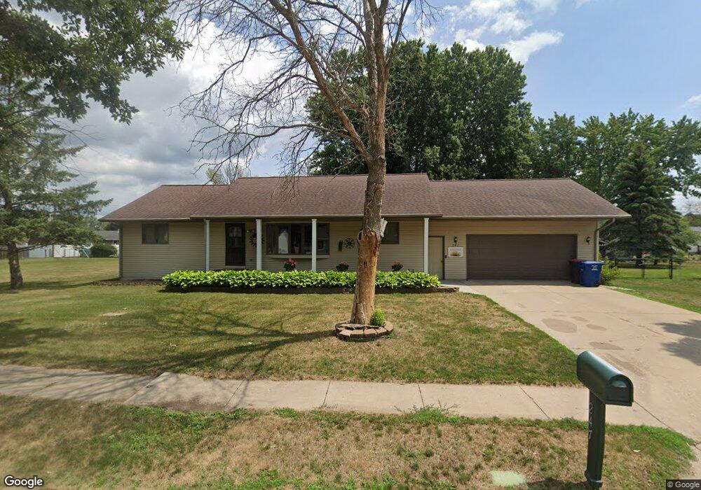
247 Fern Ave Red Wing, MN 55066
Estimated Value: $355,000 - $425,638
About This Home
This home is located at 247 Fern Ave, Red Wing, MN 55066 and is currently estimated at $401,160, approximately $109 per square foot. 247 Fern Ave is a home located in Goodhue County with nearby schools including Burnside Elementary School, Sunnyside Elementary School, and Twin Bluff Middle School.
Ownership History
We collect this data history from publicly available records. To have your information removed, we recommend requesting removal directly through your county’s website.
Purchase Details
Purchase Details
Home Financials for this Owner
Home Financials are based on the most recent Mortgage that was taken out on this home.Purchase Details
Purchase Details
Home Values in the Area
Average Home Value in this Area
Purchase History
We collect this data history from publicly available records. To have your information removed, we recommend requesting removal directly through your county’s website.
| Date | Buyer | Sale Price | Title Company |
|---|---|---|---|
| $500 | None Listed On Document | ||
| $350,000 | Knight Barry Ttl United Llc | ||
| $234,000 | Goodhue County Abstract | ||
| $152,000 | -- | ||
| $350,000 | -- |
Mortgage History
We collect this data history from publicly available records. To have your information removed, we recommend requesting removal directly through your county’s website.
| Date | Status | Borrower | Loan Amount |
|---|---|---|---|
| Previous Owner | $175,000 | ||
| Closed | $175,000 |
Tax History
We collect this data history from publicly available records. To have your information removed, we recommend requesting removal directly through your county’s website.
| Year | Tax Paid | Tax Assessment Tax Assessment Total Assessment is a certain percentage of the fair market value that is determined by local assessors to be the total taxable value of land and additions on the property. | Land | Improvement |
|---|---|---|---|---|
| 2025 | $5,668 | $429,500 | $54,300 | $375,200 |
| 2024 | $5,540 | $416,800 | $54,300 | $362,500 |
| 2023 | $5,460 | $392,000 | $54,300 | $337,700 |
| 2022 | $4,352 | $389,400 | $54,300 | $335,100 |
| 2021 | $4,030 | $299,700 | $54,300 | $245,400 |
| 2020 | $3,976 | $282,800 | $54,300 | $228,500 |
| 2019 | $3,956 | $262,300 | $54,300 | $208,000 |
| 2018 | $3,184 | $264,000 | $52,400 | $211,600 |
| 2017 | $3,112 | $230,300 | $52,400 | $177,900 |
| 2016 | $2,866 | $228,100 | $52,400 | $175,700 |
| 2015 | $2,746 | $221,100 | $52,400 | $168,700 |
| 2014 | -- | $218,500 | $52,400 | $166,100 |
Map
- 237 Butternut Ave
- 661 Spring Creek Rd S
- 125 Kingswood Dr Unit 1D
- 145 Kingswood Dr
- 912 Aurora Cir
- 921 Snowbird Dr
- 910 Snowbird Dr
- 914 Snowbird Dr
- 4958 Chalet Ct
- 4999 Chalet Ct
- 210 Sargent Dr Unit 101
- 210 Sargent Dr Unit 103
- 3447 Briarwood Ct
- 142 Red Wing Ave S
- 110 Red Wing Ave S
- 5542 Cannon Dale Ct
- 2820 N Service Dr
- 1140 Hewitt Blvd
- 1125 Hewitt Blvd
- 1181 Hewitt Blvd
Ask me questions while you tour the home.