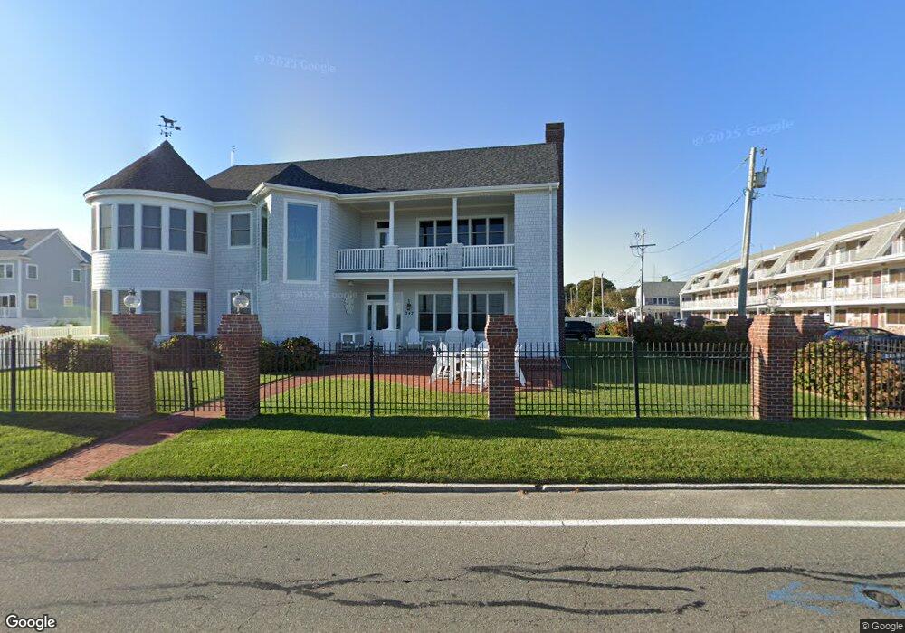
247 Grand Ave Falmouth, MA 02540
Falmouth Village NeighborhoodEstimated Value: $3,243,000 - $4,586,000
4
Beds
5
Baths
6,587
Sq Ft
$582/Sq Ft
Est. Value
About This Home
This home is located at 247 Grand Ave, Falmouth, MA 02540 and is currently estimated at $3,832,875, approximately $581 per square foot. 247 Grand Ave is a home located in Barnstable County with nearby schools including Mullen-Hall School, Morse Pond School, and Lawrence School.
Ownership History
Date
Name
Owned For
Owner Type
Purchase Details
Closed on
Sep 30, 1991
Sold by
Taylor John P
Bought by
Lowe James A and Lowe Melinda L
Current Estimated Value
Home Financials for this Owner
Home Financials are based on the most recent Mortgage that was taken out on this home.
Original Mortgage
$160,000
Interest Rate
9.1%
Mortgage Type
Purchase Money Mortgage
Create a Home Valuation Report for This Property
The Home Valuation Report is an in-depth analysis detailing your home's value as well as a comparison with similar homes in the area
Home Values in the Area
Average Home Value in this Area
Purchase History
| Date | Buyer | Sale Price | Title Company |
|---|---|---|---|
| Lowe James A | $200,000 | -- | |
| Lowe James A | $200,000 | -- |
Source: Public Records
Mortgage History
| Date | Status | Borrower | Loan Amount |
|---|---|---|---|
| Open | Lowe James A | $500,000 | |
| Closed | Lowe James A | $600,000 | |
| Closed | Lowe James A | $160,000 |
Source: Public Records
Tax History Compared to Growth
Tax History
| Year | Tax Paid | Tax Assessment Tax Assessment Total Assessment is a certain percentage of the fair market value that is determined by local assessors to be the total taxable value of land and additions on the property. | Land | Improvement |
|---|---|---|---|---|
| 2025 | $20,106 | $3,425,200 | $1,385,200 | $2,040,000 |
| 2024 | $19,136 | $3,047,100 | $1,204,500 | $1,842,600 |
| 2023 | $18,191 | $2,628,800 | $1,204,500 | $1,424,300 |
| 2022 | $17,076 | $2,121,200 | $861,600 | $1,259,600 |
| 2021 | $16,761 | $1,971,900 | $824,100 | $1,147,800 |
| 2020 | $16,295 | $1,897,000 | $749,200 | $1,147,800 |
| 2019 | $16,151 | $1,886,800 | $749,200 | $1,137,600 |
| 2018 | $15,887 | $1,847,300 | $749,200 | $1,098,100 |
| 2017 | $15,531 | $1,820,800 | $749,200 | $1,071,600 |
| 2016 | $15,240 | $1,820,800 | $749,200 | $1,071,600 |
| 2015 | $14,474 | $1,767,300 | $749,200 | $1,018,100 |
| 2014 | $13,769 | $1,689,500 | $749,100 | $940,400 |
Source: Public Records
Map
Nearby Homes
- 200 Grand Ave
- 286 Grand Ave Unit 6
- 286 Grand Ave Unit 8
- 286 Grand Ave Unit 4
- 55 Jericho Path
- 29 Miami Ave
- 61 Menauhant Rd
- 27 Sycamore St
- 253 Scranton Ave
- 22 Alma Rd
- 106 Beach St
- 480 Main St Unit 1
- 214 Menauhant Rd
- 65 Cypress St
- Lot 2 Pine Grove Ave
- 20 Swallow St
- 65 Walker St
- 1 Cuttysark Rd
- 129 Hamlin Ave
- 37 Rydal Mount Dr
- 16 Pennsylvania Ave
- 241 Grand Ave Unit 709
- 241 Grand Ave Unit 609-E
- 241 Grand Ave Unit 601
- 241 Grand Ave
- 14 Pennsylvania Ave
- 15 Pennsylvania Ave
- 11 Worcester Ave
- 11 Pennsylvania Ave
- 21 Nantucket Ave
- 0 Pennsylvania Ave
- 16 Massachusetts Ave
- 16 Massachusetts Ct
- 9 Nantucket Ave
- 261 Grand Ave
- 261 Grand Ave Unit 10
- 23 Worcester Ave
- 20 Nantucket Ave
- 16 Nantucket Ave
- 19 Worcester Ave