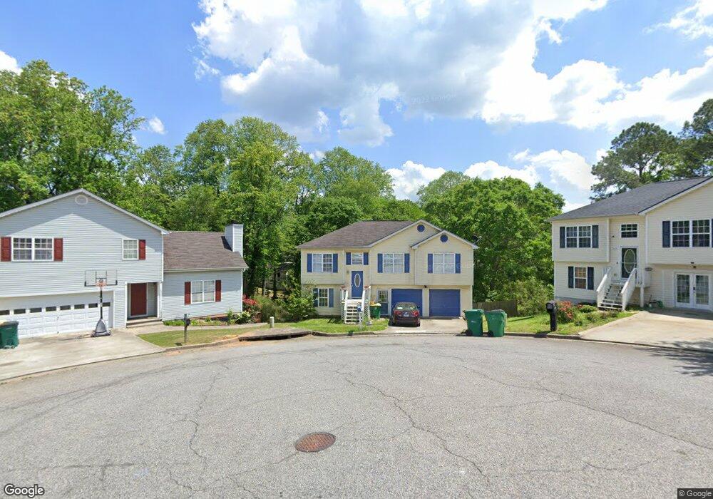
247 Jamie Ct Unit 2 Winder, GA 30680
Estimated Value: $294,000 - $309,000
3
Beds
2
Baths
1,711
Sq Ft
$176/Sq Ft
Est. Value
About This Home
This home is located at 247 Jamie Ct Unit 2, Winder, GA 30680 and is currently estimated at $301,839, approximately $176 per square foot. 247 Jamie Ct Unit 2 is a home located in Barrow County with nearby schools including Holsenbeck Elementary School, Bear Creek Middle School, and Winder-Barrow High School.
Ownership History
Date
Name
Owned For
Owner Type
Purchase Details
Closed on
May 26, 2020
Sold by
Blair Kimberly Abigail
Bought by
Blair Kimberly Abigail and Lillo John Joseph
Current Estimated Value
Home Financials for this Owner
Home Financials are based on the most recent Mortgage that was taken out on this home.
Original Mortgage
$154,156
Outstanding Balance
$136,648
Interest Rate
3.2%
Mortgage Type
FHA
Estimated Equity
$165,192
Purchase Details
Closed on
Jan 24, 2020
Sold by
Nooning David Lee Estate
Bought by
Johnson Gary L and Johnson Stephanie M
Home Financials for this Owner
Home Financials are based on the most recent Mortgage that was taken out on this home.
Original Mortgage
$124,259
Interest Rate
3.74%
Mortgage Type
New Conventional
Purchase Details
Closed on
Jan 16, 2020
Sold by
Nooning Patrick
Bought by
Nooning David Lee Estate
Home Financials for this Owner
Home Financials are based on the most recent Mortgage that was taken out on this home.
Original Mortgage
$124,259
Interest Rate
3.74%
Mortgage Type
New Conventional
Purchase Details
Closed on
Aug 21, 2009
Sold by
Hud-Housing Of Urban Dev
Bought by
Nooning David L
Home Financials for this Owner
Home Financials are based on the most recent Mortgage that was taken out on this home.
Original Mortgage
$98,940
Interest Rate
5.19%
Mortgage Type
New Conventional
Purchase Details
Closed on
Dec 4, 2007
Sold by
Taylor Bean & Whitaker Mtg Cor
Bought by
Hud-Housing Of Urban Dev
Purchase Details
Closed on
May 27, 2005
Sold by
Lewis Sheridan C
Bought by
Schweighardt Mark and Schweighardt Ellen
Home Financials for this Owner
Home Financials are based on the most recent Mortgage that was taken out on this home.
Original Mortgage
$118,047
Interest Rate
5.74%
Mortgage Type
VA
Purchase Details
Closed on
Jul 27, 2000
Sold by
Jett-Hoover Builders
Bought by
Lewis Sheridan C
Home Financials for this Owner
Home Financials are based on the most recent Mortgage that was taken out on this home.
Original Mortgage
$98,040
Interest Rate
8.23%
Mortgage Type
New Conventional
Create a Home Valuation Report for This Property
The Home Valuation Report is an in-depth analysis detailing your home's value as well as a comparison with similar homes in the area
Home Values in the Area
Average Home Value in this Area
Purchase History
| Date | Buyer | Sale Price | Title Company |
|---|---|---|---|
| Blair Kimberly Abigail | -- | -- | |
| Blair Kimberly Abigail | $157,000 | -- | |
| Johnson Gary L | $100,000 | -- | |
| Nooning David Lee Estate | -- | -- | |
| Nooning David L | -- | -- | |
| Hud-Housing Of Urban Dev | -- | -- | |
| Taylor Bean & Whitaker Mtg Cor | $121,776 | -- | |
| Schweighardt Mark | $119,900 | -- | |
| Lewis Sheridan C | $103,200 | -- |
Source: Public Records
Mortgage History
| Date | Status | Borrower | Loan Amount |
|---|---|---|---|
| Open | Blair Kimberly Abigail | $154,156 | |
| Closed | Blair Kimberly Abigail | $154,156 | |
| Previous Owner | Johnson Gary L | $124,259 | |
| Previous Owner | Nooning David L | $98,940 | |
| Previous Owner | Schweighardt Mark | $118,047 | |
| Previous Owner | Lewis Sheridan C | $98,040 |
Source: Public Records
Tax History Compared to Growth
Tax History
| Year | Tax Paid | Tax Assessment Tax Assessment Total Assessment is a certain percentage of the fair market value that is determined by local assessors to be the total taxable value of land and additions on the property. | Land | Improvement |
|---|---|---|---|---|
| 2024 | $2,536 | $92,627 | $20,000 | $72,627 |
| 2023 | $2,053 | $92,627 | $20,000 | $72,627 |
| 2022 | $2,504 | $76,372 | $16,400 | $59,972 |
| 2021 | $2,120 | $71,972 | $12,000 | $59,972 |
| 2020 | $2,297 | $66,091 | $12,000 | $54,091 |
| 2019 | $2,202 | $62,242 | $12,000 | $50,242 |
| 2018 | $2,008 | $56,516 | $10,000 | $46,516 |
| 2017 | $1,344 | $45,041 | $9,000 | $36,041 |
| 2016 | $1,363 | $39,729 | $8,000 | $31,729 |
| 2015 | $1,376 | $40,091 | $8,000 | $32,091 |
| 2014 | $1,353 | $39,163 | $5,488 | $33,675 |
| 2013 | -- | $37,527 | $5,488 | $32,039 |
Source: Public Records
Map
Nearby Homes
- 247 Jamie Ct
- 245 Jamie Ct
- 248 Jamie Ct
- 248 Jamie Ct Unit 2
- 243 Jamie Ct Unit 2
- 246 Jamie Ct
- 244 Jamie Ct
- 356 Mary Alice Dr Unit 3
- 356 Mary Alice Dr
- 241 Jamie Ct Unit 2
- 242 Jamie Ct
- 358 Mary Alice Dr Unit 3
- 271 Rutledge Dr
- 354 Mary Alice Dr Unit 3
- 262 Kesler Ct
- 239 Jamie Ct Unit 2
- 240 Jamie Ct
- 302 Mary Alice Dr Unit 1
- 352 Mary Alice Dr Unit 3
- 359 Mary Alice Dr Unit 3