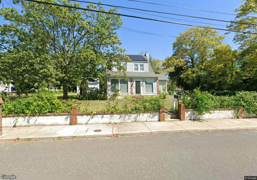
247 N 5th Ave Long Branch, NJ 07740
Estimated Value: $643,000 - $674,000
3
Beds
2
Baths
1,833
Sq Ft
$361/Sq Ft
Est. Value
About This Home
This home is located at 247 N 5th Ave, Long Branch, NJ 07740 and is currently estimated at $660,885, approximately $360 per square foot. 247 N 5th Ave is a home located in Monmouth County with nearby schools including Long Branch High School and Holy Trinity School.
Ownership History
Date
Name
Owned For
Owner Type
Purchase Details
Closed on
May 5, 1998
Sold by
Gibson Mary
Bought by
Tyler Barbara
Current Estimated Value
Home Financials for this Owner
Home Financials are based on the most recent Mortgage that was taken out on this home.
Original Mortgage
$117,000
Interest Rate
7.04%
Purchase Details
Closed on
Sep 17, 1997
Sold by
Pereira Manuel
Bought by
Gibson Mary
Home Financials for this Owner
Home Financials are based on the most recent Mortgage that was taken out on this home.
Original Mortgage
$101,000
Interest Rate
7.38%
Create a Home Valuation Report for This Property
The Home Valuation Report is an in-depth analysis detailing your home's value as well as a comparison with similar homes in the area
Home Values in the Area
Average Home Value in this Area
Purchase History
| Date | Buyer | Sale Price | Title Company |
|---|---|---|---|
| Tyler Barbara | $117,500 | -- | |
| Gibson Mary | $112,000 | -- |
Source: Public Records
Mortgage History
| Date | Status | Borrower | Loan Amount |
|---|---|---|---|
| Previous Owner | Tyler Barbara | $117,000 | |
| Previous Owner | Gibson Mary | $101,000 |
Source: Public Records
Tax History Compared to Growth
Tax History
| Year | Tax Paid | Tax Assessment Tax Assessment Total Assessment is a certain percentage of the fair market value that is determined by local assessors to be the total taxable value of land and additions on the property. | Land | Improvement |
|---|---|---|---|---|
| 2025 | $8,587 | $592,800 | $269,500 | $323,300 |
| 2024 | $7,838 | $558,700 | $249,500 | $309,200 |
| 2023 | $7,838 | $504,700 | $209,500 | $295,200 |
| 2022 | $7,608 | $433,400 | $153,800 | $279,600 |
| 2021 | $7,608 | $380,200 | $118,800 | $261,400 |
| 2020 | $7,643 | $365,700 | $105,800 | $259,900 |
| 2019 | $7,349 | $349,600 | $101,800 | $247,800 |
| 2018 | $6,801 | $321,700 | $99,800 | $221,900 |
| 2017 | $6,770 | $328,500 | $97,800 | $230,700 |
| 2016 | $6,742 | $333,600 | $108,800 | $224,800 |
| 2015 | $5,953 | $267,300 | $80,500 | $186,800 |
| 2014 | $5,568 | $263,500 | $97,800 | $165,700 |
Source: Public Records
Map
Nearby Homes
- 211 Rockwell Ave
- 184 N 5th Ave
- 190 Spruce St Unit 4
- 148 Sixth Ave
- 151 N 5th Ave
- 401 Joline Ave
- 40 University Dr
- 222 Coleman Ave
- 323 Florence Ave
- 188 Chelton Ave
- 392 Florence Ave
- 40 N 5th Ave
- 172 Chelton Ave
- 231 Long Branch Ave
- 14 Slocum Place
- 138 Rosewood Ave
- 164 Airsdale Ave
- 154 Atlantic Ave
- 15 Signal Ave
- 565 Joline Ave
- 251 N 5th Ave
- 253 N 5th Ave
- 225 N 5th Ave
- 255 N 5th Ave
- 272 Rockwell Ave
- 276 Rockwell Ave
- 246 N 5th Ave
- 248 N 5th Ave
- 254 Rockwell Ave
- 254 Rockwell Ave Unit B (UPSTAIIRS)
- 231 N 5th Ave
- 252 N 5th Ave
- 274 Rockwell Ave
- 267 N 5th Ave
- 232 N 5th Ave
- 254 N 5th Ave
- 248 Rockwell Ave
- 230 N 5th Ave Unit 2
- 230 N 5th Ave Unit 1
- 282 Rockwell Ave