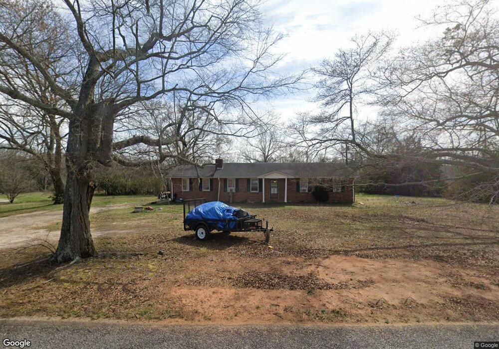
247 Simpson Rd Honea Path, SC 29654
Estimated Value: $286,000 - $381,000
3
Beds
--
Bath
1,401
Sq Ft
$236/Sq Ft
Est. Value
About This Home
This home is located at 247 Simpson Rd, Honea Path, SC 29654 and is currently estimated at $330,863, approximately $236 per square foot. 247 Simpson Rd is a home with nearby schools including Belton Honea Path High School.
Ownership History
Date
Name
Owned For
Owner Type
Purchase Details
Closed on
Apr 29, 2008
Sold by
Stewart James D
Bought by
Stewart Virginia M
Current Estimated Value
Home Financials for this Owner
Home Financials are based on the most recent Mortgage that was taken out on this home.
Original Mortgage
$262,500
Interest Rate
3.38%
Mortgage Type
Reverse Mortgage Home Equity Conversion Mortgage
Purchase Details
Closed on
Apr 28, 2008
Sold by
Stewart Grady E
Bought by
Stewart Virginia M
Home Financials for this Owner
Home Financials are based on the most recent Mortgage that was taken out on this home.
Original Mortgage
$262,500
Interest Rate
3.38%
Mortgage Type
Reverse Mortgage Home Equity Conversion Mortgage
Create a Home Valuation Report for This Property
The Home Valuation Report is an in-depth analysis detailing your home's value as well as a comparison with similar homes in the area
Home Values in the Area
Average Home Value in this Area
Purchase History
| Date | Buyer | Sale Price | Title Company |
|---|---|---|---|
| Stewart Virginia M | $30,000 | -- | |
| Stewart Virginia M | $30,000 | -- |
Source: Public Records
Mortgage History
| Date | Status | Borrower | Loan Amount |
|---|---|---|---|
| Previous Owner | Stewart Virginia M | $262,500 |
Source: Public Records
Tax History
| Year | Tax Paid | Tax Assessment Tax Assessment Total Assessment is a certain percentage of the fair market value that is determined by local assessors to be the total taxable value of land and additions on the property. | Land | Improvement |
|---|---|---|---|---|
| 2024 | $395 | $4,960 | $290 | $4,670 |
| 2023 | $392 | $4,960 | $290 | $4,670 |
| 2022 | $394 | $4,960 | $290 | $4,670 |
| 2021 | $330 | $4,420 | $280 | $4,140 |
| 2020 | $328 | $4,420 | $280 | $4,140 |
| 2019 | $328 | $4,420 | $280 | $4,140 |
| 2018 | $334 | $4,420 | $280 | $4,140 |
| 2017 | -- | $4,420 | $280 | $4,140 |
| 2016 | $264 | $4,200 | $220 | $3,980 |
| 2015 | $281 | $4,200 | $220 | $3,980 |
| 2014 | $284 | $4,200 | $220 | $3,980 |
Source: Public Records
Map
Nearby Homes
- 105 Canfield Rd
- 00 Docheno Rd
- 0 Holiday Dam Rd Unit 26097306
- 0 Holiday Dam Rd Unit 1579809
- 11900 Belton Honea Path Hwy
- 11306 Belton Honea Path Hwy
- 229 Armstrong Rd
- 00 Ellison Rd
- 181 Peach Orchard Dr
- 1 E McGee St
- 511 N Main St
- 729 Holliday Dam Rd
- 204 Deer Trot Ave
- 723 Holliday Dam Rd
- 417 N Main St
- 7 Carlisle Dr
- 600 N Main St
- 108 Longshore Dr
- 1065 Smith Cir
- 5 George St
- 205 Simpson Rd
- 155 Simpson Rd
- NPA Hamby Rd
- 0 Hamby Rd Unit 20001974
- 00 Hamby Rd
- 00 Hamby Rd Unit 30.67 Acres
- 00 Hamby Rd Unit 19.54 Acres
- 253 Simpson Rd
- 1709 Hamby Rd
- 254 Simpson Rd
- 191 Canfield Rd
- 209 Canfield Rd
- 301 Canfield Rd
- 02 Simpson Rd
- 01 Simpson Rd
- 00 Simpson Rd
- 161 Canfield Rd
- 181 Canfield Rd
- 200 Canfield Rd
- 788 Simpson Rd
Your Personal Tour Guide
Ask me questions while you tour the home.