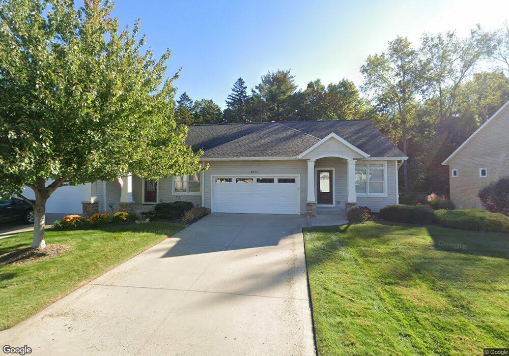
2474 Nuttall Ct Unit 9 Holland, MI 49424
Estimated Value: $412,477 - $455,000
3
Beds
3
Baths
2,136
Sq Ft
$203/Sq Ft
Est. Value
About This Home
This home is located at 2474 Nuttall Ct Unit 9, Holland, MI 49424 and is currently estimated at $434,369, approximately $203 per square foot. 2474 Nuttall Ct Unit 9 is a home located in Ottawa County with nearby schools including Woodside Elementary School, Macatawa Bay Middle School, and West Ottawa High School.
Ownership History
Date
Name
Owned For
Owner Type
Purchase Details
Closed on
Apr 28, 2021
Sold by
Stone Theron Richard and Stone Elizabeth
Bought by
Stone Theron R and Stone Elizabeth M
Current Estimated Value
Purchase Details
Closed on
Nov 21, 2008
Sold by
Oakfield Properties Llc
Bought by
Stone Theron Richard
Home Financials for this Owner
Home Financials are based on the most recent Mortgage that was taken out on this home.
Original Mortgage
$115,920
Outstanding Balance
$77,581
Interest Rate
6.48%
Mortgage Type
Purchase Money Mortgage
Estimated Equity
$356,788
Create a Home Valuation Report for This Property
The Home Valuation Report is an in-depth analysis detailing your home's value as well as a comparison with similar homes in the area
Home Values in the Area
Average Home Value in this Area
Purchase History
| Date | Buyer | Sale Price | Title Company |
|---|---|---|---|
| Stone Theron R | -- | None Available | |
| Stone Theron Richard | -- | None Available | |
| Stone Theron Richard | $144,900 | Lighthouse Title Inc |
Source: Public Records
Mortgage History
| Date | Status | Borrower | Loan Amount |
|---|---|---|---|
| Open | Stone Theron Richard | $115,920 |
Source: Public Records
Tax History Compared to Growth
Tax History
| Year | Tax Paid | Tax Assessment Tax Assessment Total Assessment is a certain percentage of the fair market value that is determined by local assessors to be the total taxable value of land and additions on the property. | Land | Improvement |
|---|---|---|---|---|
| 2025 | $2,518 | $195,600 | $0 | $0 |
| 2024 | $1,908 | $169,200 | $0 | $0 |
| 2023 | $1,841 | $130,400 | $0 | $0 |
| 2022 | $2,360 | $126,800 | $0 | $0 |
| 2021 | $2,294 | $118,800 | $0 | $0 |
| 2020 | $2,218 | $114,300 | $0 | $0 |
| 2019 | $2,182 | $87,200 | $0 | $0 |
| 2018 | $2,025 | $99,200 | $12,000 | $87,200 |
| 2017 | $1,993 | $95,900 | $0 | $0 |
| 2016 | $1,983 | $88,500 | $0 | $0 |
| 2015 | $1,898 | $80,200 | $0 | $0 |
| 2014 | $1,898 | $69,700 | $0 | $0 |
Source: Public Records
Map
Nearby Homes
- 2604 William Ave
- 0 James St Unit Lot C
- 653 W Lakewood Blvd
- 770 144th Ave
- 351 James St
- 14705 Valley View Ave
- V/L Valley View Ave
- 790 Mayfield Ave
- 401 1st Ave
- 14801 Sagebrush Dr
- 2918 Foxboro Ln
- 694 Riley St
- 2978 Creek Edge Ct
- 257 Mae Rose Ave
- 14934 Timberoak St
- 3315 142nd Ave
- 161 Manley Ave
- 2405 Burke Ave
- 145 Bay Meadows Dr
- The Poppy Plan at West Ottawa Homesites
- 2478 Nuttall Ct Unit 10
- 2322 Nuttall Ct
- 2464 Nuttall Ct
- 2464 Nuttall Ct Unit 8
- 2460 Nuttall Ct
- 2460 Nuttall Ct Unit 7
- 2490 Nuttall Ct
- 2490 Nuttall Ct Unit 11
- 2479 Nuttall Ct Unit 19
- 2467 Nuttall Ct Unit 20
- 2483 Nuttall Ct Unit 18
- 2494 Nuttall Ct Unit 12
- 2463 Nuttall Ct Unit 21
- 2448 Nuttall Ct Unit 6
- 2491 Nuttall Ct Unit 17
- 2451 Nuttall Ct
- 2451 Nuttall Ct Unit 22
- 2444 Nuttall Ct Unit 5
- 2447 Nuttall Ct Unit 23
- 2502 Nuttall Ct Unit 13