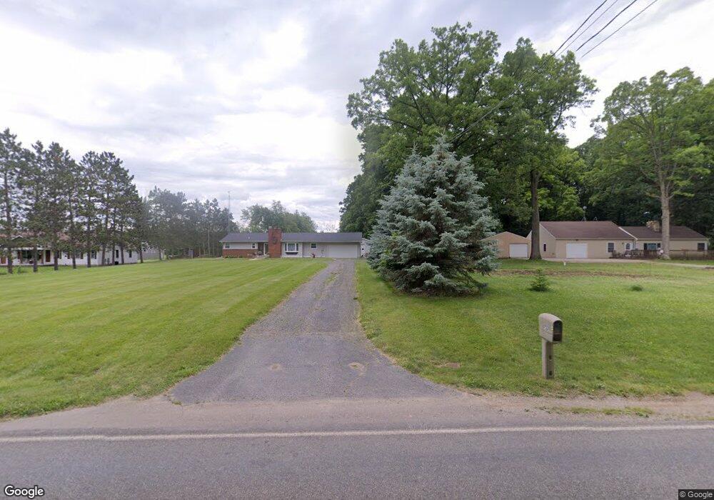
2475 W Bennington Rd Owosso, MI 48867
Estimated Value: $339,000 - $419,000
--
Bed
--
Bath
--
Sq Ft
1.4
Acres
About This Home
This home is located at 2475 W Bennington Rd, Owosso, MI 48867 and is currently estimated at $371,905. 2475 W Bennington Rd is a home located in Shiawassee County with nearby schools including Owosso High School and Owosso Christian School.
Ownership History
Date
Name
Owned For
Owner Type
Purchase Details
Closed on
Jun 17, 2025
Sold by
Winkowski Matthew J
Bought by
Winkowski Matthew J and Matthew James Winkowski Revocable Living Trus
Current Estimated Value
Purchase Details
Closed on
Jul 17, 2020
Sold by
Frolka Steven J and Frolka Dawn M
Bought by
Winkowski Matt
Home Financials for this Owner
Home Financials are based on the most recent Mortgage that was taken out on this home.
Original Mortgage
$20,000
Interest Rate
3%
Mortgage Type
New Conventional
Create a Home Valuation Report for This Property
The Home Valuation Report is an in-depth analysis detailing your home's value as well as a comparison with similar homes in the area
Home Values in the Area
Average Home Value in this Area
Purchase History
| Date | Buyer | Sale Price | Title Company |
|---|---|---|---|
| Winkowski Matthew J | -- | None Listed On Document | |
| Winkowski Matthew J | -- | None Listed On Document | |
| Winkowski Matt | $25,000 | Cislo Ttl Co Ttl Ins & Escro |
Source: Public Records
Mortgage History
| Date | Status | Borrower | Loan Amount |
|---|---|---|---|
| Previous Owner | Winkowski Matt | $20,000 |
Source: Public Records
Tax History Compared to Growth
Tax History
| Year | Tax Paid | Tax Assessment Tax Assessment Total Assessment is a certain percentage of the fair market value that is determined by local assessors to be the total taxable value of land and additions on the property. | Land | Improvement |
|---|---|---|---|---|
| 2025 | $3,977 | $182,700 | $0 | $0 |
| 2024 | $4,035 | $163,100 | $0 | $0 |
| 2023 | $1,557 | $148,000 | $0 | $0 |
| 2022 | $1,165 | $102,000 | $0 | $0 |
| 2021 | $509 | $10,800 | $0 | $0 |
| 2020 | $258 | $10,800 | $0 | $0 |
| 2019 | $254 | $10,800 | $0 | $0 |
| 2018 | $262 | $9,700 | $0 | $0 |
| 2017 | $216 | $9,700 | $0 | $0 |
| 2016 | -- | $9,700 | $0 | $0 |
| 2015 | -- | $9,600 | $0 | $0 |
| 2014 | $1 | $8,100 | $0 | $0 |
Source: Public Records
Map
Nearby Homes
- 2377 W Bennington Rd
- 4458 S M 52
- 4650 Waugh Rd
- V/L Morrice Rd Rd
- 2628 W Brewer Rd
- 2973 W Brewer Rd
- 2560 S Morrice Rd
- 2419 S Morrice Rd
- 8 Bennington Greens Dr
- 539 W Wildwood Dr
- 4764 W Hibbard Rd
- 0 Gale Rd Unit 50124635
- 1627 Michigan 52
- 1560 S M 52
- 25 Bennington Greens Dr
- 26 Bennington Greens Dr Unit 26
- 20 Bennington Greens Dr
- 24 Bennington Greens Dr
- 38 Bennington Greens Dr
- 14 Bennington Greens Dr
- 2475 W Bennington Rd
- 2507 W Bennington Rd
- 6764 W Bennington Rd
- 2425 W Bennington Rd
- 2425 W Bennington Rd
- 2545 W Bennington Rd
- 4095 S Blue Spruce Ct
- 2510 W Bennington Rd
- 4115 S Blue Spruce Ct
- 2400 W Bennington Rd
- 4010 S Blue Spruce Ct
- 2635 W Bennington Rd
- 4124 S Blue Spruce Ct
- 4124 S Blue Spruce Ct
- 2039 Smith Park Dr Unit Bldg-Unit
- 2039 Smith Park Dr
- 2039 Smith Park Dr
- PAR C Old Colony
- PAR B Old Colony
- Lot 20 Brookside Dr