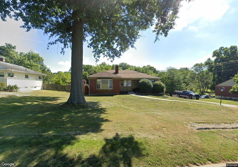
2478 Banning Rd Cincinnati, OH 45239
Estimated Value: $217,000 - $262,760
3
Beds
2
Baths
1,964
Sq Ft
$118/Sq Ft
Est. Value
About This Home
This home is located at 2478 Banning Rd, Cincinnati, OH 45239 and is currently estimated at $231,190, approximately $117 per square foot. 2478 Banning Rd is a home located in Hamilton County with nearby schools including White Oak Middle School, Colerain High School, and Cincinnati Achievement Academy.
Ownership History
Date
Name
Owned For
Owner Type
Purchase Details
Closed on
Jul 29, 2004
Sold by
Bailey Kenneth W and Bailey Reevie B
Bought by
Bailey Reevie B
Current Estimated Value
Home Financials for this Owner
Home Financials are based on the most recent Mortgage that was taken out on this home.
Original Mortgage
$149,869
Interest Rate
4.87%
Mortgage Type
New Conventional
Purchase Details
Closed on
May 17, 2002
Sold by
Storer Dennis and Storer Rebecca H
Bought by
Bailey Kenneth W and Bailey Reevie B
Home Financials for this Owner
Home Financials are based on the most recent Mortgage that was taken out on this home.
Original Mortgage
$122,900
Interest Rate
5.62%
Purchase Details
Closed on
Jun 17, 1998
Sold by
Wintermeyer Robert C and Wintermeyer Lisa M
Bought by
Storer Dennis and Storer Becky H
Home Financials for this Owner
Home Financials are based on the most recent Mortgage that was taken out on this home.
Original Mortgage
$93,280
Interest Rate
11.8%
Create a Home Valuation Report for This Property
The Home Valuation Report is an in-depth analysis detailing your home's value as well as a comparison with similar homes in the area
Home Values in the Area
Average Home Value in this Area
Purchase History
| Date | Buyer | Sale Price | Title Company |
|---|---|---|---|
| Bailey Reevie B | -- | -- | |
| Bailey Kenneth W | $122,900 | -- | |
| Storer Dennis | $106,000 | Phoenix Land Title Agency In |
Source: Public Records
Mortgage History
| Date | Status | Borrower | Loan Amount |
|---|---|---|---|
| Closed | Bailey Reevie B | $149,869 | |
| Closed | Bailey Kenneth W | $122,900 | |
| Closed | Storer Dennis | $93,280 |
Source: Public Records
Tax History Compared to Growth
Tax History
| Year | Tax Paid | Tax Assessment Tax Assessment Total Assessment is a certain percentage of the fair market value that is determined by local assessors to be the total taxable value of land and additions on the property. | Land | Improvement |
|---|---|---|---|---|
| 2024 | $3,402 | $63,375 | $13,668 | $49,707 |
| 2023 | $3,420 | $63,375 | $13,668 | $49,707 |
| 2022 | $2,358 | $35,543 | $10,675 | $24,868 |
| 2021 | $2,341 | $35,543 | $10,675 | $24,868 |
| 2020 | $2,362 | $35,543 | $10,675 | $24,868 |
| 2019 | $2,108 | $29,642 | $9,048 | $20,594 |
| 2018 | $1,892 | $29,642 | $9,048 | $20,594 |
| 2017 | $1,793 | $29,642 | $9,048 | $20,594 |
| 2016 | $2,339 | $38,269 | $12,488 | $25,781 |
| 2015 | $2,362 | $38,269 | $12,488 | $25,781 |
| 2014 | $2,366 | $38,269 | $12,488 | $25,781 |
| 2013 | $2,446 | $41,594 | $13,573 | $28,021 |
Source: Public Records
Map
Nearby Homes
- 2481 Crosley Meadow
- 2412 Amelia Ct
- 2424 Banning Rd
- 6851 Rutherford Ct
- 2342 Banning Rd
- 2268 Deblin Dr
- 2347 Golf Dr
- 2390 Golf Dr
- 2598 Byrneside Dr
- 2532 Flanigan Ct
- 2536 Flanigan Ct
- 2503 Flanigan Ct
- 2811 Breezy Way
- 5851 Monfort Hills Ave
- 2029 Sundale Ave
- 5970 Colerain Ave
- 2125 Mckinley Ave
- 3041 Preserve Ln
- 6505 Simpson Ave
- 2606 Kipling Ave
- 2486 Banning Rd
- 2474 Banning Rd
- 2477 Banning Rd
- 2466 Banning Rd
- 2488 Banning Rd
- 2499 Banning Rd
- 2460 Banning Rd
- 2452 Banning Rd
- 2430 Crosley Meadow
- 2460 Crosley Meadow
- 2390 Deblin Dr
- 2448 Banning Rd
- 2380 Deblin Dr
- 2438 Crosley Meadow
- 7121 Pippin Rd
- 2370 Deblin Dr
- 2464 Crosley Meadow
- 2464 Crosley Meadow
- 2464 Crosley Meadow
- 2360 Deblin Dr