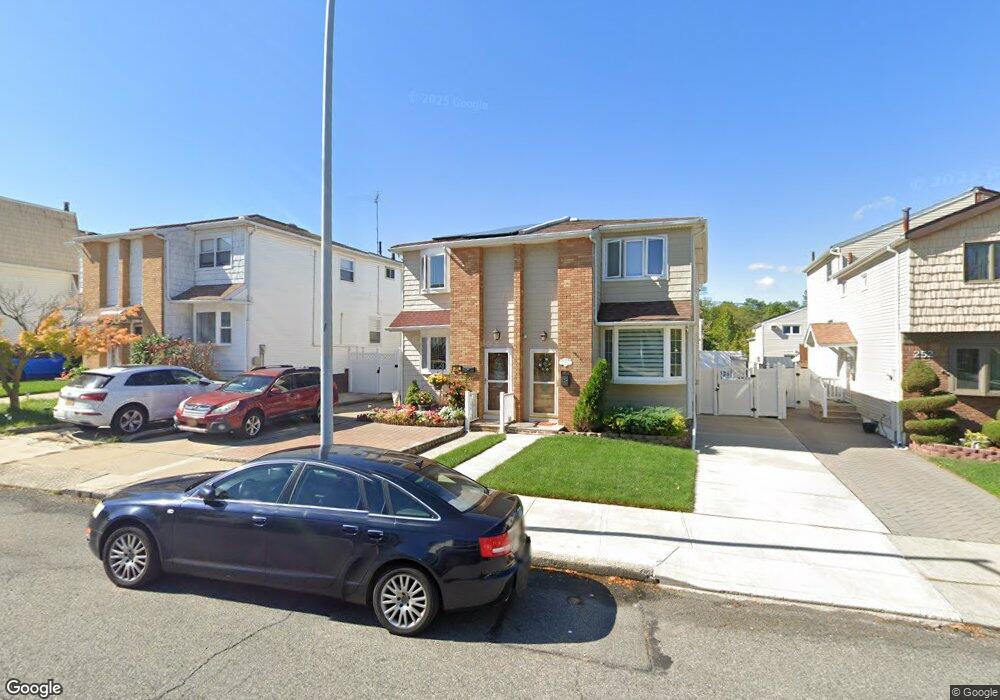
248 Brookfield Ave Staten Island, NY 10308
Great Kills NeighborhoodEstimated Value: $686,000 - $718,000
3
Beds
3
Baths
1,512
Sq Ft
$467/Sq Ft
Est. Value
About This Home
This home is located at 248 Brookfield Ave, Staten Island, NY 10308 and is currently estimated at $705,386, approximately $466 per square foot. 248 Brookfield Ave is a home located in Richmond County with nearby schools including P.S. 32 The Gifford School, I.S. 075 Frank D. Paulo, and Susan E Wagner High School.
Ownership History
Date
Name
Owned For
Owner Type
Purchase Details
Closed on
Aug 27, 2020
Sold by
Cardello Mary Lou
Bought by
Mary Lou Cardello 2020 Irrevocable Trust and Cardello
Current Estimated Value
Purchase Details
Closed on
Jan 31, 2008
Sold by
Rossi Lynn A and Rossi Lucia
Bought by
Cardello Mary Lou
Home Financials for this Owner
Home Financials are based on the most recent Mortgage that was taken out on this home.
Original Mortgage
$230,000
Interest Rate
5.72%
Mortgage Type
Purchase Money Mortgage
Create a Home Valuation Report for This Property
The Home Valuation Report is an in-depth analysis detailing your home's value as well as a comparison with similar homes in the area
Home Values in the Area
Average Home Value in this Area
Purchase History
| Date | Buyer | Sale Price | Title Company |
|---|---|---|---|
| Mary Lou Cardello 2020 Irrevocable Trust | -- | Titleworks Abstract | |
| Cardello Mary Lou | $356,000 | None Available |
Source: Public Records
Mortgage History
| Date | Status | Borrower | Loan Amount |
|---|---|---|---|
| Previous Owner | Cardello Mary Lou | $230,000 |
Source: Public Records
Tax History Compared to Growth
Tax History
| Year | Tax Paid | Tax Assessment Tax Assessment Total Assessment is a certain percentage of the fair market value that is determined by local assessors to be the total taxable value of land and additions on the property. | Land | Improvement |
|---|---|---|---|---|
| 2025 | $6,171 | $38,100 | $7,168 | $30,932 |
| 2024 | $6,183 | $36,780 | $7,285 | $29,495 |
| 2023 | $5,974 | $30,816 | $6,346 | $24,470 |
| 2022 | $5,834 | $36,060 | $8,340 | $27,720 |
| 2021 | $5,784 | $32,820 | $8,340 | $24,480 |
| 2020 | $5,480 | $31,740 | $8,340 | $23,400 |
| 2019 | $3,601 | $30,300 | $8,340 | $21,960 |
| 2018 | $4,937 | $25,680 | $8,340 | $17,340 |
| 2017 | $4,909 | $25,550 | $8,108 | $17,442 |
| 2016 | $4,509 | $24,104 | $8,054 | $16,050 |
| 2015 | $4,282 | $22,740 | $6,960 | $15,780 |
| 2014 | $4,282 | $22,310 | $6,602 | $15,708 |
Source: Public Records
Map
Nearby Homes
- 307 Abingdon Ave
- 259 Brookfield Ave
- 339 Abingdon Ave
- 345 Colon Ave
- 248 Abingdon Ave
- 185 Brookfield Ave
- 919 Armstrong Ave
- 223 Abingdon Ave
- 271 Doane Ave
- 26 E Brandis Ave
- 350 Brookfield Ave
- 414 Elverton Ave
- 63 Genesee Ave
- 924 Armstrong Ave Unit 2-3
- 72 Eric Ln
- 74 E Brandis Ave
- 379 Brookfield Ave
- 131 Cortelyou Ave Unit 1-1
- 466 Doane Ave
- 57 Middle Loop Rd
- 244 Brookfield Ave Unit 246
- 244-246 Brookfield Ave
- 250 Brookfield Ave
- 242 Brookfield Ave
- 252 Brookfield Ave
- 240 Brookfield Ave
- 254 Brookfield Ave
- 238 Brookfield Ave
- 315 Abingdon Ave
- 258 Brookfield Ave
- 317 Abingdon Ave
- 305 Abingdon Ave
- 319 Abingdon Ave
- 234 Brookfield Ave
- 303 Abingdon Ave
- 260 Brookfield Ave
- 321 Abingdon Ave
- 232 Brookfield Ave
- 299 Abingdon Ave
- 323 Abingdon Ave