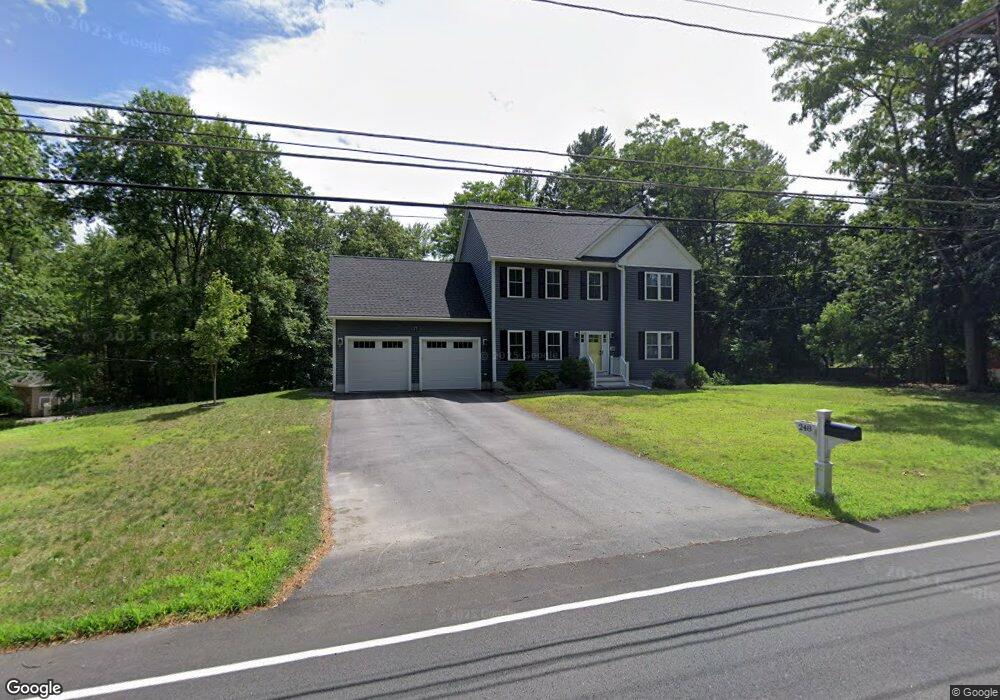
248 Dunstable Rd North Chelmsford, MA 01863
North Chelmsford NeighborhoodEstimated Value: $779,723 - $885,000
4
Beds
3
Baths
1,920
Sq Ft
$435/Sq Ft
Est. Value
About This Home
This home is located at 248 Dunstable Rd, North Chelmsford, MA 01863 and is currently estimated at $835,181, approximately $434 per square foot. 248 Dunstable Rd is a home located in Middlesex County with nearby schools including Charles D. Harrington Elementary School, Parker Middle School, and Chelmsford High School.
Ownership History
Date
Name
Owned For
Owner Type
Purchase Details
Closed on
Jun 2, 2020
Sold by
Jjn Rt
Bought by
Amin Rahul and Patel Priyal
Current Estimated Value
Home Financials for this Owner
Home Financials are based on the most recent Mortgage that was taken out on this home.
Original Mortgage
$555,200
Outstanding Balance
$493,060
Interest Rate
3.3%
Mortgage Type
New Conventional
Estimated Equity
$342,121
Purchase Details
Closed on
Oct 30, 2019
Sold by
Illg John A
Bought by
Jjn Rt
Home Financials for this Owner
Home Financials are based on the most recent Mortgage that was taken out on this home.
Original Mortgage
$413,725
Interest Rate
3.7%
Mortgage Type
Construction
Purchase Details
Closed on
Dec 29, 1976
Bought by
Illg John A
Create a Home Valuation Report for This Property
The Home Valuation Report is an in-depth analysis detailing your home's value as well as a comparison with similar homes in the area
Home Values in the Area
Average Home Value in this Area
Purchase History
| Date | Buyer | Sale Price | Title Company |
|---|---|---|---|
| Amin Rahul | $694,000 | None Available | |
| Jjn Rt | $175,000 | -- | |
| Illg John A | -- | -- |
Source: Public Records
Mortgage History
| Date | Status | Borrower | Loan Amount |
|---|---|---|---|
| Open | Amin Rahul | $555,200 | |
| Previous Owner | Jjn Rt | $413,725 |
Source: Public Records
Tax History Compared to Growth
Tax History
| Year | Tax Paid | Tax Assessment Tax Assessment Total Assessment is a certain percentage of the fair market value that is determined by local assessors to be the total taxable value of land and additions on the property. | Land | Improvement |
|---|---|---|---|---|
| 2025 | $10,029 | $721,500 | $281,000 | $440,500 |
| 2024 | $9,798 | $719,400 | $281,000 | $438,400 |
| 2023 | $9,253 | $643,900 | $299,000 | $344,900 |
| 2022 | $9,137 | $579,400 | $256,000 | $323,400 |
| 2021 | $8,410 | $534,300 | $234,900 | $299,400 |
| 2020 | $4,228 | $257,000 | $219,700 | $37,300 |
| 2019 | $4,125 | $252,300 | $217,700 | $34,600 |
| 2018 | $4,111 | $228,900 | $196,100 | $32,800 |
| 2017 | $3,853 | $215,000 | $183,600 | $31,400 |
| 2016 | $3,963 | $219,800 | $186,100 | $33,700 |
| 2015 | $3,729 | $199,400 | $169,100 | $30,300 |
| 2014 | $3,595 | $189,400 | $159,400 | $30,000 |
Source: Public Records
Map
Nearby Homes
- 10 Worden Rd
- 5 Mission Rd Unit 107
- 1 Hope St
- 863 Wellman Ave Unit 863
- 23 Morrison Ln
- 126 Groton Rd
- 330 Wellman Ave
- 436 Wellman Ave
- 10 Butterfield St
- 10 Dickens Ln
- 20 Merrimac Way Unit 20E
- 271 Wellman Ave
- 251 Wellman Ave Unit 251
- 739 Wellman Ave
- 30 Russell Rd
- 0 Dunstable Rd
- 24 Old Tyng Rd
- 730 Wellman Ave
- 76 Russells Way
- 123 Sherburne Ave
- 270 Dunstable Rd
- 250 Dunstable Rd
- 2 Ledge Rd
- 2 Ledge Rd
- 251 Dunstable Rd
- 2 Stonehill Rd
- 10 Ledge Rd
- 242 Dunstable Rd
- 4 Stonehill Rd
- C27 Scotty Hollow Dr Unit 27C
- A-11 Scotty Hollow Dr Unit A-11
- Unit 2 Robin Hill Meadows Unit 2
- D10 Scotty Hollow Dr Unit D10
- B10 Sinai Cir Unit B10
- c26 Scotty Hollow Unit C26
- Unit 2 Robin Hill Meadows
- Lot 2 Pine Hill Rd
- LOT 3 Arthur Ave #13
- LOT 31 Twelfth Ave
- LOT 33 Willis Dr