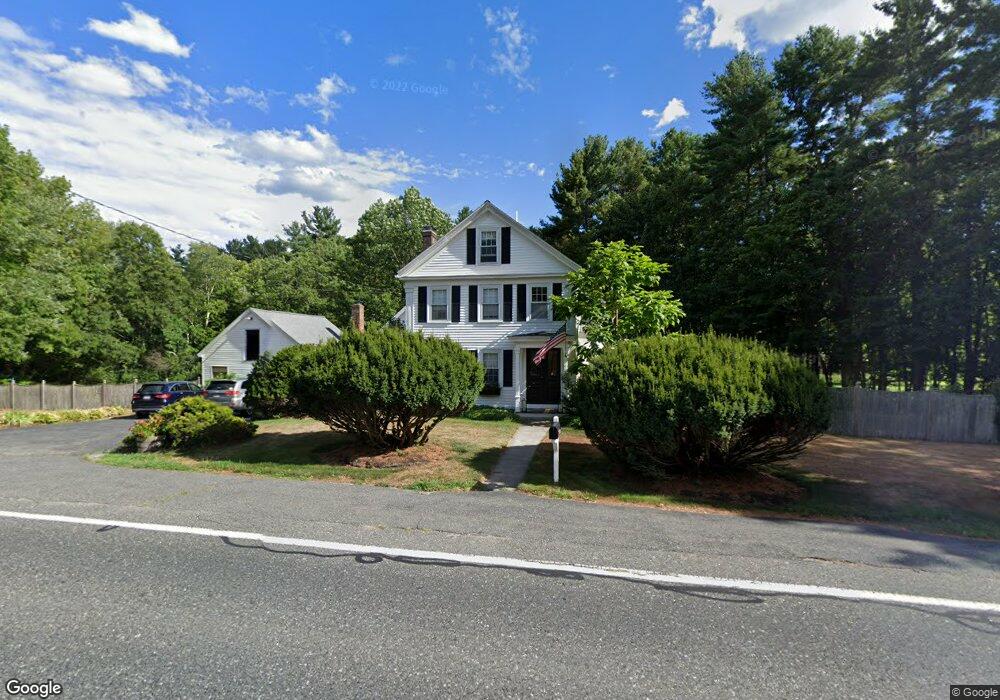
248 Eliot St Natick, MA 01760
Estimated Value: $1,152,016 - $1,313,000
3
Beds
2
Baths
2,395
Sq Ft
$523/Sq Ft
Est. Value
About This Home
This home is located at 248 Eliot St, Natick, MA 01760 and is currently estimated at $1,253,254, approximately $523 per square foot. 248 Eliot St is a home located in Middlesex County with nearby schools including Natick High School, Memorial Elementary School, and J F Kennedy Middle School.
Ownership History
Date
Name
Owned For
Owner Type
Purchase Details
Closed on
May 17, 2021
Sold by
Lallak Mark C and Lallak Laurie C
Bought by
Laurie C Lallak Lt
Current Estimated Value
Purchase Details
Closed on
Dec 22, 1995
Sold by
Mcnamara William P and Mcnamara Patricia A
Bought by
Lallak Mark C and Lallak Laurie C
Home Financials for this Owner
Home Financials are based on the most recent Mortgage that was taken out on this home.
Original Mortgage
$209,300
Interest Rate
7.33%
Mortgage Type
Purchase Money Mortgage
Purchase Details
Closed on
Aug 6, 1987
Sold by
Mccole Thomas P
Bought by
Mcnamara William P
Home Financials for this Owner
Home Financials are based on the most recent Mortgage that was taken out on this home.
Original Mortgage
$50,859
Interest Rate
10.37%
Mortgage Type
Purchase Money Mortgage
Create a Home Valuation Report for This Property
The Home Valuation Report is an in-depth analysis detailing your home's value as well as a comparison with similar homes in the area
Home Values in the Area
Average Home Value in this Area
Purchase History
| Date | Buyer | Sale Price | Title Company |
|---|---|---|---|
| Laurie C Lallak Lt | -- | None Available | |
| Lallak Mark C | $261,683 | -- | |
| Mcnamara William P | $275,000 | -- |
Source: Public Records
Mortgage History
| Date | Status | Borrower | Loan Amount |
|---|---|---|---|
| Previous Owner | Mcnamara William P | $203,000 | |
| Previous Owner | Mcnamara William P | $209,300 | |
| Previous Owner | Mcnamara William P | $50,859 |
Source: Public Records
Tax History Compared to Growth
Tax History
| Year | Tax Paid | Tax Assessment Tax Assessment Total Assessment is a certain percentage of the fair market value that is determined by local assessors to be the total taxable value of land and additions on the property. | Land | Improvement |
|---|---|---|---|---|
| 2025 | $12,022 | $1,005,200 | $547,600 | $457,600 |
| 2024 | $11,609 | $946,900 | $518,800 | $428,100 |
| 2023 | $11,619 | $919,200 | $518,800 | $400,400 |
| 2022 | $10,467 | $784,600 | $418,700 | $365,900 |
| 2021 | $10,096 | $741,800 | $396,600 | $345,200 |
| 2020 | $9,871 | $725,300 | $380,100 | $345,200 |
| 2019 | $9,219 | $725,300 | $380,100 | $345,200 |
| 2018 | $8,831 | $676,700 | $364,300 | $312,400 |
| 2017 | $8,920 | $661,200 | $360,900 | $300,300 |
| 2016 | $8,681 | $639,700 | $360,900 | $278,800 |
| 2015 | $8,479 | $613,500 | $360,900 | $252,600 |
Source: Public Records
Map
Nearby Homes
- 21 Harvest Moon Dr
- 15 Wyndemere Ln
- 5 Deer Path
- 48 Graystone Ln
- 39 Indian Ridge Rd
- 25 Yorkshire Rd
- 18 Phillips Pond Rd
- 39 Davis Brook Dr
- 91 Glen St
- 16 Wayside Rd Unit 14
- 16 Wayside Rd
- 94 Woodland St
- 104 Glen St
- 53 Yorkshire Rd
- 10 Sundance Way
- 8 Greystone Rd
- 6 Ambler Ct
- 216-218 S Main St
- 8 Warren Rd
- 29 Water St