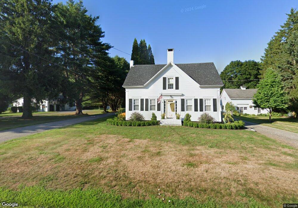
248 Ferry Rd Saco, ME 04072
East Saco NeighborhoodEstimated Value: $534,333 - $687,000
4
Beds
2
Baths
2,008
Sq Ft
$296/Sq Ft
Est. Value
About This Home
This home is located at 248 Ferry Rd, Saco, ME 04072 and is currently estimated at $594,083, approximately $295 per square foot. 248 Ferry Rd is a home located in York County with nearby schools including C K Burns School, Saco Middle School, and Saint James School.
Ownership History
Date
Name
Owned For
Owner Type
Purchase Details
Closed on
Mar 9, 2005
Sold by
Hogan Francis E and Hogan Theresa L
Bought by
Kamrath Jennifer R and Kamrath Karl B
Current Estimated Value
Home Financials for this Owner
Home Financials are based on the most recent Mortgage that was taken out on this home.
Original Mortgage
$285,750
Outstanding Balance
$54,468
Interest Rate
5.64%
Mortgage Type
Unknown
Estimated Equity
$539,615
Purchase Details
Closed on
Mar 2, 2005
Sold by
Leach John D and Leach Catherine H
Bought by
Hogan Francis E and Hogan Theresa L
Home Financials for this Owner
Home Financials are based on the most recent Mortgage that was taken out on this home.
Original Mortgage
$285,750
Outstanding Balance
$54,468
Interest Rate
5.64%
Mortgage Type
Unknown
Estimated Equity
$539,615
Create a Home Valuation Report for This Property
The Home Valuation Report is an in-depth analysis detailing your home's value as well as a comparison with similar homes in the area
Home Values in the Area
Average Home Value in this Area
Purchase History
| Date | Buyer | Sale Price | Title Company |
|---|---|---|---|
| Kamrath Jennifer R | -- | -- | |
| Hogan Francis E | -- | -- |
Source: Public Records
Mortgage History
| Date | Status | Borrower | Loan Amount |
|---|---|---|---|
| Open | Kamrath Jennifer R | $285,750 |
Source: Public Records
Tax History
| Year | Tax Paid | Tax Assessment Tax Assessment Total Assessment is a certain percentage of the fair market value that is determined by local assessors to be the total taxable value of land and additions on the property. | Land | Improvement |
|---|---|---|---|---|
| 2024 | $5,612 | $399,400 | $165,200 | $234,200 |
| 2023 | $5,891 | $399,400 | $165,200 | $234,200 |
| 2022 | $5,365 | $292,700 | $125,500 | $167,200 |
| 2021 | $5,179 | $274,300 | $113,800 | $160,500 |
| 2020 | $9,324 | $249,300 | $102,200 | $147,100 |
| 2019 | $1,717 | $249,300 | $102,200 | $147,100 |
| 2018 | $4,750 | $245,100 | $98,000 | $147,100 |
| 2017 | $4,382 | $226,100 | $89,100 | $137,000 |
| 2016 | $4,750 | $244,600 | $85,500 | $159,100 |
| 2015 | $4,667 | $242,800 | $85,500 | $157,300 |
| 2014 | $4,521 | $242,800 | $85,500 | $157,300 |
| 2013 | $4,511 | $242,800 | $85,500 | $157,300 |
Source: Public Records
Map
Nearby Homes
- 295 Ferry Rd
- TBD 530 Ferry Rd
- 3 Walker Dr Unit 101
- 4 Walker Dr Unit 101
- 3 Walker Dr Unit 101
- 353 Pool St
- 378 Pool St
- 343 Pool St
- 30 Vines Rd
- 11 Peabody Ln Unit 101
- 2 Breakwater Way Unit 2
- 6 Decary Rd
- 38 Pine Ridge Rd
- 4 Mainsail Ln Unit 4
- 625 Pool St
- 650 Pool St
- 280 Seaside Ave
- 74 Guinea Rd
- 12 Marial Ave
- 8 Heritage Way Unit 21
Your Personal Tour Guide
Ask me questions while you tour the home.