C
Seller's Agent in 2025
Carolyn Sheldrick
William Raveis Real Estate & Home Services
(508) 280-9278
26 in this area
26 Total Sales
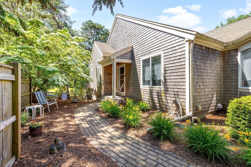
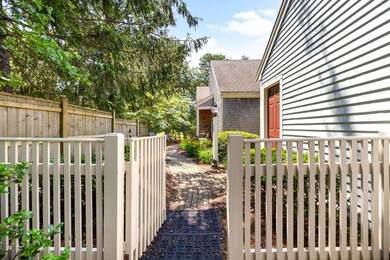
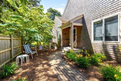
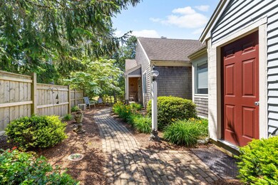
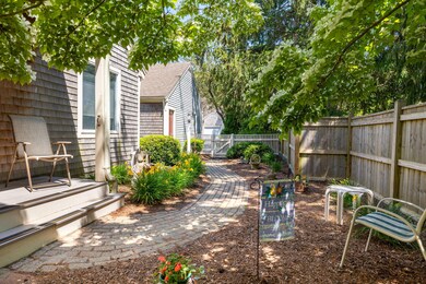
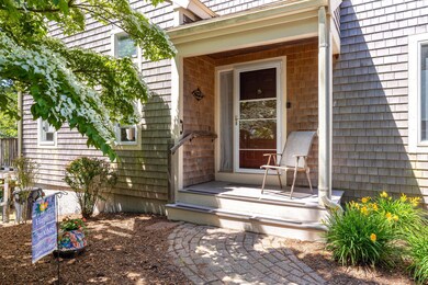

Come and enjoy one floor living in Kings Way, Cape Cod's premier condo community. This is an end unit with beautiful courtyard and a 2 car garage. Relax in the light, bright living room with a gas fireplace, built-ins and sliders to your private deck overlooking the 12th fairway and green. The primary bedroom ensuite offers cathedral ceiling, bay window, and double closets There is a 2nd bedroom and bath. Floors are hardwood in the living, dining room, and bedrooms. The finished lower level offers a family room, bonus room and lots of storage. Come and enjoy the Kings Way lifestyle with many amenities including a golf course, restaurant, 2 pools, tennis and pickleball courts, meeting house, social center and year round social activities.
Last Agent to Sell the Property
William Raveis Real Estate & Home Services License #72822 Listed on: 06/23/2025

Last Buyer's Agent
Cape Cod Retirement Group
Kinlin Grover Compass
| Date | Type | Sale Price | Title Company |
|---|---|---|---|
| Condominium Deed | $622,800 | -- | |
| Quit Claim Deed | -- | None Available | |
| Land Court Massachusetts | $379,000 | -- |
| Date | Event | Price | List to Sale | Price per Sq Ft |
|---|---|---|---|---|
| 07/31/2025 07/31/25 | Sold | $622,800 | +4.0% | $407 / Sq Ft |
| 06/25/2025 06/25/25 | Pending | -- | -- | -- |
| 06/23/2025 06/23/25 | For Sale | $599,000 | -- | $391 / Sq Ft |
| Year | Tax Paid | Tax Assessment Tax Assessment Total Assessment is a certain percentage of the fair market value that is determined by local assessors to be the total taxable value of land and additions on the property. | Land | Improvement |
|---|---|---|---|---|
| 2025 | $3,550 | $501,400 | $0 | $501,400 |
| 2024 | $3,969 | $537,800 | $0 | $537,800 |
| 2023 | $3,384 | $417,300 | $0 | $417,300 |
| 2022 | $3,658 | $398,500 | $0 | $398,500 |
| 2021 | $3,556 | $372,000 | $0 | $372,000 |
| 2020 | $3,588 | $358,800 | $0 | $358,800 |
| 2019 | $3,361 | $332,800 | $0 | $332,800 |
| 2018 | $3,157 | $306,800 | $0 | $306,800 |
| 2017 | $2,944 | $293,800 | $0 | $293,800 |
| 2016 | $2,802 | $280,800 | $0 | $280,800 |
| 2015 | $2,935 | $292,300 | $0 | $292,300 |
C
Seller's Agent in 2025
Carolyn Sheldrick
William Raveis Real Estate & Home Services
(508) 280-9278
26 in this area
26 Total Sales
C
Buyer's Agent in 2025
Cape Cod Retirement Group
Kinlin Grover Compass
Source: Cape Cod & Islands Association of REALTORS®
MLS Number: 22503075
APN: YARM-000142-000001-000248-C000000
Disclaimer: Certain information contained herein is derived from information provided by parties other than Homes.com. All information provided is deemed reliable, but is not guaranteed to be accurate and should be independently verified.
![]() All data relating to real estate for sale on this page comes from the Broker Reciprocity (BR) of the Cape Cod & Islands Multiple Listing Service, Inc. Detailed information about real estate listings held by brokerage firms other than CC&I Assoc. of REALTORS®, Inc. includes the name of the listing company. Neither the listing company nor CC&I Assoc. of REALTORS®, Inc. shall be responsible for any typographical errors, misinformation, misprints and shall be held totally harmless. The Broker providing this data believes it to be correct, but advises interested parties to confirm any item before relying on it in a purchase decision. All properties are subject to prior sale, changes, or withdrawal. Copyright 2025 © Cape Cod & Islands Multiple Listing Service, Inc. All rights reserved.
All data relating to real estate for sale on this page comes from the Broker Reciprocity (BR) of the Cape Cod & Islands Multiple Listing Service, Inc. Detailed information about real estate listings held by brokerage firms other than CC&I Assoc. of REALTORS®, Inc. includes the name of the listing company. Neither the listing company nor CC&I Assoc. of REALTORS®, Inc. shall be responsible for any typographical errors, misinformation, misprints and shall be held totally harmless. The Broker providing this data believes it to be correct, but advises interested parties to confirm any item before relying on it in a purchase decision. All properties are subject to prior sale, changes, or withdrawal. Copyright 2025 © Cape Cod & Islands Multiple Listing Service, Inc. All rights reserved.