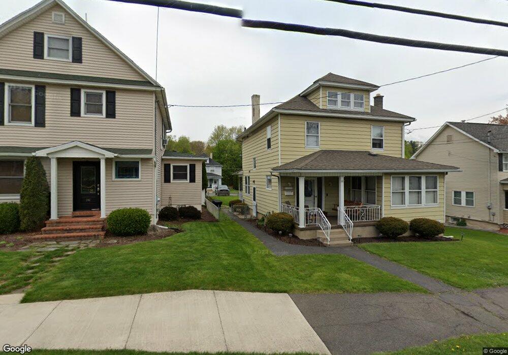
248 N Main St Archbald, PA 18403
Estimated Value: $206,000 - $275,000
3
Beds
2
Baths
2,200
Sq Ft
$112/Sq Ft
Est. Value
About This Home
This home is located at 248 N Main St, Archbald, PA 18403 and is currently estimated at $247,233, approximately $112 per square foot. 248 N Main St is a home located in Lackawanna County with nearby schools including Valley View Intermediate School, Valley View Middle School, and Valley View High School.
Ownership History
Date
Name
Owned For
Owner Type
Purchase Details
Closed on
Dec 20, 2011
Sold by
Sansone Erik T
Bought by
Burge Thomas and Husosky Lisa
Current Estimated Value
Home Financials for this Owner
Home Financials are based on the most recent Mortgage that was taken out on this home.
Original Mortgage
$128,165
Outstanding Balance
$89,298
Interest Rate
4.4%
Mortgage Type
FHA
Estimated Equity
$157,935
Purchase Details
Closed on
Feb 15, 2006
Sold by
Penn Security Bank & Trust Co
Bought by
Sansone Erik T
Home Financials for this Owner
Home Financials are based on the most recent Mortgage that was taken out on this home.
Original Mortgage
$100,800
Interest Rate
6.23%
Mortgage Type
New Conventional
Purchase Details
Closed on
Dec 13, 2005
Sold by
Pradel Gerald and Pradel Laura
Bought by
Security Bank & Trust Co
Create a Home Valuation Report for This Property
The Home Valuation Report is an in-depth analysis detailing your home's value as well as a comparison with similar homes in the area
Home Values in the Area
Average Home Value in this Area
Purchase History
| Date | Buyer | Sale Price | Title Company |
|---|---|---|---|
| Burge Thomas | $131,500 | None Available | |
| Sansone Erik T | $103,000 | None Available | |
| Security Bank & Trust Co | $1,837 | None Available |
Source: Public Records
Mortgage History
| Date | Status | Borrower | Loan Amount |
|---|---|---|---|
| Open | Burge Thomas | $128,165 | |
| Previous Owner | Sansone Erik T | $100,800 |
Source: Public Records
Tax History Compared to Growth
Tax History
| Year | Tax Paid | Tax Assessment Tax Assessment Total Assessment is a certain percentage of the fair market value that is determined by local assessors to be the total taxable value of land and additions on the property. | Land | Improvement |
|---|---|---|---|---|
| 2025 | $1,801 | $7,000 | $1,600 | $5,400 |
| 2024 | $1,545 | $7,000 | $1,600 | $5,400 |
| 2023 | $1,545 | $7,000 | $1,600 | $5,400 |
| 2022 | $1,497 | $7,000 | $1,600 | $5,400 |
| 2021 | $1,493 | $7,000 | $1,600 | $5,400 |
| 2020 | $1,465 | $7,000 | $1,600 | $5,400 |
| 2019 | $1,359 | $7,000 | $1,600 | $5,400 |
| 2018 | $1,334 | $7,000 | $1,600 | $5,400 |
| 2017 | $1,327 | $7,000 | $1,600 | $5,400 |
| 2016 | $605 | $7,000 | $1,600 | $5,400 |
| 2015 | -- | $7,000 | $1,600 | $5,400 |
| 2014 | -- | $7,000 | $1,600 | $5,400 |
Source: Public Records
Map
Nearby Homes
- 287 Main St Unit REAR STURGES
- 818 Henry St
- 0 Joel (Lot 30) Dr
- 462 Delaware St
- 0 Ledgewood Dr
- 1104 E Filbert St
- 1108 Filbert St
- 0 Skyline Dr
- 197 Columbus Dr
- 1119 E State St
- 0 Forest Ln
- 217 219 Laurel St
- 00 Hickory St
- 112 Pine St
- 116 S Main St
- 0 Joel (Lot 4) Dr
- 1317 Crestwood Dr
- 446 Kennedy Dr
- 0 Joel (Lot 49) Dr Unit GSBSC3076
- 140 Cemetery St