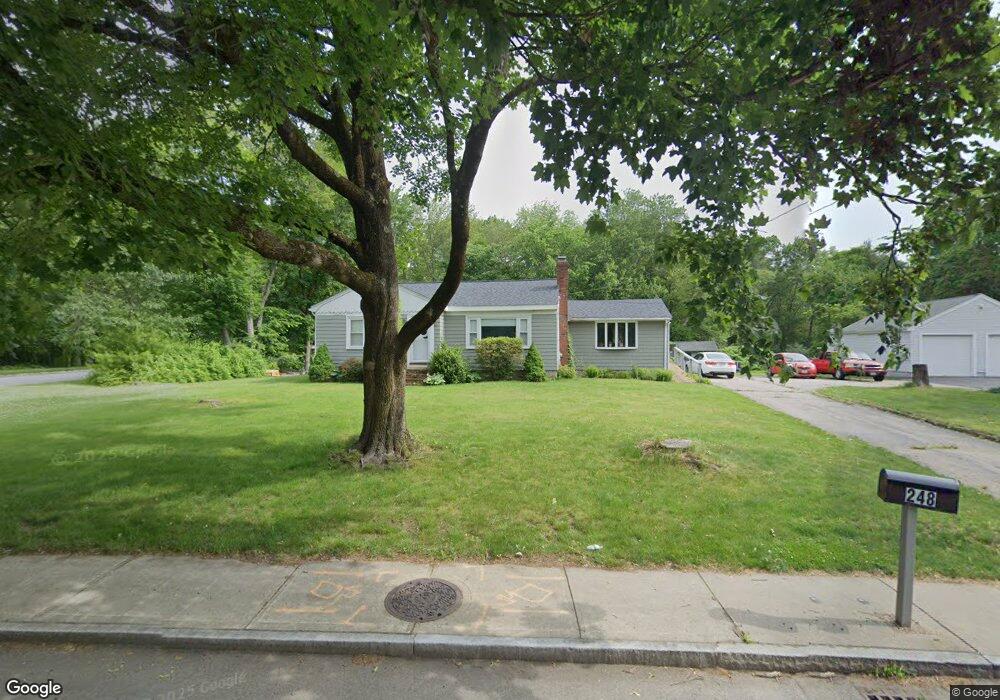
248 Pratt St Mansfield, MA 02048
Estimated Value: $582,708 - $661,000
3
Beds
1
Bath
1,282
Sq Ft
$476/Sq Ft
Est. Value
About This Home
This home is located at 248 Pratt St, Mansfield, MA 02048 and is currently estimated at $610,427, approximately $476 per square foot. 248 Pratt St is a home located in Bristol County with nearby schools including Everett W. Robinson Elementary School, Jordan/Jackson Elementary School, and Harold L. Qualters Middle School.
Ownership History
Date
Name
Owned For
Owner Type
Purchase Details
Closed on
Feb 21, 2012
Sold by
Glovino Robert A Est
Bought by
Giovino Nancy M
Current Estimated Value
Home Financials for this Owner
Home Financials are based on the most recent Mortgage that was taken out on this home.
Original Mortgage
$15,000
Outstanding Balance
$10,296
Interest Rate
3.93%
Mortgage Type
New Conventional
Estimated Equity
$600,131
Create a Home Valuation Report for This Property
The Home Valuation Report is an in-depth analysis detailing your home's value as well as a comparison with similar homes in the area
Home Values in the Area
Average Home Value in this Area
Purchase History
| Date | Buyer | Sale Price | Title Company |
|---|---|---|---|
| Giovino Nancy M | -- | -- |
Source: Public Records
Mortgage History
| Date | Status | Borrower | Loan Amount |
|---|---|---|---|
| Open | Giovino Nancy M | $15,000 |
Source: Public Records
Tax History Compared to Growth
Tax History
| Year | Tax Paid | Tax Assessment Tax Assessment Total Assessment is a certain percentage of the fair market value that is determined by local assessors to be the total taxable value of land and additions on the property. | Land | Improvement |
|---|---|---|---|---|
| 2025 | $6,082 | $461,800 | $230,400 | $231,400 |
| 2024 | $5,927 | $439,000 | $254,700 | $184,300 |
| 2023 | $5,852 | $415,300 | $254,700 | $160,600 |
| 2022 | $5,683 | $374,600 | $235,700 | $138,900 |
| 2021 | $3,123 | $336,300 | $187,200 | $149,100 |
| 2020 | $2,893 | $331,800 | $187,200 | $144,600 |
| 2019 | $2,369 | $300,200 | $148,100 | $152,100 |
| 2018 | $3,548 | $267,900 | $133,800 | $134,100 |
| 2017 | $3,357 | $271,600 | $130,000 | $141,600 |
| 2016 | $3,816 | $247,600 | $110,000 | $137,600 |
| 2015 | $3,491 | $225,200 | $110,000 | $115,200 |
Source: Public Records
Map
Nearby Homes
- 82 Brook St
- 99 Pleasant St
- 76 Samoset Ave
- 22 Pleasant St Unit B
- 22 Pleasant St Unit A
- 72 Court St Unit B
- 241-243 N Main St
- 38 Court St
- 28 Court St
- 28 Court St Unit 4
- 60 King St
- 150 Rumford Ave Unit 222
- 130 Morse St
- 55-57 Pine Needle Ln
- 16 East St Unit 2
- 21 East St Unit 1D
- 631 East St Unit H102
- 631 East St Unit B102
- 631 East St Unit E101
- 12 Wilson Place