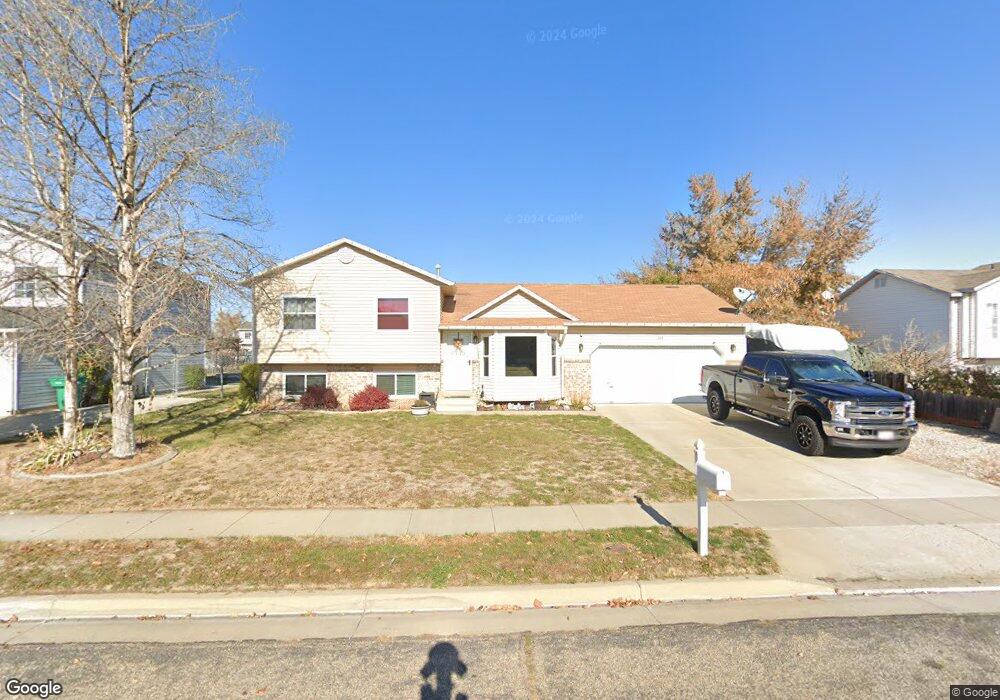
248 W 1980 S Clearfield, UT 84015
Estimated Value: $419,000 - $446,000
4
Beds
2
Baths
1,570
Sq Ft
$275/Sq Ft
Est. Value
About This Home
This home is located at 248 W 1980 S, Clearfield, UT 84015 and is currently estimated at $431,606, approximately $274 per square foot. 248 W 1980 S is a home located in Davis County with nearby schools including Antelope Elementary School, North Davis Junior High School, and Clearfield High School.
Ownership History
Date
Name
Owned For
Owner Type
Purchase Details
Closed on
Jun 6, 2023
Sold by
Crosby Sarah
Bought by
4245 Ramblewood Dr Llc
Current Estimated Value
Purchase Details
Closed on
Nov 20, 1998
Sold by
Handy Todd J and Handy Lisa F
Bought by
Ives Bryant Norman and Ives Lindy S
Home Financials for this Owner
Home Financials are based on the most recent Mortgage that was taken out on this home.
Original Mortgage
$114,520
Interest Rate
6.42%
Mortgage Type
FHA
Create a Home Valuation Report for This Property
The Home Valuation Report is an in-depth analysis detailing your home's value as well as a comparison with similar homes in the area
Home Values in the Area
Average Home Value in this Area
Purchase History
| Date | Buyer | Sale Price | Title Company |
|---|---|---|---|
| 4245 Ramblewood Dr Llc | -- | Old Republic Title | |
| Ives Bryant Norman | -- | First American Title Co |
Source: Public Records
Mortgage History
| Date | Status | Borrower | Loan Amount |
|---|---|---|---|
| Previous Owner | Ives Bryant Norman | $114,520 |
Source: Public Records
Tax History Compared to Growth
Tax History
| Year | Tax Paid | Tax Assessment Tax Assessment Total Assessment is a certain percentage of the fair market value that is determined by local assessors to be the total taxable value of land and additions on the property. | Land | Improvement |
|---|---|---|---|---|
| 2025 | $2,602 | $233,200 | $73,199 | $160,001 |
| 2024 | $2,498 | $225,499 | $69,974 | $155,525 |
| 2023 | $2,167 | $359,000 | $111,892 | $247,108 |
| 2022 | $2,332 | $209,000 | $64,000 | $145,000 |
| 2021 | $2,157 | $292,000 | $68,463 | $223,537 |
| 2020 | $1,867 | $251,000 | $57,655 | $193,345 |
| 2019 | $1,801 | $239,000 | $60,135 | $178,865 |
| 2018 | $1,639 | $212,000 | $53,376 | $158,624 |
| 2016 | $1,456 | $98,450 | $21,349 | $77,101 |
| 2015 | $1,276 | $82,225 | $21,509 | $60,716 |
| 2014 | $1,192 | $77,850 | $21,509 | $56,341 |
| 2013 | -- | $71,584 | $30,258 | $41,326 |
Source: Public Records
Map
Nearby Homes