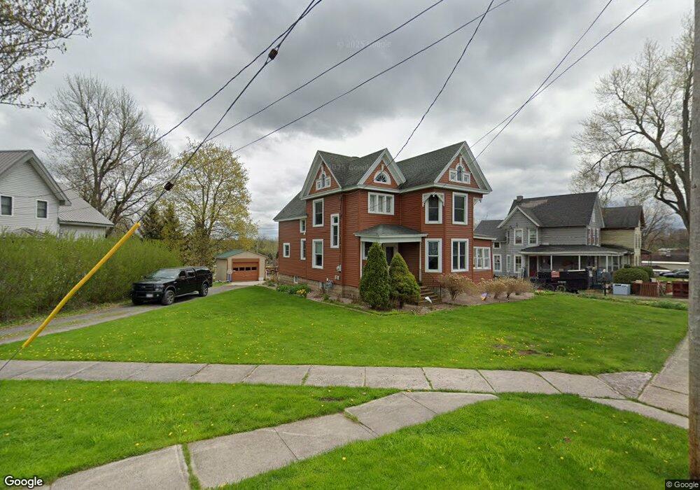
248 William St Dexter, NY 13634
Estimated Value: $276,000 - $307,000
5
Beds
2
Baths
1,962
Sq Ft
$148/Sq Ft
Est. Value
About This Home
This home is located at 248 William St, Dexter, NY 13634 and is currently estimated at $291,318, approximately $148 per square foot. 248 William St is a home located in Jefferson County with nearby schools including General Brown Junior/Senior High School.
Ownership History
Date
Name
Owned For
Owner Type
Purchase Details
Closed on
Nov 9, 2020
Sold by
Nutting Carmen A
Bought by
Townsend Thomas P and Townsend Elissa D
Current Estimated Value
Home Financials for this Owner
Home Financials are based on the most recent Mortgage that was taken out on this home.
Original Mortgage
$212,000
Outstanding Balance
$188,650
Interest Rate
2.8%
Mortgage Type
FHA
Estimated Equity
$102,668
Purchase Details
Closed on
May 17, 2006
Sold by
Nutting Dale
Bought by
Nutting Carmen
Create a Home Valuation Report for This Property
The Home Valuation Report is an in-depth analysis detailing your home's value as well as a comparison with similar homes in the area
Home Values in the Area
Average Home Value in this Area
Purchase History
| Date | Buyer | Sale Price | Title Company |
|---|---|---|---|
| Townsend Thomas P | $212,000 | None Available | |
| Nutting Carmen | -- | Lisa Proven |
Source: Public Records
Mortgage History
| Date | Status | Borrower | Loan Amount |
|---|---|---|---|
| Open | Townsend Thomas P | $212,000 |
Source: Public Records
Tax History Compared to Growth
Tax History
| Year | Tax Paid | Tax Assessment Tax Assessment Total Assessment is a certain percentage of the fair market value that is determined by local assessors to be the total taxable value of land and additions on the property. | Land | Improvement |
|---|---|---|---|---|
| 2024 | $4,451 | $156,500 | $21,400 | $135,100 |
| 2023 | $4,467 | $156,500 | $21,400 | $135,100 |
| 2022 | $4,292 | $156,500 | $21,400 | $135,100 |
| 2021 | $4,227 | $156,500 | $21,400 | $135,100 |
| 2020 | $3,939 | $156,500 | $21,400 | $135,100 |
| 2019 | $3,855 | $156,500 | $21,400 | $135,100 |
| 2018 | $3,855 | $156,500 | $21,400 | $135,100 |
| 2017 | $3,821 | $156,500 | $21,400 | $135,100 |
| 2016 | $3,455 | $156,500 | $21,400 | $135,100 |
| 2015 | -- | $77,000 | $8,800 | $68,200 |
| 2014 | -- | $77,000 | $8,800 | $68,200 |
Source: Public Records
Map
Nearby Homes
- 214 E Bronson St
- 107 W Kirby St
- 220 Water St
- 15764 Maynard Ave S
- 15625 Foster Park Rd
- 15541 Foster Park Rd
- 15890 New York 12e
- 16744 Thompson Trail Dr
- 16687 Limerick Heights Dr
- 14335 Nys Rte 12e
- 17467 Evans Rd
- 0 Evans Rd
- 118 Patrician Ln
- 115 Patrician Ln
- 219-221 W Main St
- 109 St Lawrence Ave W
- 24142 County Route 54
- 104 Brown Rd
- 0 Bonney Rd Unit S1642943
- 305 Washington St
- 242 William St
- 304 E Kirby St
- 234 William St
- 219 E Kirby St
- 314 E Kirby St
- 303 William St Unit 305
- 213 E Kirby St
- 400 William St
- 226 William St
- 320 E Kirby St
- 229 William St
- 205 E Kirby St
- 218 E Bradley St
- 411 Orchard St
- 403 William St
- 328 E Kirby St
- 217 William St
- 208 E Bradley St
- 132 E Kirby St
- 410 William St